
When last we saw Paul and the Long Suffering Wife they were in their second day visiting the Grand Canyon. On Day One they had taken a bus tour out to the west with stops at Hopi Point, Mohave Point, and Trail View Point, walked along the rim in the village, and saw a wonderful sunset and some critters. On Day Two, we’re on a bus heading east along the rim, stopping at Yaki Point, and now, at Moran Point.
 (Google Maps)
As you can see, the major stopping points east of the village are farther out and farther apart . (The map scale has been zoomed out from the first six.) For timing considerations if you go (we had to make sure we were back in time to catch the train) it’s fifteen minutes or so between stops to the east, where it’s only five minutes to the west. Once you’re done on the eastern leg (we’re not there yet, two more stops after this), it’s about forty minutes back to the village.
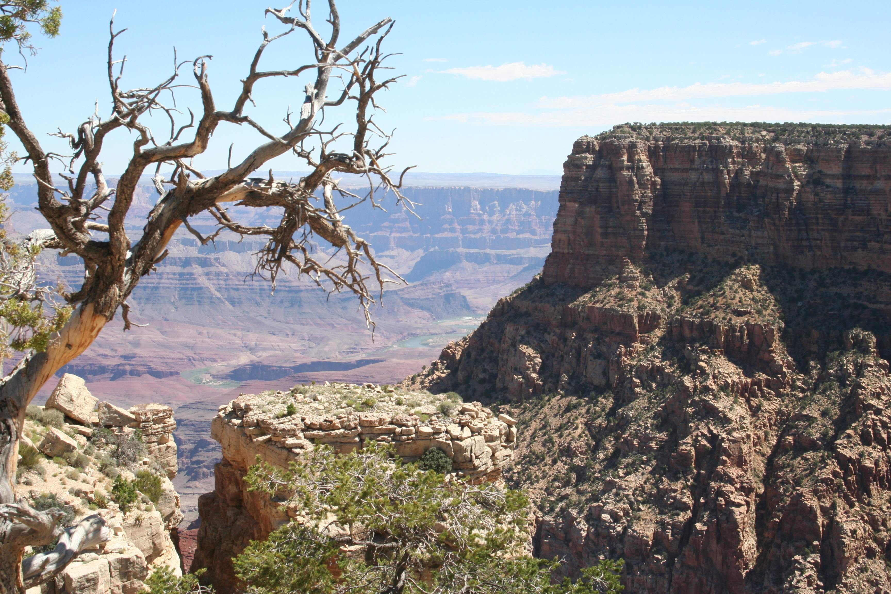 This might be my favorite picture of the hundreds and hundreds I took on this trip. I really like the composition and depth.
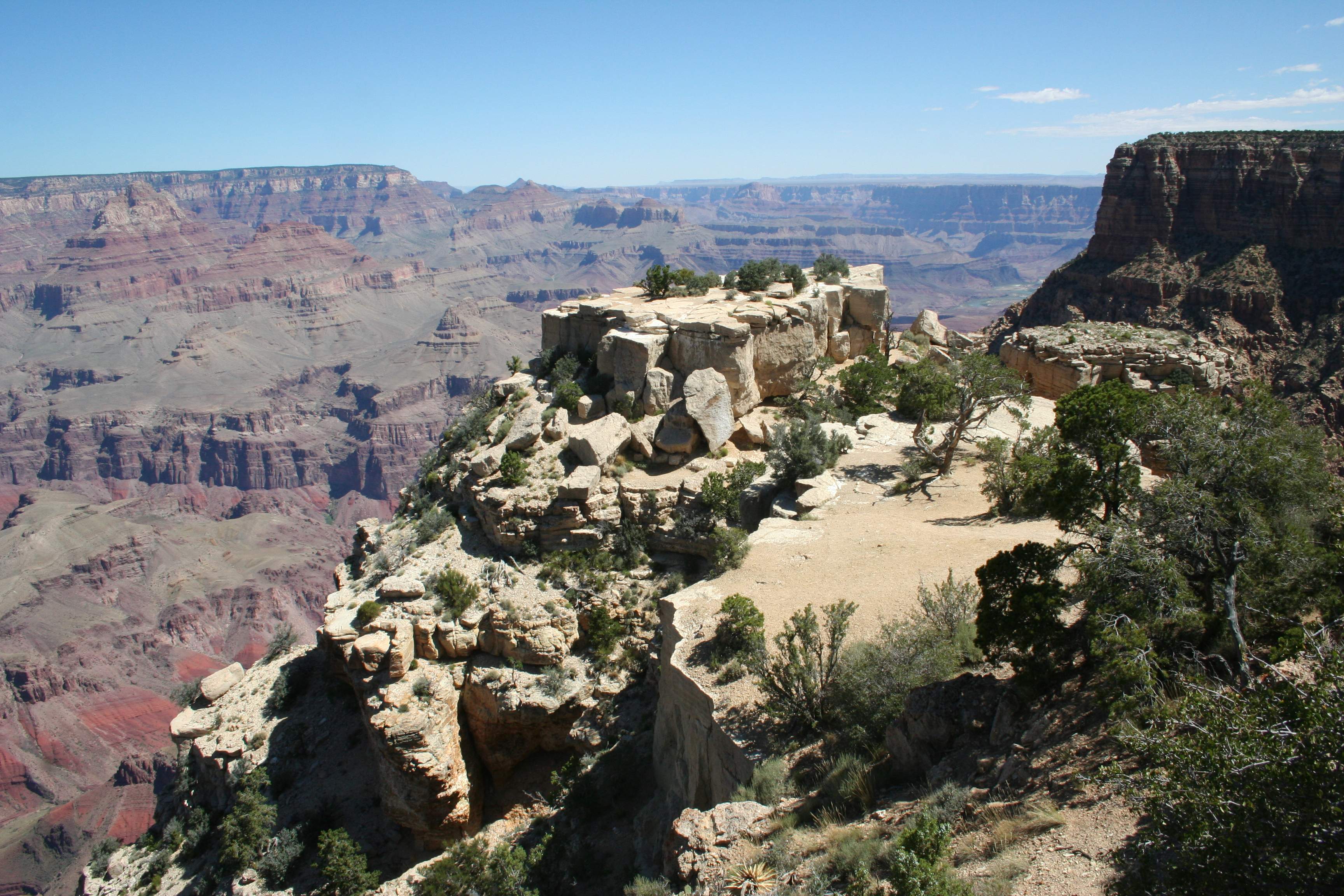 I show this outcrop of white blocks because to me it’s an example of how some folks just aren’t playing with a full deck.
This picture was taken from one of the viewing areas, with rails and fences that let you get right up the edge of a thousand-foot drop. Off the right, you can see that it was quite possible to simply hop the railing, go down that little embankment, and walk and climb around on this rock outcrop. There weren’t any signs prohibiting it, no warnings that doing so could lead to a horrible & painful death. Maybe they just figured it was obvious.
It wasn’t obvious to a group of young men and women who were out there trying to see just how high they could free climb on these rocks and how close they could get to the edge. (They weren’t from our bus — our bus was full of old and older dudes and dudettes.) “YOLO,” I guess. It could be that I’m just above-average risk averse, but these folks were way out on the other side of the bell curve.
There are people who keep track of that sort of thing and have published a book about it. Apparently there were twenty-one deaths at the Canyon in 2011 with over 4.3 million visitors. As a percentage, that’s pretty low. It seems that deaths by falls are even more rare. You’re much more likely to die from heat stroke, drowning in the river, or in an airplane crash on an aerial tour. So from a statistical perspective, I’m just being an old curmudgeon. (Not news!)
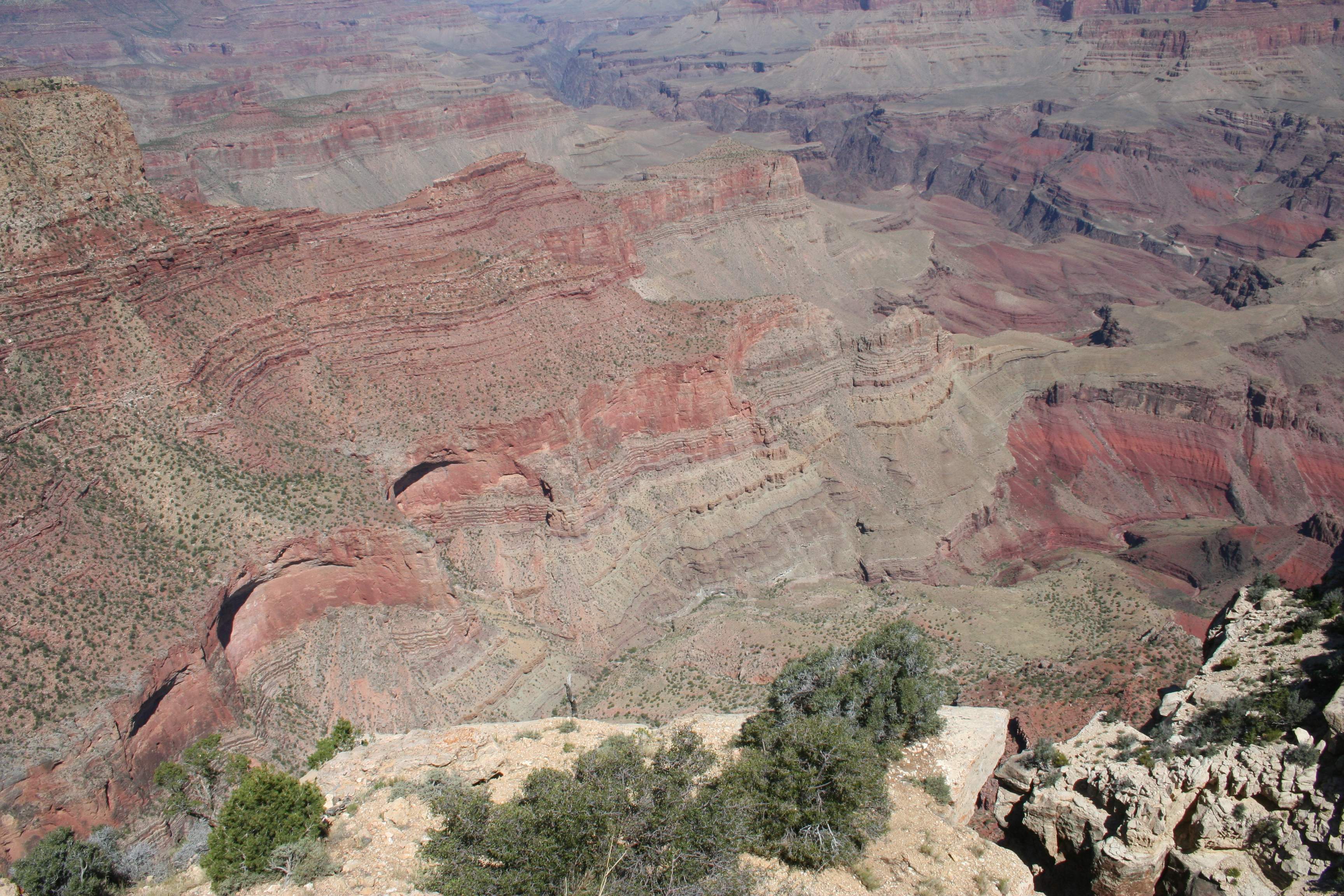 You see these cup-shaped outcroppings all over the place, formed when a huge mass of rock fractures off and falls. I also just love the shades of red all through this picture, but especially on the right side.
 When the first humans saw this, Native Americans or Europeans, did any of them understand what all of these layers and colors represented in terms of geologic history? Or did that come much, much later? I guess I could Google it…
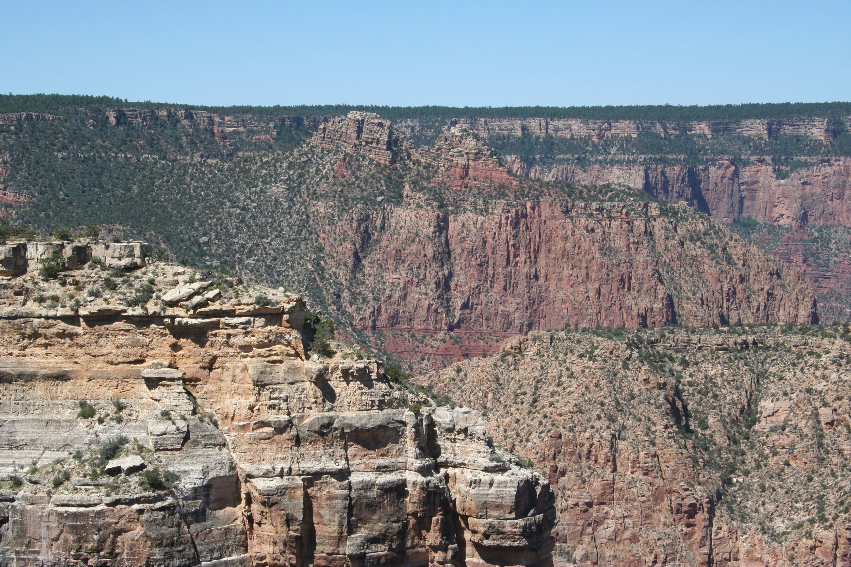 From Moran Point you can see several structures like this one, like long, narrow fins sticking out into the canyon. The top is covered with layers of harder rock that protects the rock underneath it, while everything on the sides erodes away. On this one, the rocks at the top got tilted up at an angle at some point after being formed horizontally by sediment. Given fifty million years or so, it’s amazing what you can accomplish.
 There was a great view of the river to the east here, with some of the rapids showing.
 Another one of those features that looks like it’s got a huge ocean liner made of rock on top.
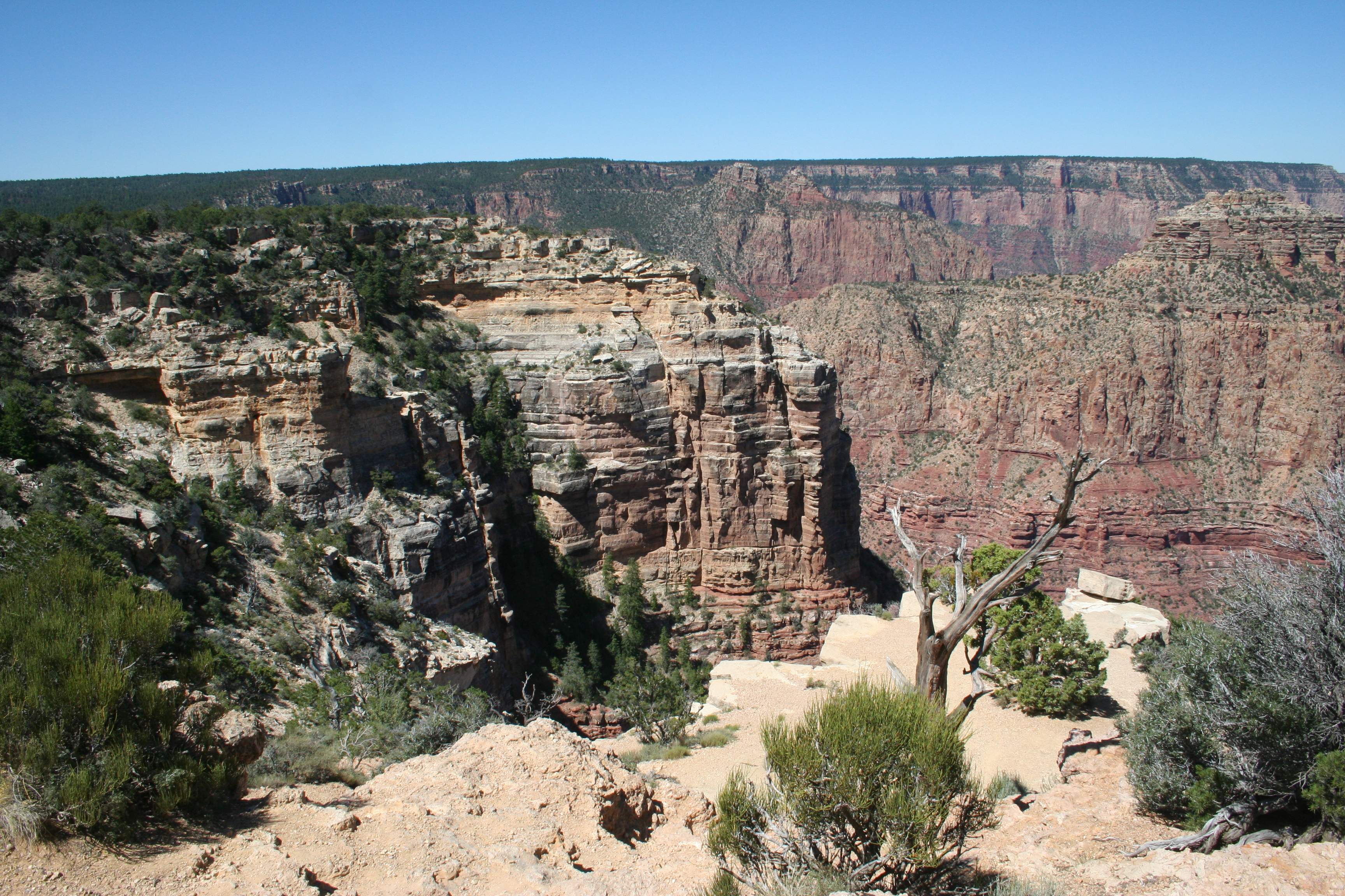
 Looking back to the west.
