
Prior to last night’s little episode with lightning & thunder (which almost blew me into next month), the approaching storm gave a fantastic display of mammatus clouds just before it got dark.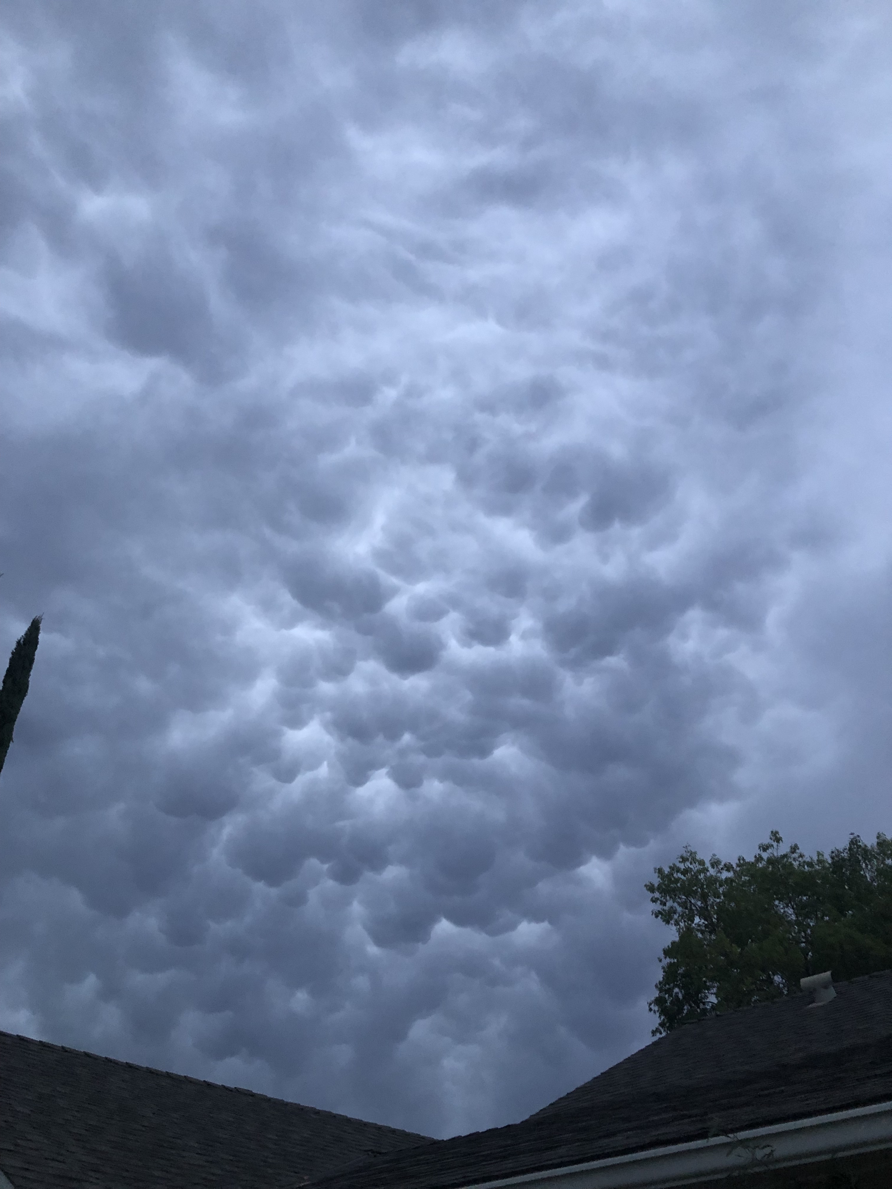
Usually seen at the bottom of a cumulonimbus cloud, they’re a sign of a huge amount of turbulence above as opposing updrafts and downdrafts in the clouds churn the air.

The name comes from their sack-like appearance, looking like breasts hanging down from the clouds. As a pilot, I would avoid flying underneath.

We don’t see these out in this part of the world often, so this was a treat. This particular storm cell was just starting to drop some light rain, and it had moved on and wasn’t responsible for the lighting and thunder later, but with this sort of activity building you can bet that it lit up the skies up over Ventura and Santa Barbara counties later.

What stood out in a wider view is the distinct difference in the cloud’s appearance across the bottom. On the right you see it smooth and fairly featureless where rain was starting to fall and obscure the mammatus formations above it.
But on the left you can still see up through a hole in the rain layer to the higher formation in the cloud. I was surprised to see that foundry so clearly defined.
Mammatus clouds – a good sign that meteorological mischief is afoot. And maybe a good time to get inside, or at least under the porch awning, and off of the golf course or lawn.
