Category Archives: Travel

Encino Nike Base

A week or so ago, after looking at a bunch of things that I had written here, ranting about stuff that really had me PO’d (“gremlin” issues, the cable war thing, politics, and so on) I had decided to make a conscious decision to be less negative and more positive. I was going to look for the good, not dwell on the bad.

Then this whole Congressional epic fail thing happened and my Twitter feed is full of NASA sites and scientists shutting down for the duration and I see and hear all of the BS from both sides and it just puts my head back into a very negative place. (Wow, how 70’s!)

But I’m learning (slowly) that I can have a choice to NOT be a victim in these events. That’s leading to some very mixed up and far reaching thought processes about the whole thing, which I’m hoping will lead to some really interesting posts here once it all gets distilled down into rational thoughts. (Plus there are time-consuming and hopefully positive things going on this week on the job hunt mess, as well as my beloved Chiefs to follow, and hockey started today! But I digress…)

The process of distilling the raw “ARAGGGGHH!!” reaction to the world into actual English is going to take a few days at least, so for now, y’all may just get a bunch of pictures every day for the next few. (I take a LOT of pictures!)

A few years ago a good friend from work let me in on a little known, special place up in the Santa Monica Mountains. For those of you not familiar with Los Angeles, the Santa Monicas run east-west from the Pacific coast, through the middle of the city, to Griffith Park. At the west end you have Malibu to the south and the western San Fernando Valley to the north of the mountains. At the east end you have downtown Los Angeles, Hollywood, and Dodger Stadium to the south and the eastern San Fernando Valley (Burbank & Glendale) to the north.

Back in the 1950’s when we all thought that we were going to get fried by Russian Commie Nukes at any second, the government went up into those mountains and found a perfect spot to put a Nike missile base. From the top of one of the mountains you could see all of the San Fernando Valley, downtown LA, almost all of the LA Basin and the coastline from Malibu to Palos Verdes. For a long time, there were anti-missile missiles up in them thar hills.

The missiles are gone, but the base got turned over to the folks who are making almost all of that mountain range a public park. The base has been partially restored as a historical site and it’s open to the public – if you know where it is and how to get there.

There aren’t any signs and as far as I can tell it’s only publicized by word of mouth. You have to know where to turn off of Mulholland Drive (which is pretty narrow and twisty turny to begin with) onto an unmarked road, then park in this dirt lot. From there it’s about a mile hike up a dirt fire road to the top of the hill. Lots of hikers know about it (the fire roads get hiked a lot, as well as the many hiking trails up in the park) and the dirt bikers know about it. But since you can’t drive up there, and would really need a four-wheel-drive vehicle if you did, most folks have no idea it’s there.

But oh, the views you can get on a clear day! (This particular clear day was April 29, 2010.)

(Previewing this post I realize that there’s something that I assume you all know, but maybe I shouldn’t assume. If you click on any of these pictures, you’ll get the full-sized picture, not just the tiny one in the post. You knew that, right?)

01_IMG_6233_small
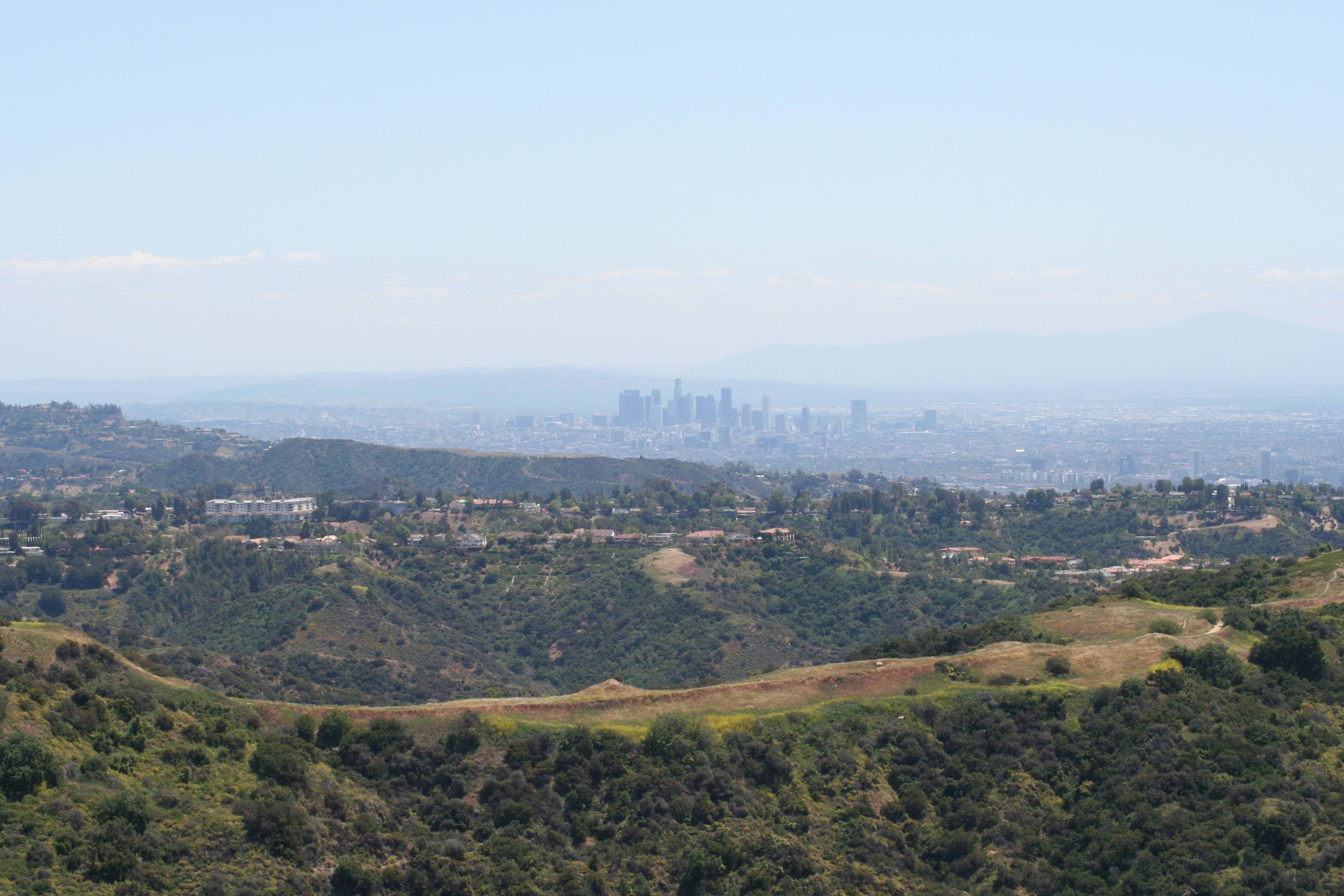
A wide shot showing downtown Los Angeles about eighteen miles away. On the right, just over the foreground hills, you can see the skyscrapers of Century City. In the far distance on the right you can see Saddleback Mountain rising up over eastern Orange County, over fifty miles away.

02_IMG_6353_small
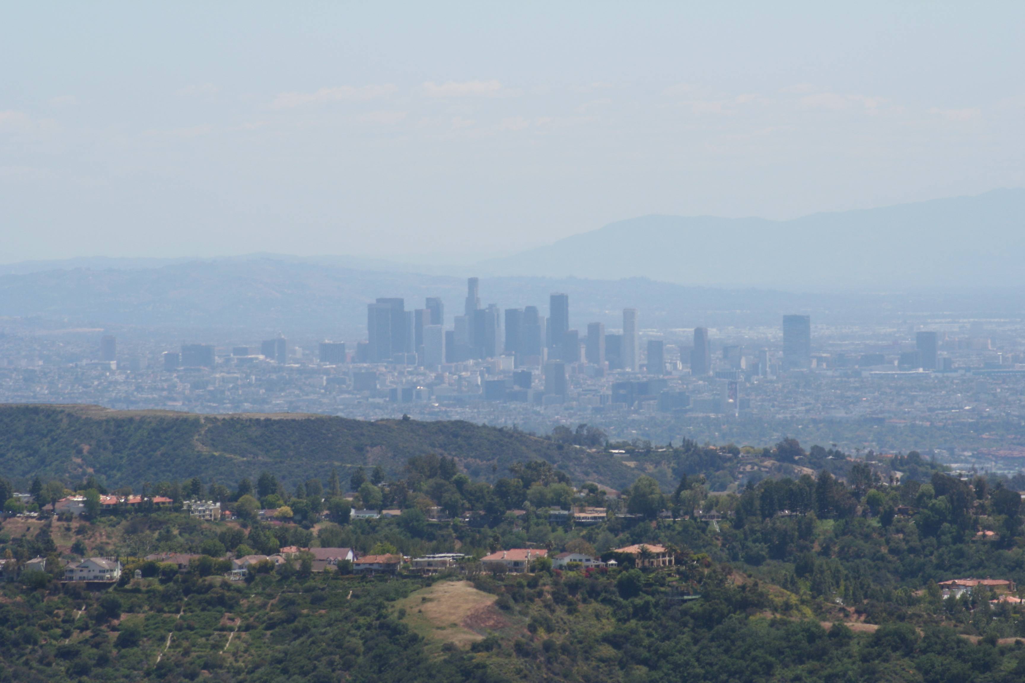
A telephoto shot of the view of downtown LA. The houses on the hill in the foreground are in Sherman Oaks, Westwood, and Bel Aire. Very, VERY pricey housing.

03_IMG_6238_small
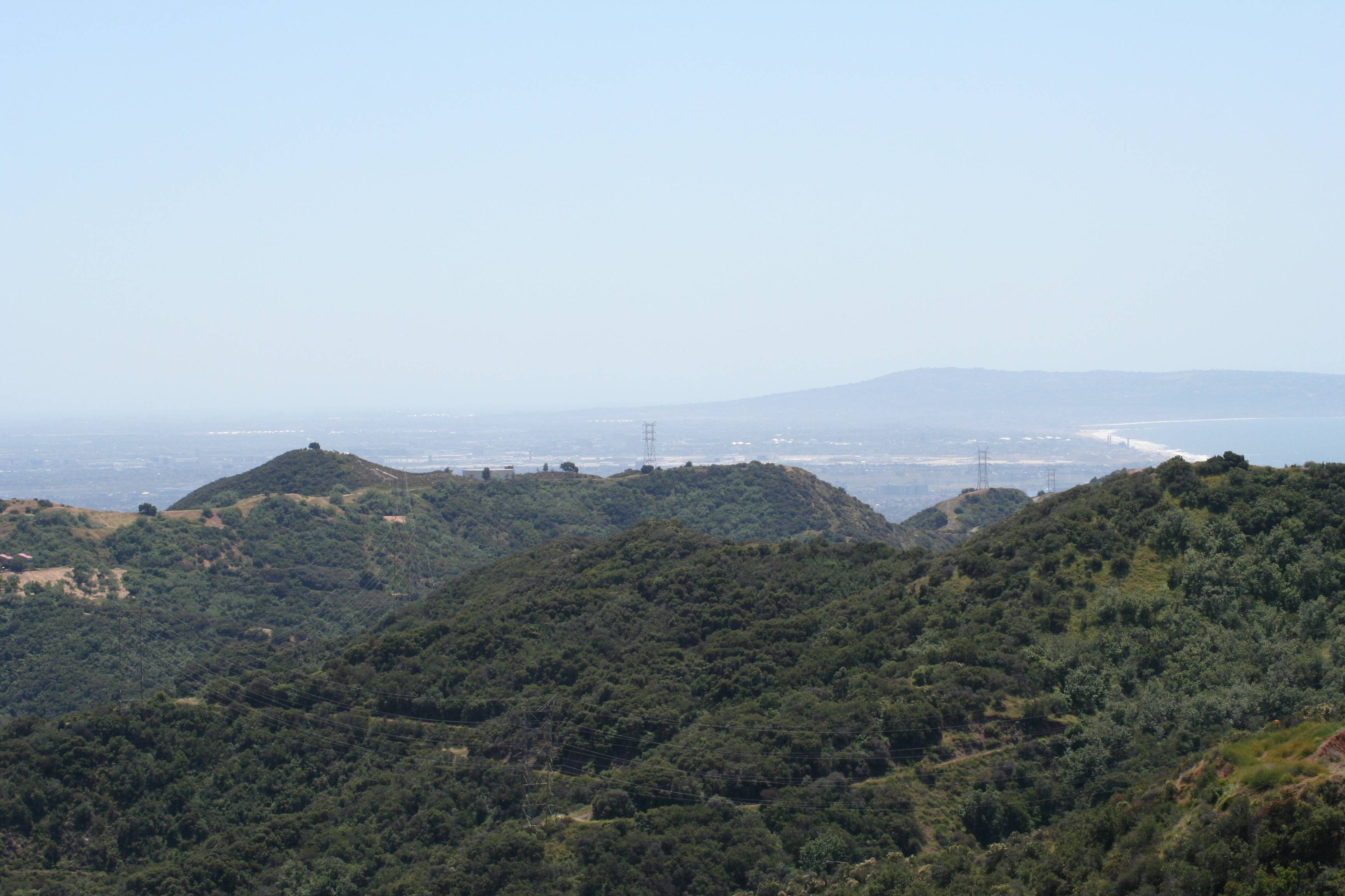
A wide shot looking down toward the coastline. You can see the beach over the hill on the far right, with the Palos Verdes Peninsula rising up in the distance. Just over the hills you can clearly see a large white area running from left to right just inland from the coast – that’s LAX.

04_IMG_6355_small
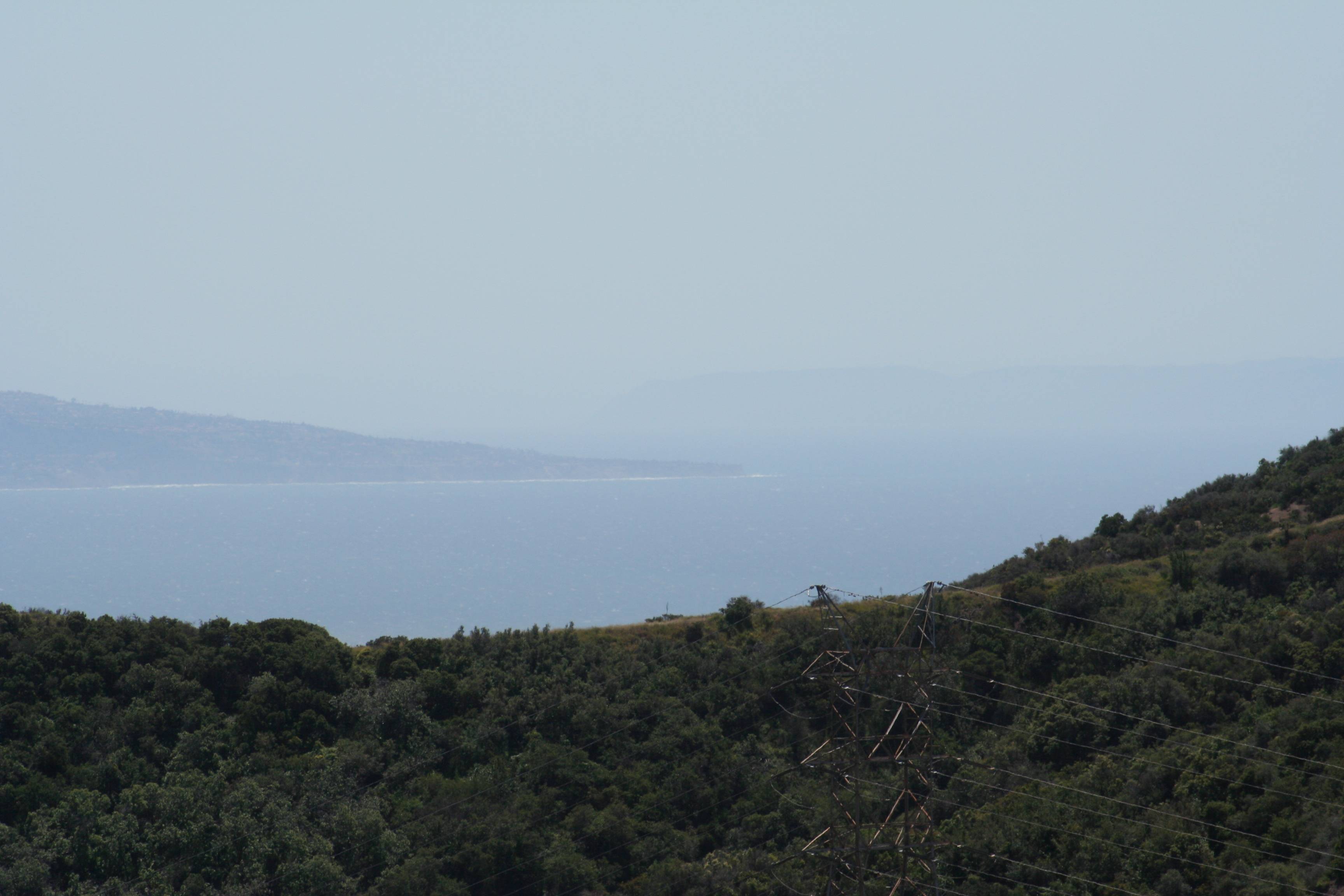
A telephoto shot of the tip of the Palos Verdes Peninsula sticking out from the left in the distance (twenty-five miles away). Just visible sticking up though the marine haze on the horizon that big grey thing is Santa Catalina Island. It might be “twenty-six miles across the sea” in the song, but it’s about fifty miles from here.

05_IMG_6374_smallOut in the central San Fernando Valley is Van Nuys airport. Just in front of it is Lake Balboa, a huge man-made lake and park which uses totally recycled waste water. A great place to play, stroll, chill, run, and picnic.

06_IMG_6363_small
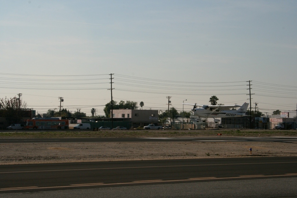
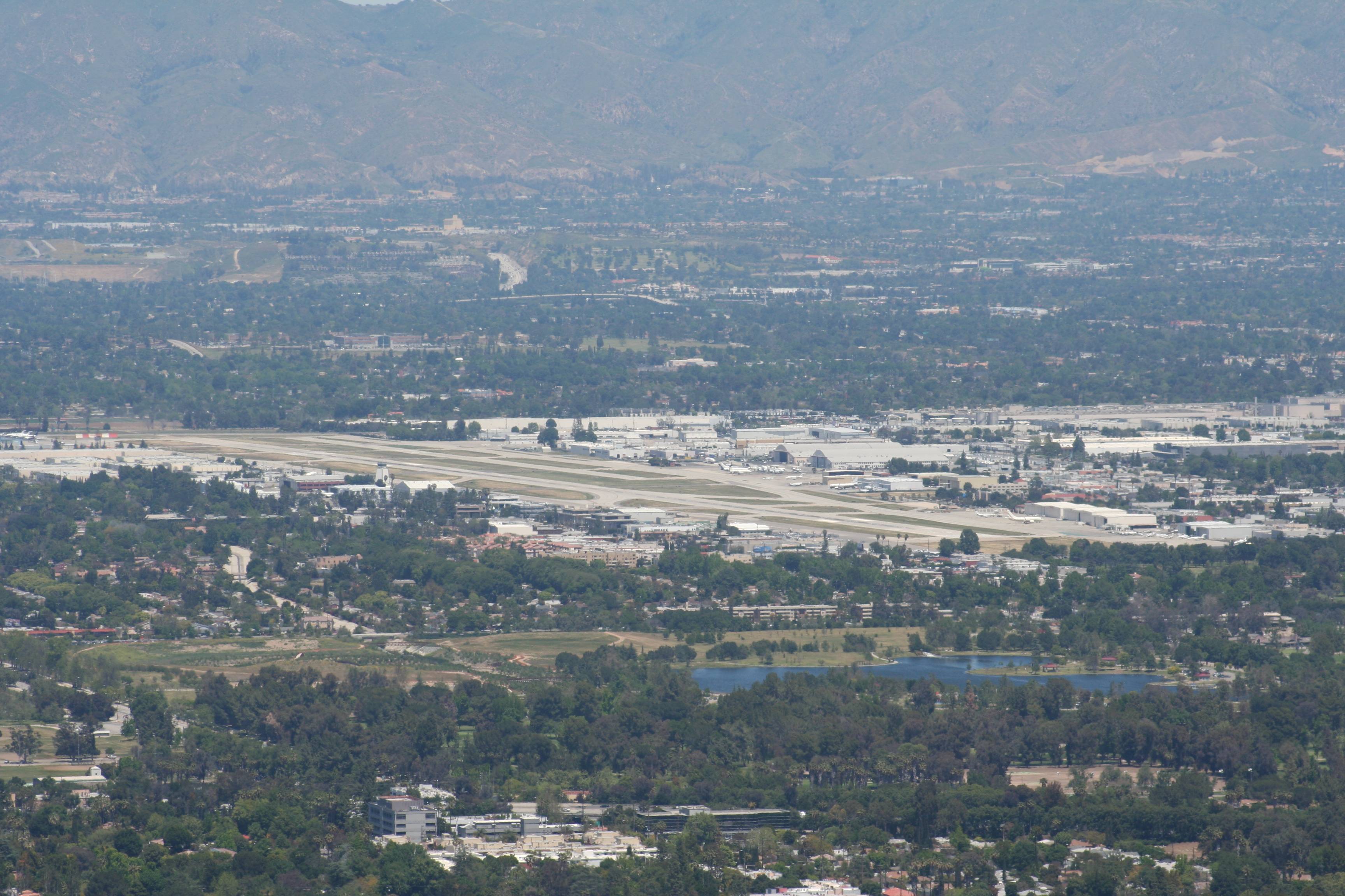
Way off in the distance, at the base of the San Bernardino Mountains, you can see Whiteman Airport, my home base when I fly. The big, white, curved area in the center is Hansen Dam and Recreation Center. Just to the right of it you can see four red and white striped smoke stacks, known to pilots as the “four towers”. Whiteman is just in front of the dam and the normal takeoff on Runway 12 aims you straight at the four towers. They mark the boundary between Whiteman’s airspace and Burbank’s, so if you’re not talking to Burbank’s tower real quick after takeoff, you had better be peeling off another direction or be planning on a long, uncomfortable talk with the FAA.

07_IMG_6384_small
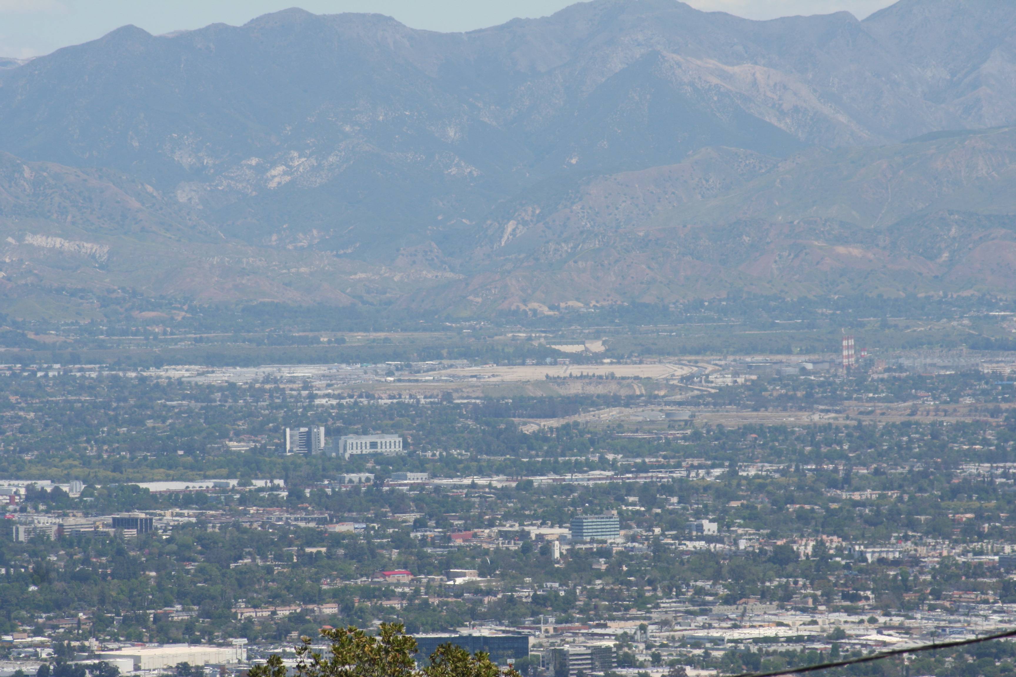
The wide shot of the central San Fernando Valley, with Whiteman Airport, Hansen Dam, and the four towers way up at the top and the office buildings of Encino in the foreground. A couple of those office buildings are where I worked for well over twenty years.

08_IMG_6366_small
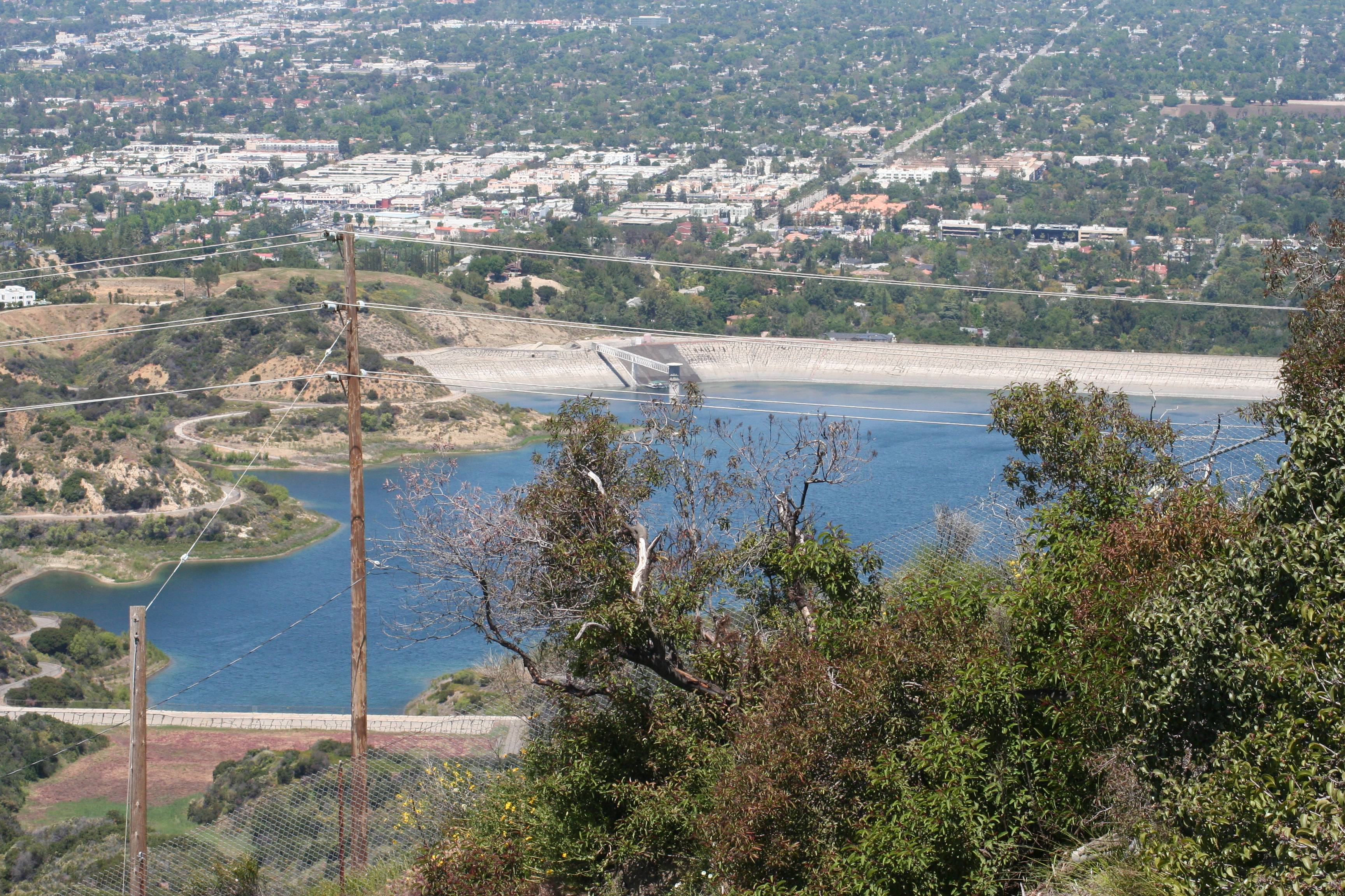
From the Nike Base tower you’re looking down into the Encino Reservoir. Running right to left along the base of these hills you can see a lot of bigger buildings – that’s Ventura Boulevard. The major street running perpendicular to it from the mid-upper right is White Oak Boulevard. Reseda Boulevard is cutting north-south across a piece of the top, left corner.

09_IMG_6255_small
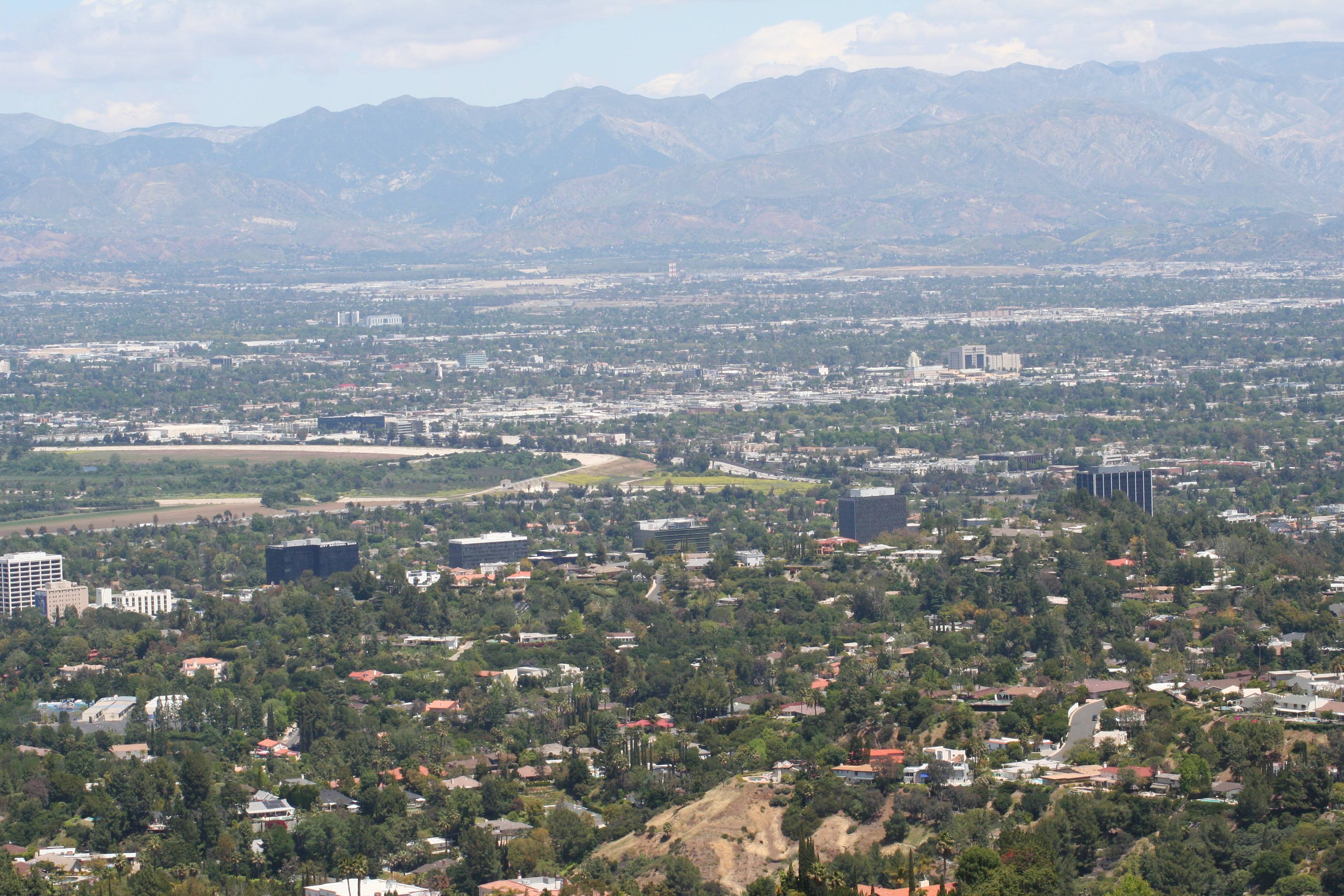
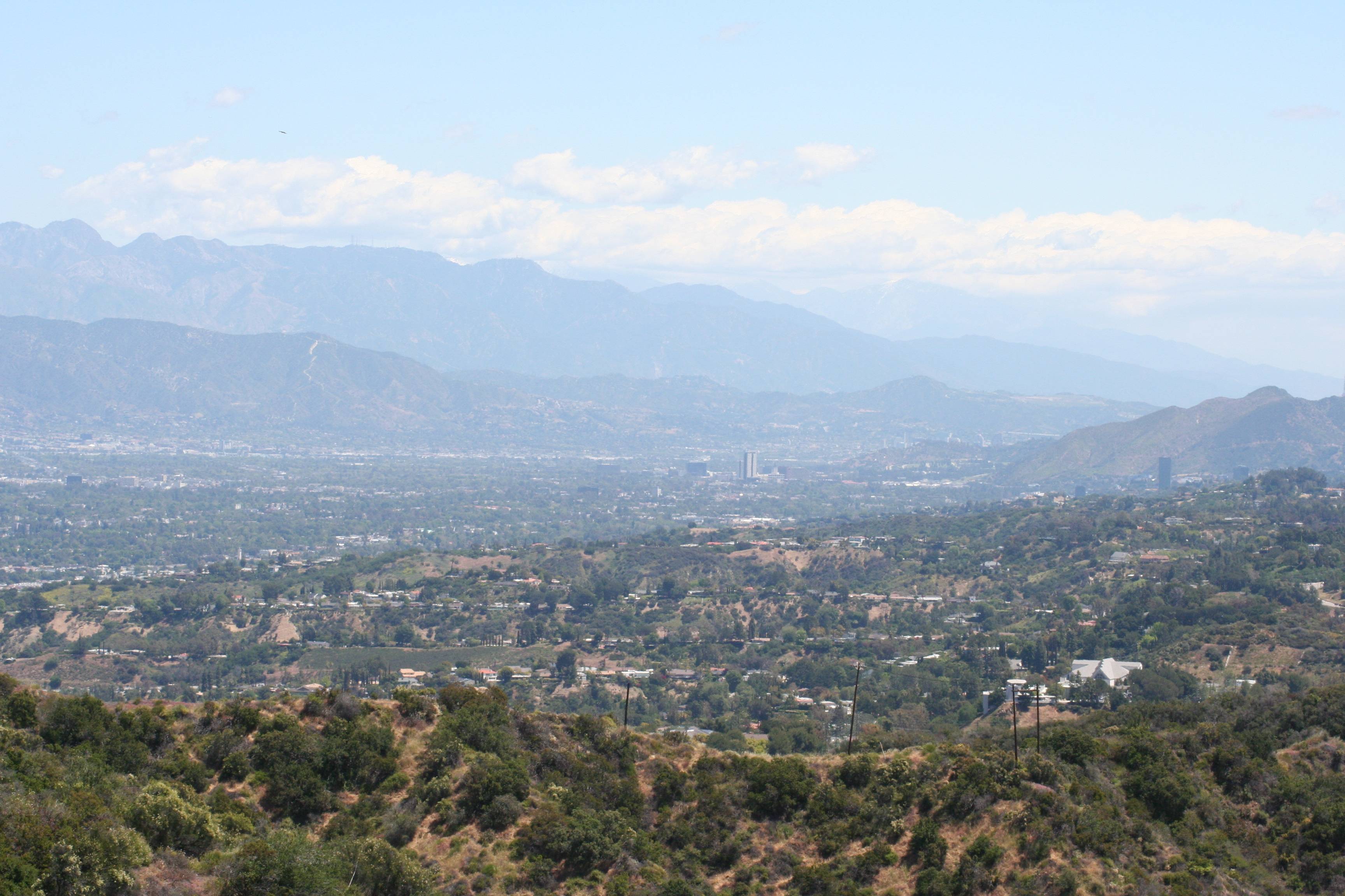
The west San Fernando Valley, with the skyscrapers of Warner Ranch in the center. Ventura County starts at the top of those hills at the far end of the SFV as seen from here. Our house is out there to the left of Warner Center, right near the base of those hills.

10_IMG_6259_small
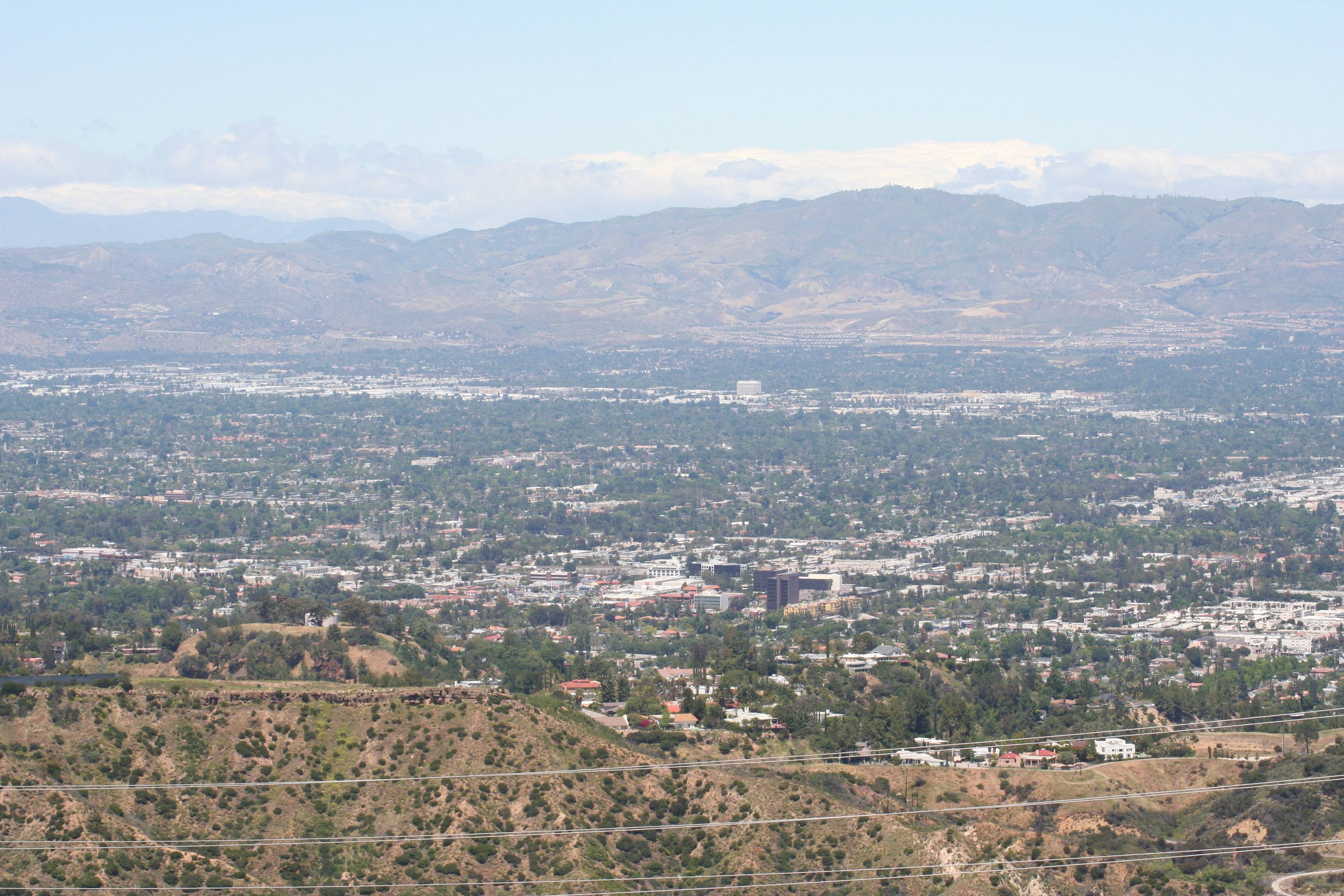
The central San Fernando Valley, with Tarzana in the foreground and Chatsworth (porn production capital of the world!) in the distance. The Santa Suzanna Mountains are at the northwest edge of the SFV in the background, with Simi Valley on the other side.

11_IMG_6273_small
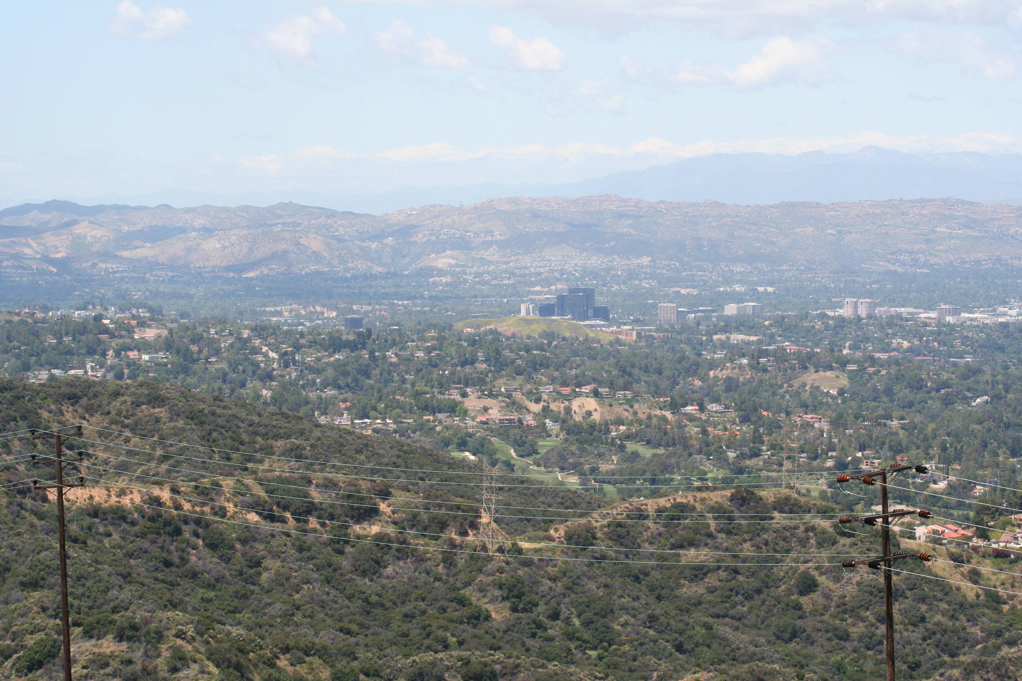
The eastern San Fernando Valley, with the San Bernardino Mountains rising up in the distance. In the center middle distance you can see the skyscrapers of Glendale, and the infamous Universal City “black tower” is at the middle near the right edge. Griffith Park is in the hills behind the black tower. That gap you see between Griffith Park and the San Bernardinos will take you off to Pasadena, the Rose Bowl, and into the San Gabriel Valley.

12_IMG_6360_small
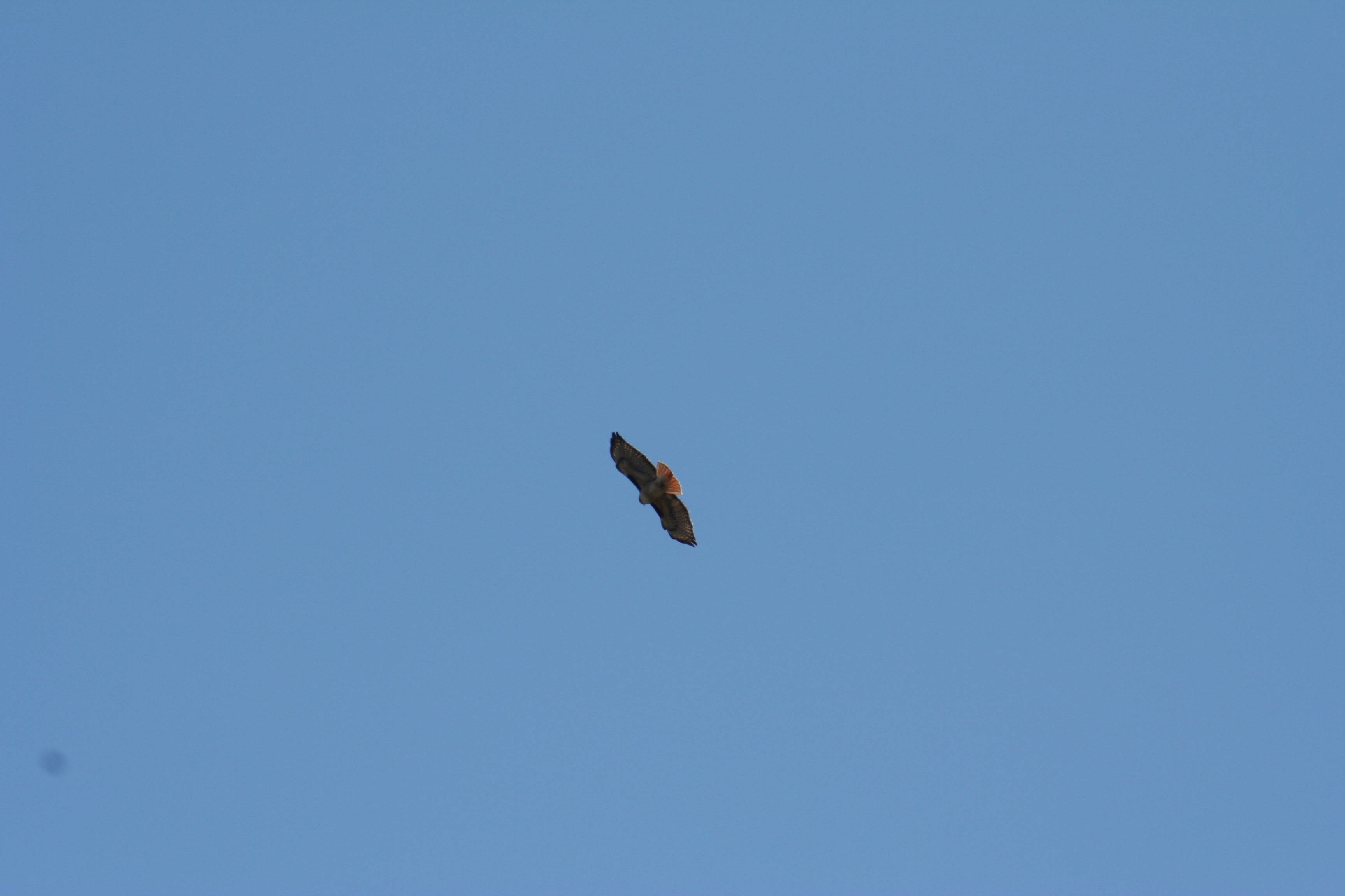
Here there be many red-tail hawks, riding the thermals and looking for lunch.

(See, wasn’t that much more relaxing and soothing than ranting about things that we have no power to change? Yes, I thought so, too.)

1 Comment

Filed under Flying, Photography, Travel

Goldstone

Two and a half years ago, in March 2011, my son was home on leave (he’s in the Air Force) and had a surprise for my birthday.

Remember I was talking a few days ago about mankind’s first starship, Voyager I? That “antique” spacecraft is currently over twelve billion miles from Earth and transmitting with 23 watts of power, which is about a quarter of the energy output of the average refrigerator light bulb. By the time it gets here it’s a pretty stinking faint signal. How do we pick that signal up? With some really, really freakin’ big antennas.

Goldstone, one of the three primary antenna sites for the Deep Space Network is a couple hundred miles outside of Los Angeles. They have a limited number of public tours available and my son had snagged two spots for us. For a space cadet like me (and like him!) this was an über cool site visit.


IMG_7861_small

IMG_9136_small

IMG_9149_small

IMG_9158_small

IMG_9167_small

IMG_9185_small

IMG_9175_smallIf you get a chance, go to see it! (In March. Or February, maybe January. Not in July or August. Just stupid hot out there in the summer.)

Leave a comment

Filed under Photography, Space, Travel

Autumn’s Here

I spent my mid-teen years (i.e., high school) growing up in Vermont. I still have family there as well as many friends I’ve stayed in touch with over the years.

With the arrival of autumn a couple of days ago, I’m starting to see plenty of pictures from all of them about the leaves starting to turn. The days are getting short, the nights long, the air crisp as winter approaches, and Mother Nature’s fireworks show is starting to fire off.

I know that lots of parts of the world have fall foliage to see, but nothing’s like Vermont. Seriously. If you ever have a chance to get up there during the fall foliage season, take it!

The next few days should see the peak color in northern Vermont, up by the Canadian border and along Lake Champlain. The next ten days to three weeks will be the peak color areas moving southward, so by Halloween most of the state will be past peak and the colors will be getting vivid in the mid-Atlantic states and the southern Appalachian Mountains.

So go to Vermont this weekend! Take a camera.

These pictures are from the last time I was there in the autumn, in 2006.

IMG_6431_smallFlying into Burlington from Boston, along the shores of Lake Champlain.

IMG_6434_smallOn short final to Burlington, the color is really beginning to show.

IMG_6457_smallStowe.

IMG_6462_smallStowe, at the Ben & Jerry’s factory.

IMG_6470_smallBarre.

IMG_6485_smallNear the summit of Mount Ascutney.

IMG_6489_smallA birch grove near the summit of Mount Ascutney.

IMG_6505_smallFrom the observation tower on the top of Mount Ascutney, looking west.

IMG_6533_smallFrom the observation tower at the top of Mount Ascutney, looking north.

IMG_6541_small
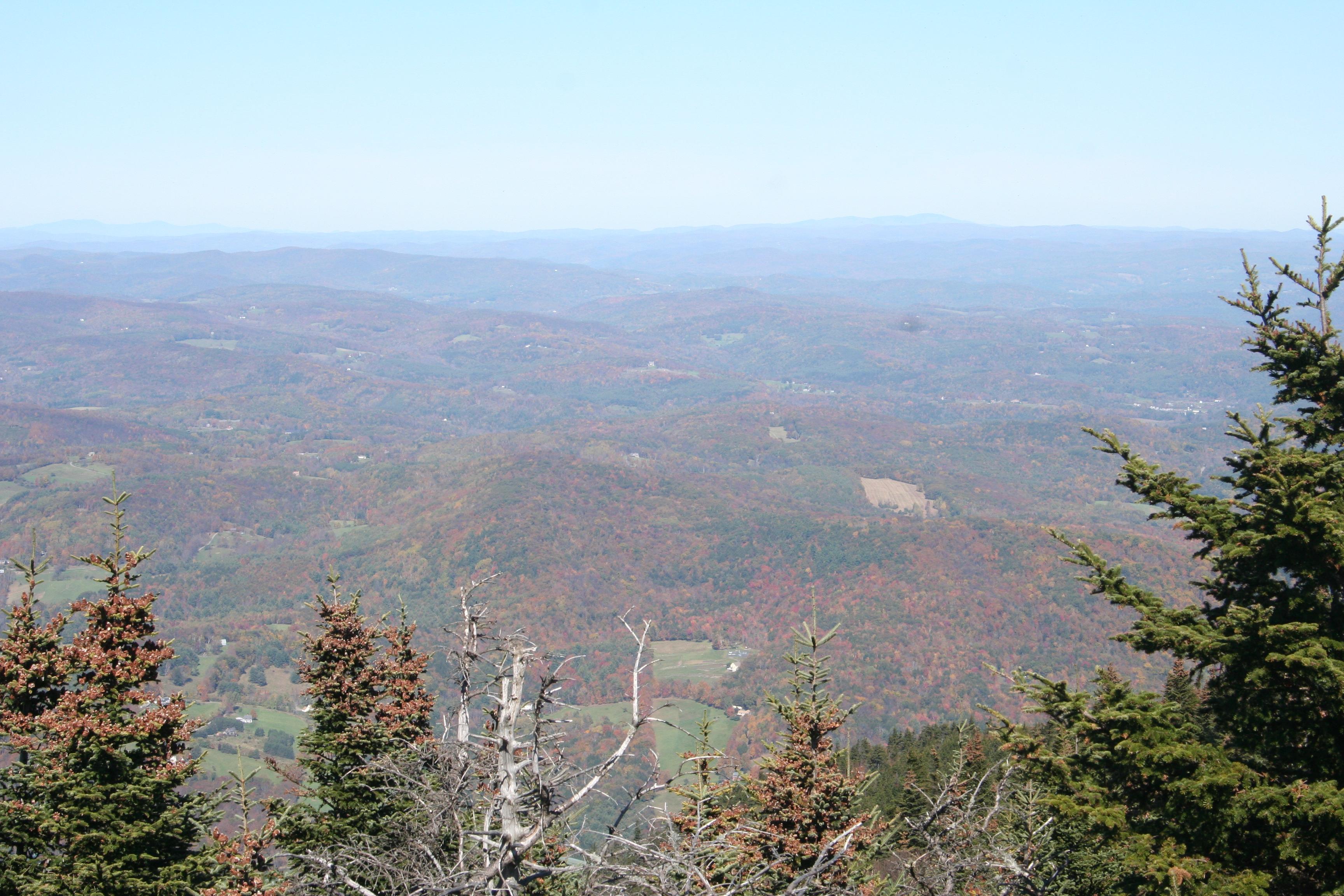
From the observation tower at the top of Mount Ascutney, looking east. In the valley running left to right along the bottom of the picture is the Connecticut River. Everything beyond it is New Hampshire.

IMG_6600_smallOn the road down from the Mount Ascutney summit.

IMG_6632_smallBellows Falls.

2 Comments

Filed under Photography, Travel

Sedona, Arizona

A few days ago I posted some pictures and a description of the area on Arizona Route 89A where the highway descends into Oak Creek Canyon. About thirteen miles south of that point Oak Creek Canyon spills out of the mountains and onto a beautiful, carved up mesa. There you’ll find the town of Sedona.

20130913-224843.jpgLike much of the US Southwest in Arizona, Utah, New Mexico, and Colorado, the area is covered in red sandstone formations, carved into all sorts of odd shapes over millions of years by wind and rain.

20130913-225002.jpgIn this part of the world it’s pretty easy to see the layering of the earth just about anywhere you look.

20130913-225029.jpgThere are plenty of tours that will take you off of the main road and into the back country. (We use the Pink Jeep tour company and were quite happy with the experience.) Unless you have the experience and vehicle to handle an off-road tour, don’t try it on your own! While we were out on our tour in country that only Jeeps and goats roamed, we encountered a couple of Japanese tourists in a compact rental car with no four-wheel drive, no water, no idea of where they were going, and no clue how much trouble they were getting themselves into. We hope that they listened to the advice our guide gave them about stopping and going back down, carefully!

20130913-225042.jpgThere are critters about and you may see some of them. We saw a lot of birds and a couple of small animals, but there are deer, coyote, snakes, and god knows what else out there.

20130913-225102.jpgYou might want to go to Sedona in the spring or fall when it’s not too expensive and not too hot. In the winter all of the snowbirds will be there and it will get expensive. In the summer it’s going to be “one hundred and stupid in the shade” before 10:00 AM.

20130913-225125.jpgOne thing that we did not do on this last trip but I would love to plan into the next one is some hiking. Again, even more so than for driving off-road, make sure you know what you’re doing, have what you need (water and sunscreen!), and have a Plan B. You might be only five miles (or 500 yards) from town, but you can still get into some serious hurt if you’re not careful. I would also just love to get out away from town here with a telescope on some clear night!

20130913-225340.jpgFrom the 1930’s on the area has been used to make dozens of movies, both Westerns and other types of films. The town has and still does promote itself as “Arizona’s Little Hollywood”.

20130913-225354.jpgEven if the off-road experience isn’t for you, there’s a very nice state park just south of town with the usual small museum, observation sites, easy to medium difficulty hiking trails, and the obligatory gift shop.

20130913-225408.jpgOne of the things that makes Sedona such a tourist attraction these days is its reputation as a location of “spiritual vortices”. Remember the “Harmonic Convergence” in 1987? According to many “New Age” groups, Sedona was where it was supposed to happen. I didn’t see or feel any of that, but there was a fantastic thunderstorm which I enjoyed a great deal!

All in all we found Sedona to be a great place to visit. The main town seems to be a bit “upscale touristy” for me, sort of like Malibu or Newport Beach without the beach. (It probably wasn’t a coincidence that The Eagles’ song “The Last Resort” was playing in my head for days after we left — it’s like the song was written for Sedona.) But it’s easy enough to avoid all of that, there were good restaurants to be found, and if you’re there for the beauty of the desert there are plenty of opportunities to get out of town and see it.

We’ll be back! (With hiking boots and a telescope, perhaps?)

Leave a comment

Filed under Photography, Travel, Weather

Arizona Route 89A

If you should find yourself tooling around Northern Arizona (not a bad thing), you might visit Flagstaff (a lovely town, see the Lowell Observatory) and then want to go down to Sedona. Sedona is charming and has some spectacular scenery. Well worth the visit.

Looking at the map to figure out how to get from Flagstaff to Sedona, you’ll see that you need to go south on Arizona Route 89A. This turns out to be a beautiful drive, high country forest, clean air, and so on. But in the middle of it, sandwiched between two long, more-or-less straight stretches, you’ll find this:

20130913-195908.jpgPhoto: Google Maps

I was curious about what that big knot-like structure was there in the middle of the highway. Turns out, if you’re driving a semi it’s your worst nightmare. (Stay on I-17 to the east!). But if you’re on a motorcycle or driving a convertible, it’s a great stretch of twisty-turny switchbacks as the highway descends pretty much straight down a cliff face, over the Mongollon Rim and into Oak Creek Canyon.

20130913-203325.jpgWe were driving the convertible that day. It was glorious!20130913-201216.jpgOak Creek Canyon is obviously is not quite as deep or as wide or as spectacular as the Grand Canyon seventy-five miles to the north. Then again, you don’t get to drive down the cliff face into the Grand Canyon.20130913-201302.jpgOff at the other end of Oak Creek Canyon, or at least where that canyon has widened out a couple of miles, you’ll find Sedona.

Go see the Grand Canyon. Then go see Flagstaff. There’s a great Mexican restaurant we found in Flagstaff that was featured on “Diners, Drive-Ins & Dives“. Then go down to Sedona. Just make sure that you take a little extra time on the way to enjoy this particular stretch of Arizona 89A.

We recommend the convertible rather than the semi!

2 Comments

Filed under Photography, Travel

Labor Day Weekend

It was thirty-five years ago this weekend, Labor Day 1978, when I was first exposed to the wonderful world that is “science fiction fandom.” Since then I have always known where I wanted to be for the week of Worldcon (usually Labor Day weekend).

I’ve been thinking about that a lot this weekend because I am not in San Antonio with a few thousand of my closest friends, nor am I terribly optimistic about being in London next year. Since I wasn’t able to get to Chicago last year, or Reno in 2011, or Melbourne in 2010, this is a trend that bothers me greatly.

When I first showed up in Phoenix for IguanaCon II in 1978, I had no idea what I was getting involved with. I had, of course, been ravenously reading science fiction and fantasy (among other things) since early childhood, but had only vaguely heard of “Trekkies”, usually when they were being mocked by the local press. What I found in fandom was a group of people and friends who are fun, diverse, often bizarre, intellectually stimulating, hilarious, inspiring, and inclusive. This was a place where folks like me could get together with other folks like me. This was a world of geeks and nerds who were proud to be geeks and nerds, but it was so, so much more.

When many people think of science fiction conventions (“cons” for short) they think of ComicCon or a Star Trek based convention. While these exist and in fact are some of the biggest conventions of their types, they’re by and large commercial operations run by big corporations. Worldcon and all of the other cons run by fans are smaller, more intimate, non-profit, more diverse, more inclusive, and much more enjoyable. After getting involved in fandom, I ended up being a founding committee member for the ConChord convention, serving on the first five (or six?) committees and being committee chairman for ConChord 2 and ConChord 5.

(It was a long time ago – see Barney Evan’s ConChord history site for actual details that don’t depend on my swiss-cheese-like memory. To show how bad it can get, in looking up the page to get the link in the previous sentence, I did a complete double take in realizing that the still photo on the page that links to the 1990 ConChord 6 video is a picture of me.)

While there are many long-running cons that occur every year across the US and around the world, generally occuring on the same holiday weekend every year (for example, Westercon on the US west coast on the July 4th weekend), and many long-running cons that cater to subgroups of fandom (for example, Ohio Valley Filk Fest around the Halloween weekend), Worldcon is the crown jewel of the conventions run by fandom.

As just one example of what goes on at Worldcon, the Hugo Awards are given out at Worldcon. (They actually start in less than a half-hour and are being livestreamed, so if you’re reading this soon, go to the web site to get the link.) I try to make a point each year to read as many of the nominated novels, short stories, novellas, and novelettes as possible. (This year I reviewed three of the nominated novels here, here, and here – next year I’ll do better!) Then there’s “filking” (which I’ll have to go into in much greater detail some other time), hall costumes, the Masquerade, the art show, the dealer’s room, regency dancing, panels with authors, panels with astronauts and scientists, panels on a zillion different topics, and sitting around schmoozing with good friends that you only get to see every couple of years (usually at Worldcon!).

From 1978 until 1984 I attended all seven Worldcons, in Phoenix, Brighton, Boston, Denver, Chicago, Baltimore, and Los Angeles. From 1985 through 2009 I attended twelve of the twenty-four Worldcons. (Having a family will make some adjustments to your financial priorities.) But only once in that time did I miss Worldcon three consecutive years. The fact that I’ve missed it four years in a row and now have the potential to miss five or more years in a row  is not something that I’m very happy about.

The 2015 Worldcon has just been awarded to Spokane, and in a worst-case scenario for me, even if I can’t get to London next year, I’m going to really try to get to Spokane. In the meantime, it’s time to find (or manufacture) a reason to get to Loncon 3 next year, August 14-18. Five years is too many years in a row to miss being at your favorite place!

Leave a comment

Filed under Fandom, Science Fiction, Travel

Solo

Dang, that’s a long drive! About 400 miles each way and the A/C died on the way up on Monday.

Random thoughts that actually connect (I think):

  • Driving alone, I get to listen to my music and turn it up REAL LOUD (especially when the windows are open to avoid dying from heat stroke)
  • There’s a lot of time to think with six hours on the road
  • When I get clear of the trucks and “rolling roadblocks” I push it to “maximum freeway speed” in order to keep the drive time to a minimum
  • I wasn’t so much driving real fast as I was flying real low
  • It would have been faster if I were flying, although my cargo load is better in the minivan
  • Solo + flying + thinking + really, really tired = pictures (taken with my camera by my flight instructor) of my first solo flights on December 14, 2007:

20130828-201616.jpg

First solo landing

20130828-201633.jpg

Third solo landing

20130828-201645.jpg

Exhilarated!

20130828-201658.jpg

Achievement unlocked, although I have no clue what took that divot out of my hair. The flight school office staff and my instructor then cut my shirt off, drew on it, and hung it on the wall. I guess it’s a tradition.

Leave a comment

Filed under Flying, Photography, Travel

Juicy Chunks O’ Wisdom For Tuesday, August 27th

‘Cause I’m really exhausted, been used like a rented mule, that’s why.

  • That was an even better cardio workout than the Habitat For Humanity day.
  • Last week it was in the upper 70’s, today it was in the upper 90’s – bad timing.
  • On the other hand, they invented the term “One Hundred & Stupid” here, so it could have been even worse.
  • The Pocket seems like a nice area.
  • The food at Sheri’s Cafe & Pies on Florin is very good.
  • They’re open 24/7/365.
  • People who deliberately drive at 55 in the fast lane on I-5 between Southern California and Northern California “BECAUSE THAT’S WHAT JIMMY CARTER SAID WE SHOULD DO!” are sanctimonious clods.
  • They are also extremely dangerous.
  • Despite their self-righteous beliefs (or utter ignorance), they are the ones driving illegally.
  • It wouldn’t bother me if they got life in front of a firing squad.
  • Marriott was the first hotel chain that I know of that made ALL of their properties 100% smoke free.
  • Despite that, it’s been my experience that Marriott rooms are the ones most likely to smell like the last guest was a three-pack a day smoker and completely ignored the 100% smoke free policy.
  • Despite the somewhat offensive smell, I suspect I’ll sleep well tonight.

20130827-212741.jpg

Taken yesterday afternoon from the Westley rest area on the I-5, just south of the I-5/I-580 split. Google Maps says that it’s just over 100 miles from there to Yosemite, but the pyrocumulus clouds rising above the Rim Fire there are clearly visible.

Leave a comment

Filed under Juicy Chunks, Travel

Odds & Sods For Friday, August 23rd

Item The First: Is there some corollary of Murphy’s Law that says that you will see typos and stupid mistakes in emails and blog posts in the first ten seconds after you hit the “Send” or “Publish” buttons? Twice in the last month I’ve told WordPress to send out the emails to everyone to let them know there’s a new post here and a heartbeat later yelled “SHAZBATT!” (or something much like that) and looked for an “Undo” button. (There isn’t one.)

Even worse, I’ve also sent out two email cover letters on job applications with simple, stupid typos in them. This happened after I had read them, re-read them, walked away from them for a while, checked them for a third time, blessed it, and hit “Send”. Of course, doing so instantly labels me as an idiot and is incredibly frustrating. The first rule of job hunting is to avoid typos and look professional at all costs. There are a hundred people battling for each job and it doesn’t take much to kick your resume out of the “review” pile and into the trash. Making your first impression one where the potential employer thinks you’re not big on details and can’t communicate well puts at least two strikes against you immediately.

I like ranting about freakin’ idiots much more than I like being a freakin’ idiot.

On the other hand:

Every Time You Make A Typo

Item The Second: I wrote about Kickstarter and mentioned that in the near future there will be an opportunity for actual equity investment by crowdfunding as opposed to “contributions”. Here’s an article from the Hollywood Reporter talking about how this will effect how television shows and movies are capitalized. It indicates that the new rules for “equity crowdfunding” will be going into effect near the end of September for “accredited investors” (those individuals with a net worth of over $1M and over $200K per year income) and sometime in 2014 for “unaccredited investors” (those with a net worth of less than $1M but more than $100K) with limitations on how much one can invest.

Item The Third: Speaking of errors I’ve made, on August 18th I posted some pictures of what I thought was the California state capitol in Sacramento. I was posting quickly (on the road in Virginia) and looking at tiny thumbnails, not the best of conditions. Even at the time I had little alarm bells going off in my head, but didn’t listen to them because I was in a rush and working with more limited resources than I usually have. About ten minutes after posting I saw the full-sized pictures and realized that it wasn’t Sacramento.

No one has yet guessed correctly, so it’s time to just say that it’s the Colorado state capitol building in Denver.

Under the category of “Not Really An Error, More Of An Update”, on August 17th I posted a bunch of pictures I took from the plane travelling from LAX to DFW. The caption for the tenth image down says, “I think this one might be St Johns, but I would have to check a sectional to be sure.” Well, I checked the sectional and Google Earth (34°24’56.45″ N 103°13’09.42″ W) to be sure and it’s not St Johns Industrial Airpark in Arizona, but Cannon AFB in New Mexico, just to the west of Clovis, NM.

Item The Fourth: That spider web that so fascinated me is still there, and growing. Not only is that original, fishing-line-like thread there, but a much bigger web is being anchored to it, all intact despite days and days of the breezes whipping around the branches from the two trees that it’s strung between. I haven’t seen the spider yet, but if it’s sized like its web, I expect it to be the size of a squirrel. Anyone know where someone can get a fifty-gallon drum of DDT? (Asking for a friend.)

Item The Fifth: Peter Piper picked a peck of pretty little purple pink polka dotted people pepper upper pills. If Peter Piper picked a peck of pretty little purple pink polka dotted people pepper upper pills, how many pecks of pretty little purple pink polka dotted people pepper upper pills did Peter Piper pick?

My friend Kevin McNamara taught me that in high school. Forty years later it rolls off the tongue, but to save my life I can’t remember where I left my iPad an hour ago.

Leave a comment

Filed under Crowdfunding, Flying, Freakin' Idiots!, Odds & Sods, Photography, Travel

What Do You See Flying DFW To LAX?

I know, I said yesterday that there wouldn’t be any pictures from today’s flights back to Los Angeles from Norfolk, but I was pleasantly mistaken. It turned out that the airplane on the DFW to LAX leg was only about half full. While I was booked into a middle seat, with no one in the window seat in our row I slid over to the window seat and got to take pictures. (I take a LOT of pictures.)

OLYMPUS DIGITAL CAMERA

The Skybridge people mover at DFW can be seen above the planes at Terminal A here as we’re getting ready to go.

OLYMPUS DIGITAL CAMERA

I didn’t take many pictures over Texas (it can be a bit monotonous, despite being BIG) but the scenery gets more interesting in New Mexico. This is around Willard, NM.

OLYMPUS DIGITAL CAMERA

We started dodging some building thunderheads over the Manzano Mountains in New Mexico.

OLYMPUS DIGITAL CAMERA

The Rio Grande valley around Belen, NM really stands out, a bright stripe of green running north and south.

OLYMPUS DIGITAL CAMERA

More building cumulus clouds over eastern Arizona, then it turned into a solid, flat deck of clouds, that’s even more monotonous than west Texas.

OLYMPUS DIGITAL CAMERA

The next time I peaked out the window, the clouds were gone and Lake Havasu, AZ was below, formed by the Colorado River being backed up behind Parker Dam.

OLYMPUS DIGITAL CAMERA

Twenty-Nine Palms, CA. If this isn’t the middle of nowhere, you can see it from here.

OLYMPUS DIGITAL CAMERA

These buttes stand out around Landers, CA, while from 25,000 feet the city looks more like Mos Eisley spaceport.

OLYMPUS DIGITAL CAMERA

Moving into the greater Los Angeles area, the first big airport you see is San Bernardino International, which is used primarily for cargo.

OLYMPUS DIGITAL CAMERA

Smaller airports dot the area also, although not nearly as many as there used to be. I believe this is Flabob Airport in Riverside, CA.

OLYMPUS DIGITAL CAMERA

Airports aren’t the only big landmarks that stand out. So does the Ontario Motor Speedway.

OLYMPUS DIGITAL CAMERA

Just to the west of the Ontario Motor Speedway is the Ontario International Airport.

OLYMPUS DIGITAL CAMERA

On final approach to LAX you’ll see downtown Los Angeles off to your right, with Hollywood visible in the far distance beyond it.

Then it’s time to shut off all electronics because we’re going to be on the ground in about three minutes. Now it’s time to shut off my brain because it’s been a twenty-one hour and 2,781 mile day.

Leave a comment

Filed under Flying, Photography, Travel