Category Archives: Travel

Hot Air Ballooning

They say to write what you know…

On Saturday I posted pictures from Manitou Springs, Colorado, which has been a location used in my NaNoWriMo novel this month. A few days later I wrote two chapters that centered around a hot air balloon ride. There was a reason that I found the action in those chapters relatively easy to write.

IMG_3657 small
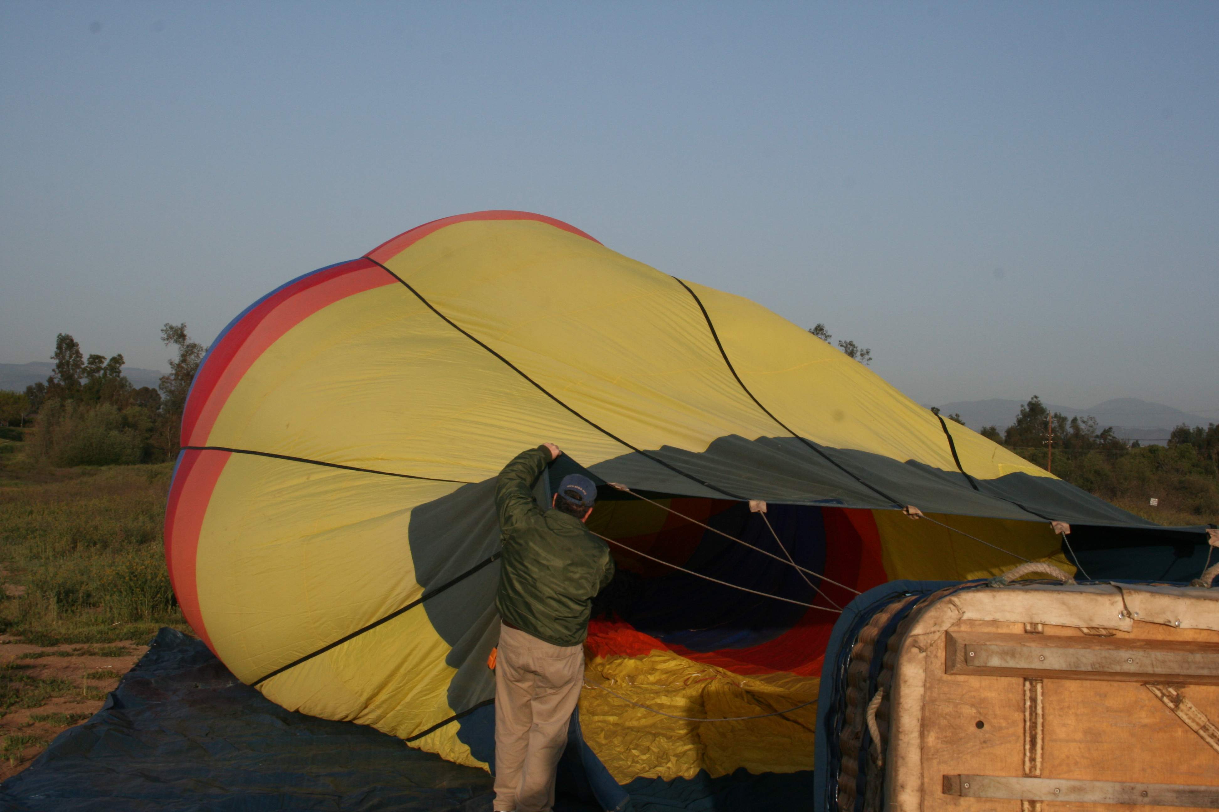
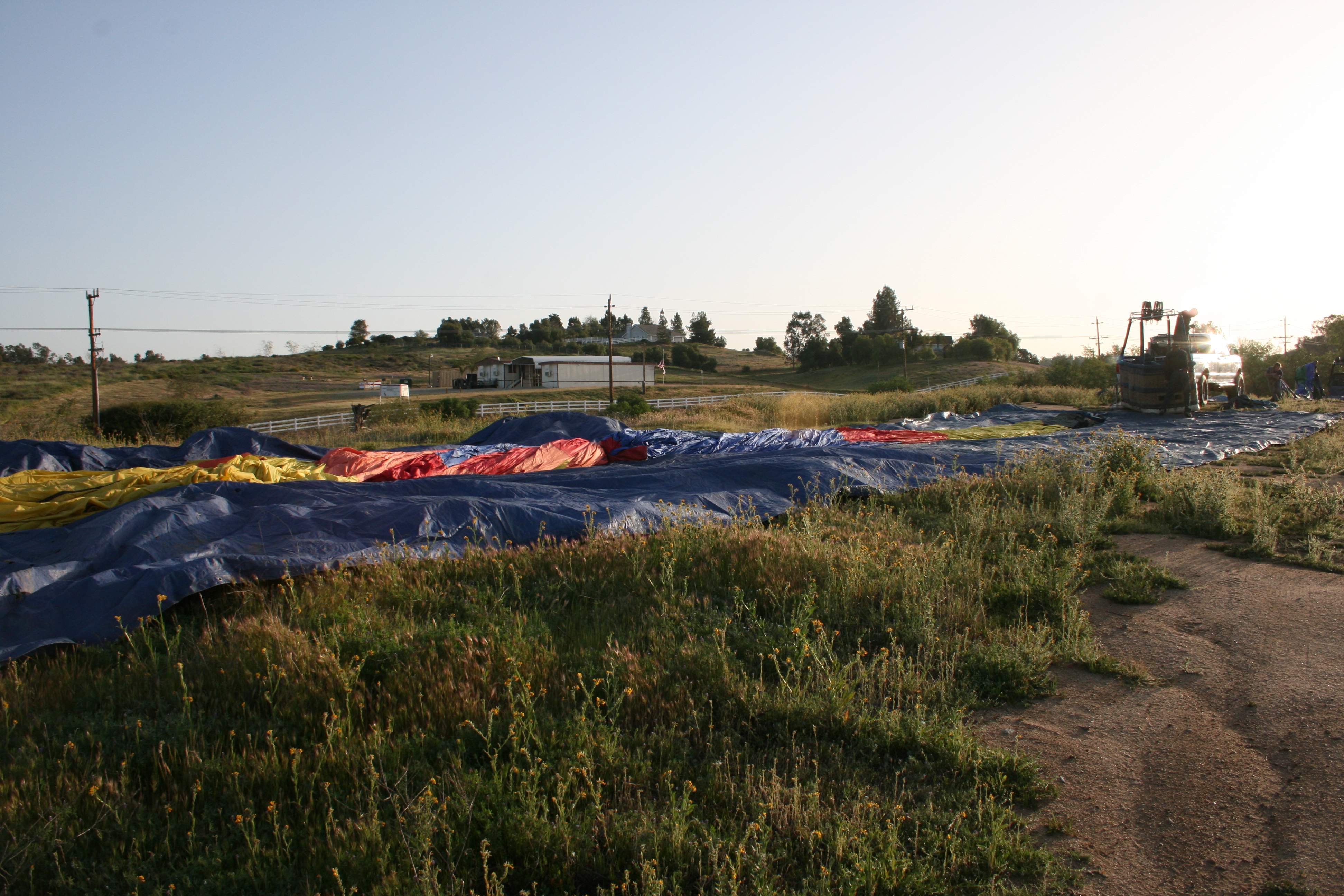
The Long Suffering Wife and I went hot air ballooning about four years ago in Temecula, California. We were in a convoy of  four balloons. Here you can see how the balloons are all being laid on on these huge tarps as they’re set up.

IMG_3659 small
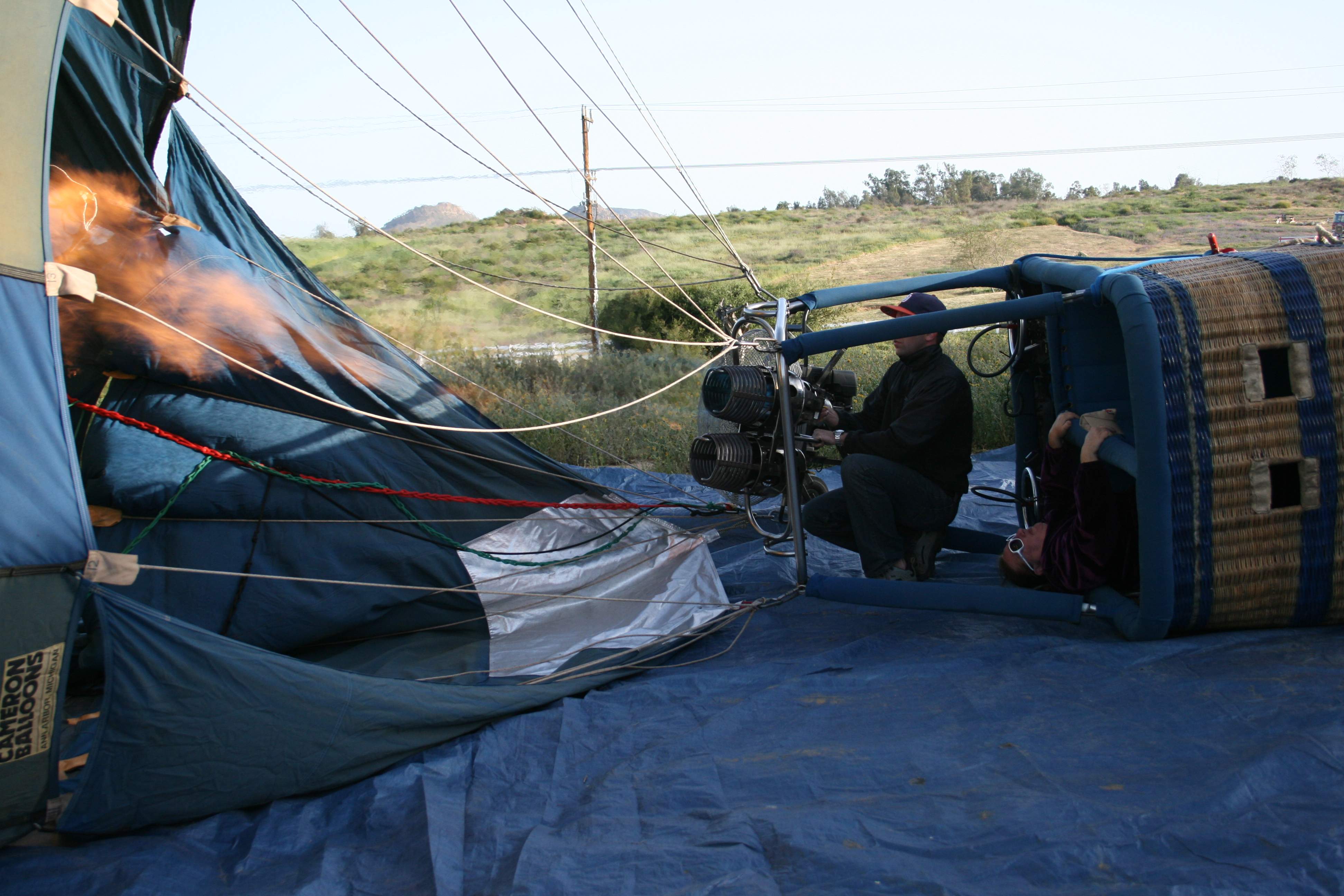
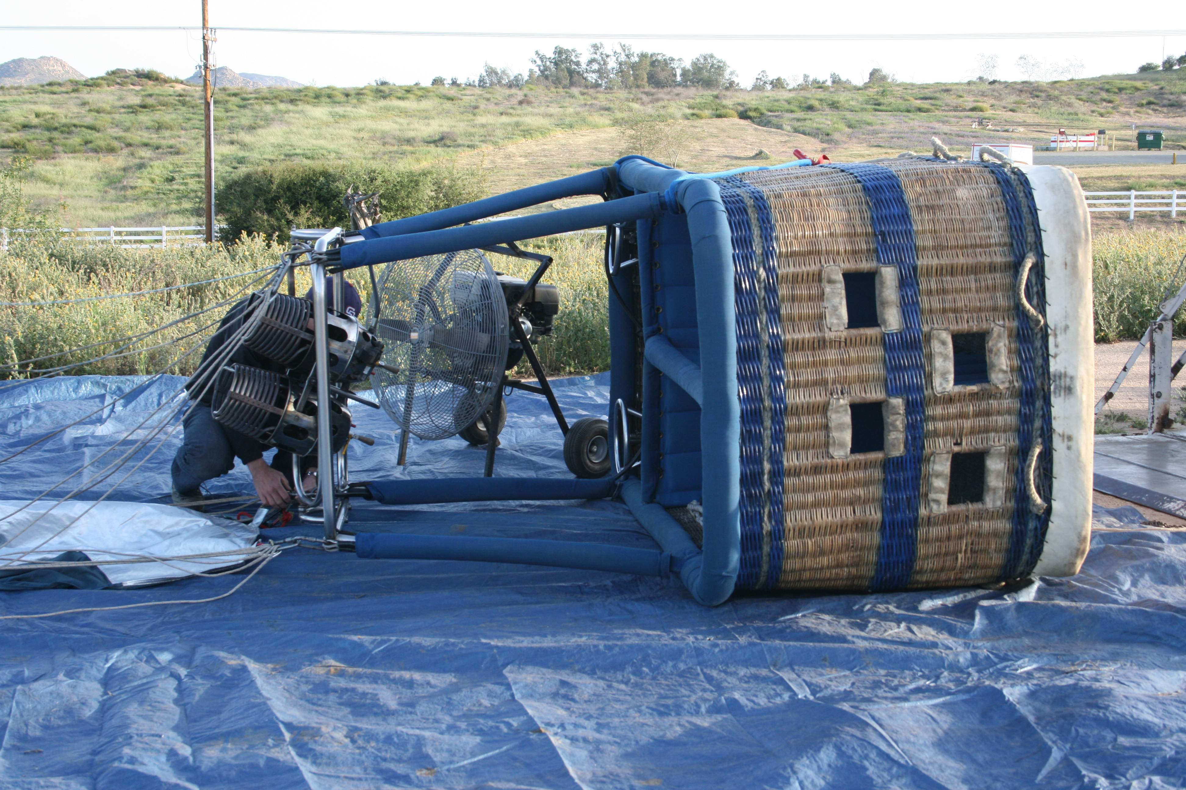
Here’s our basket being attached to the canopy. The big burners are on the left, at the top of the basket. You can also see the gas-powered fan that’s used to blow air into the canopy until it fills enough for the big burners to be turned on.

IMG_3661 smallWe’re inflating the canopy, I’m helping to hold the mouth of the balloon open so that the hot air can be blown into it.

IMG_3683 small
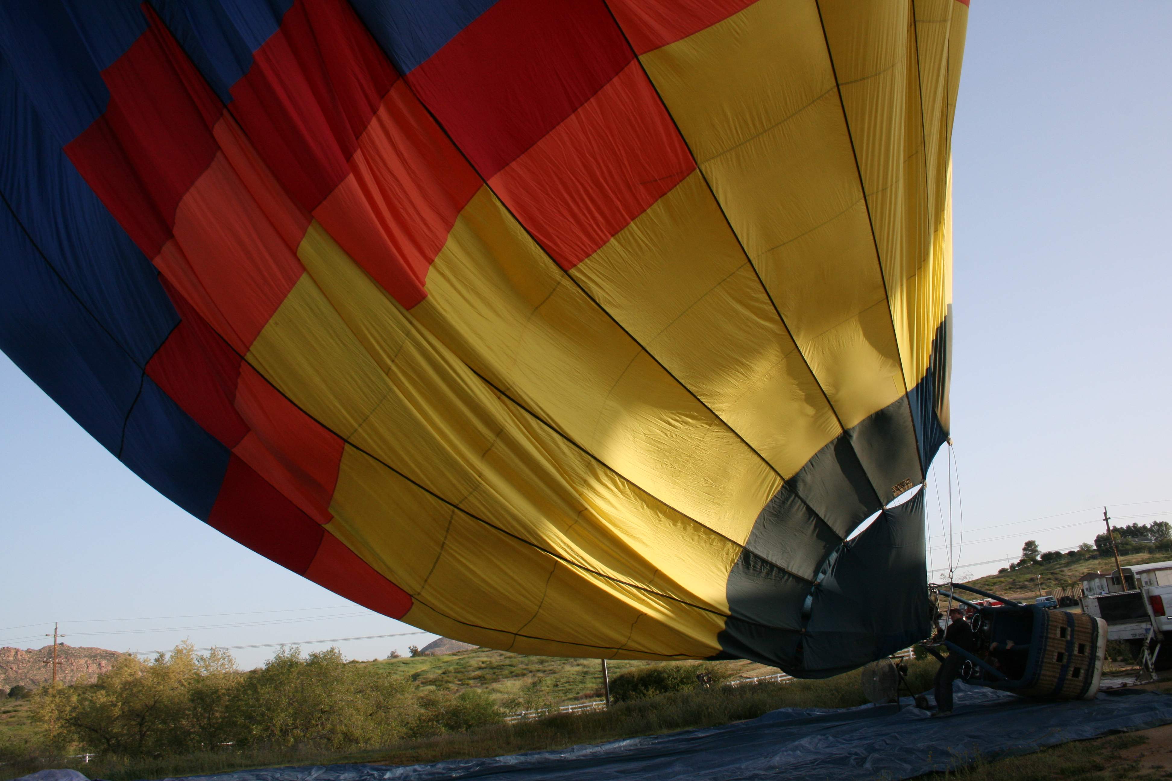
Once the fan has blown enough air into the canopy, the burners get lit off. The canopy inflates and starts to lift quickly. In the basket, you can see The Long Suffering Wife on her back, waiting to be lifted vertically when the whole rig tilts up.

IMG_3690 smallAnd there it goes, starting to become buoyant.

IMG_3699 small
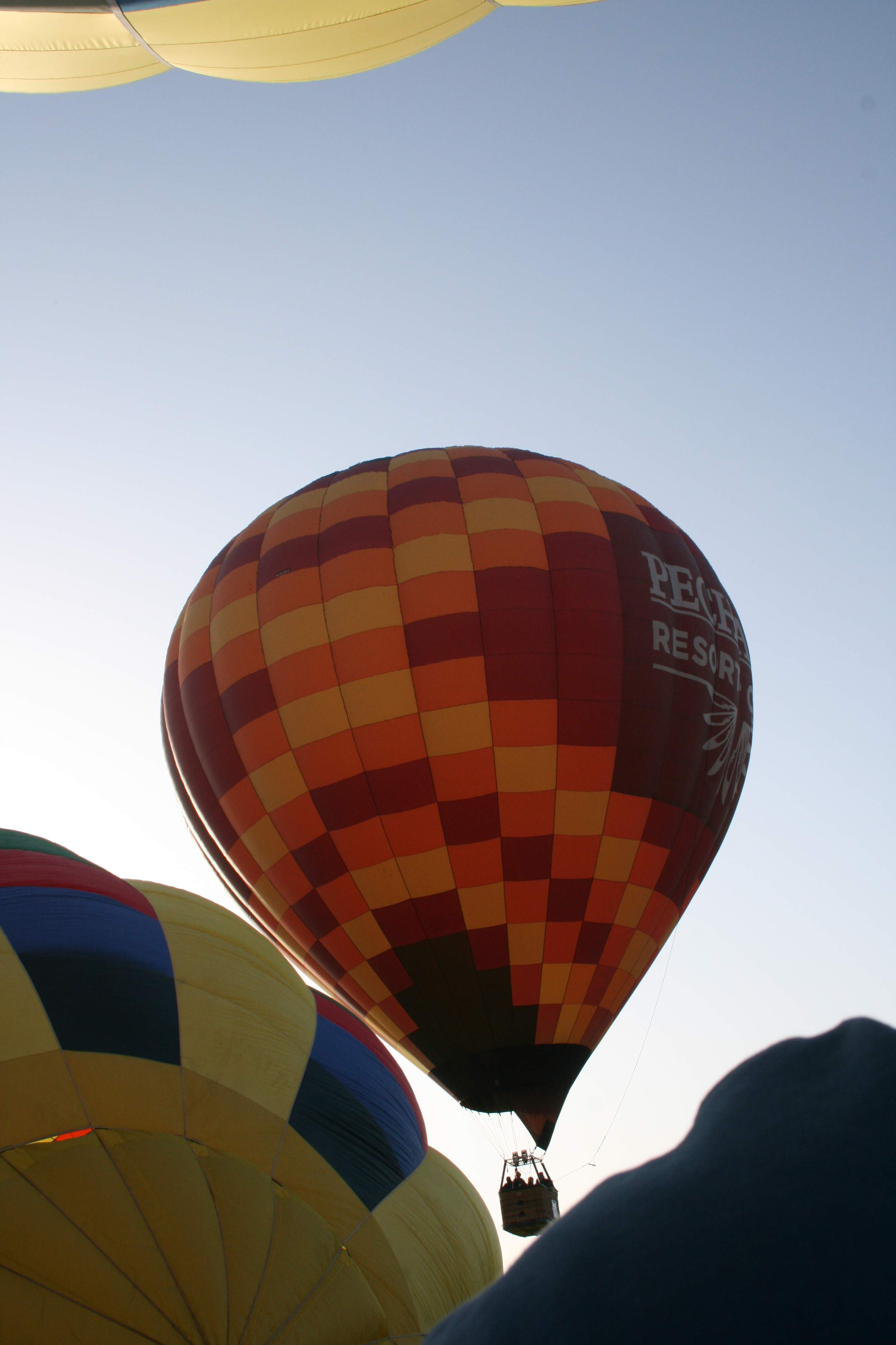
The fleet is starting to rise.

IMG_3727 small
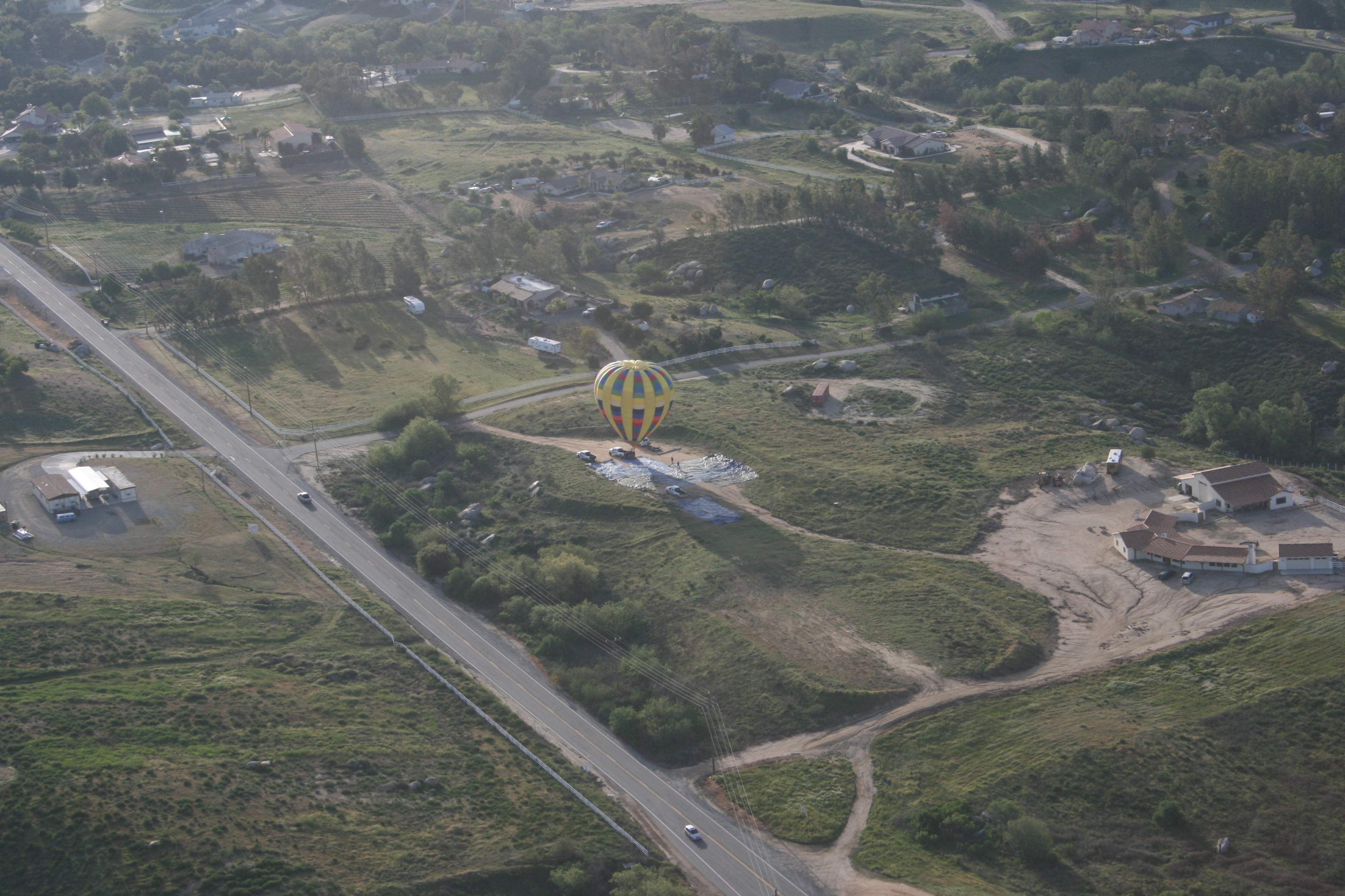
We got off the ground, leaving beind the final balloon. You can see where we set up in some empty lot that they used, the area covered with tarps from the balloon setup. The ground crews pick up all the gear and tarps, then starts chasing us so they’re ready to help us land in an hour or so.

IMG_3802 small
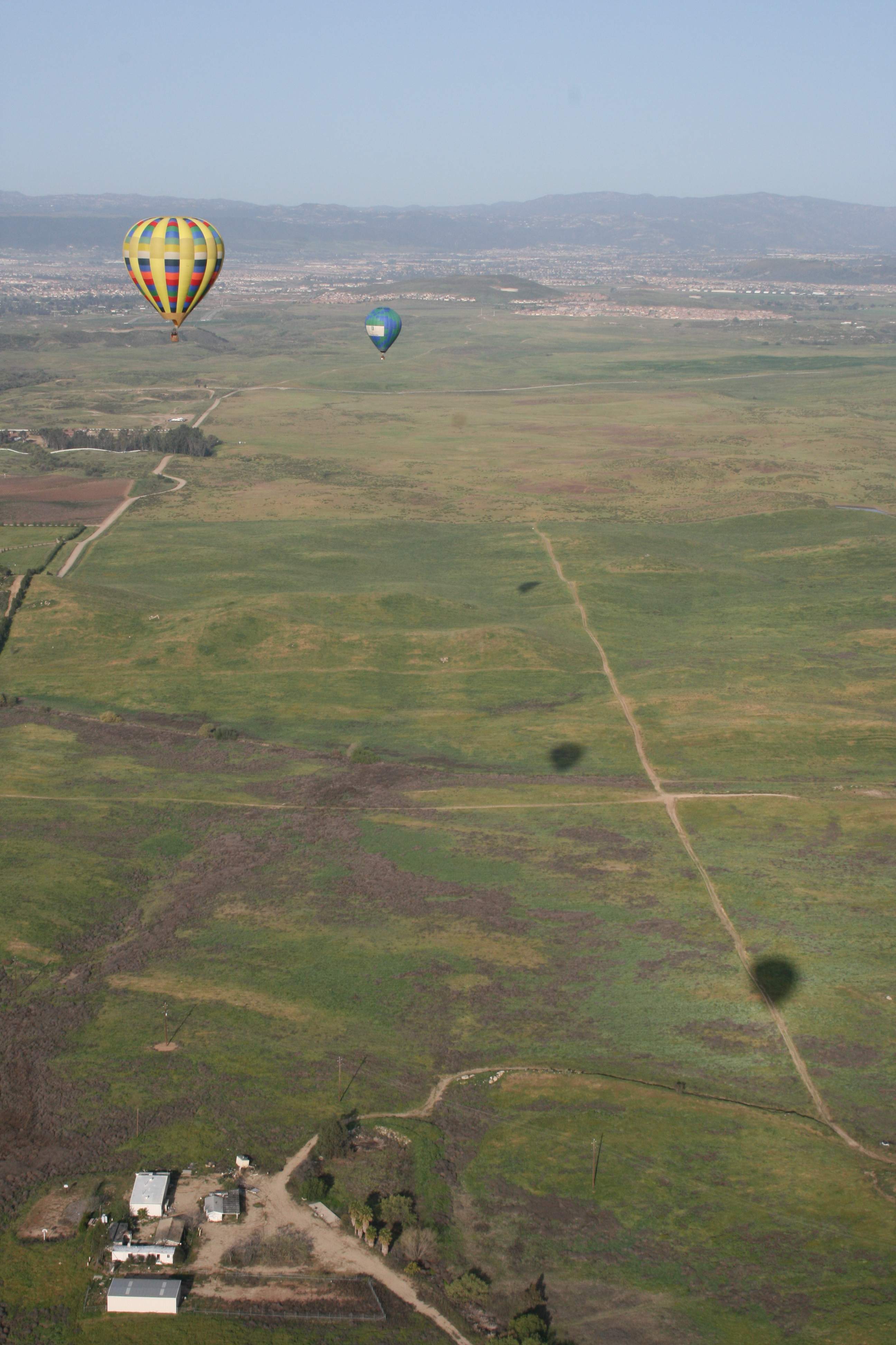
The view from on high. The third shadow in the bottom right  is us. We’re heading down to land out in these fields.

IMG_3814 small
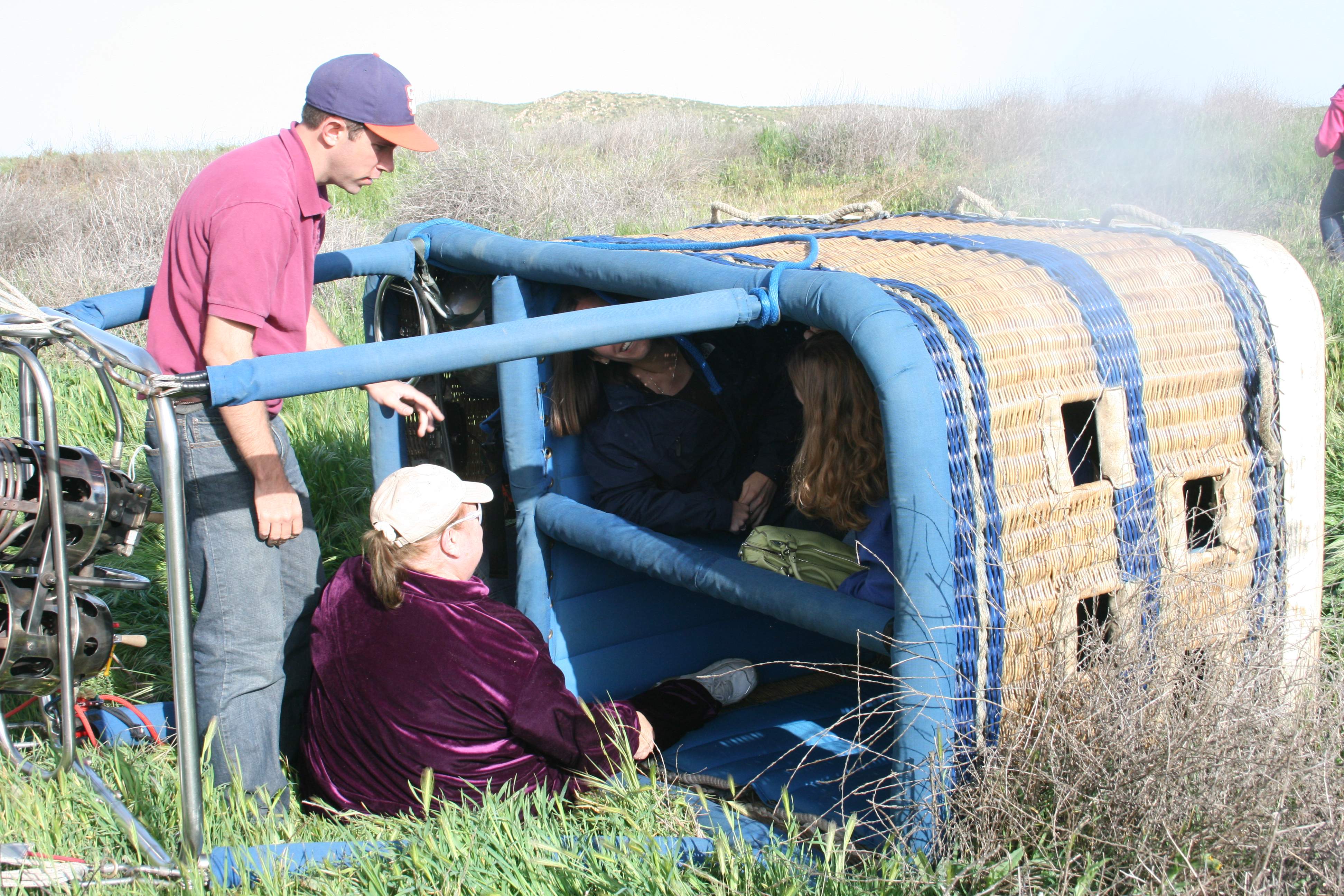
We landed and got pulled over onto our side by the collapsing canopy. I scrambled out first (and got something on the lens of the camera for my trouble) with Ronnie following. The other passengers just hung out and chilled until it was their turn.

IMG_3828 small
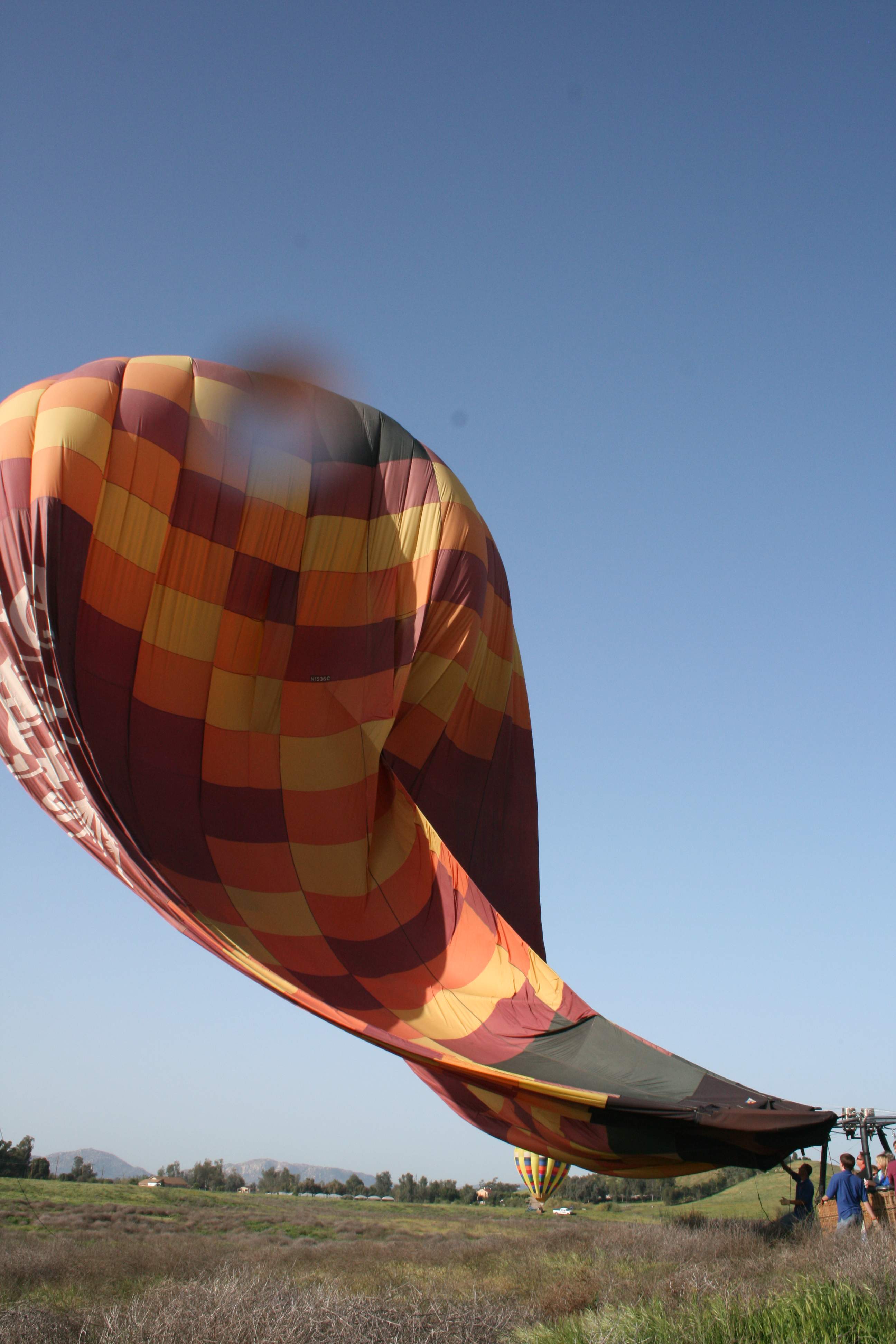
One of the other balloons in our group came in and landed fifty yards away. They stayed upright. Here you can see their canopy collapsing as the vents are pulled loose and all of the hot air spills out the top. (A third balloon can be seen just landing in the distance.)

Let there be no doubt — this was a LOT of fun! Ronnie and I would both go do this again in a heartbeat, any time.

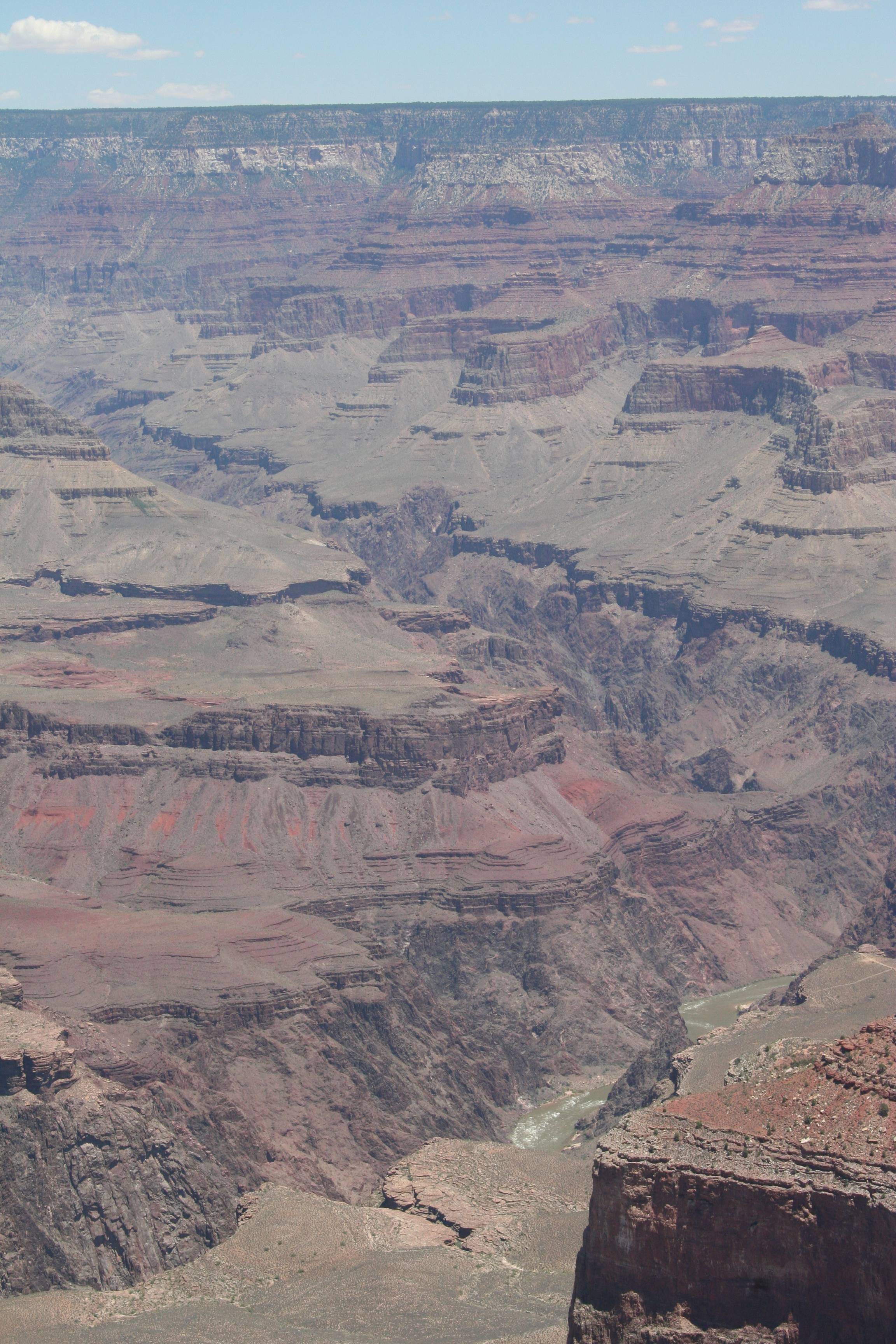
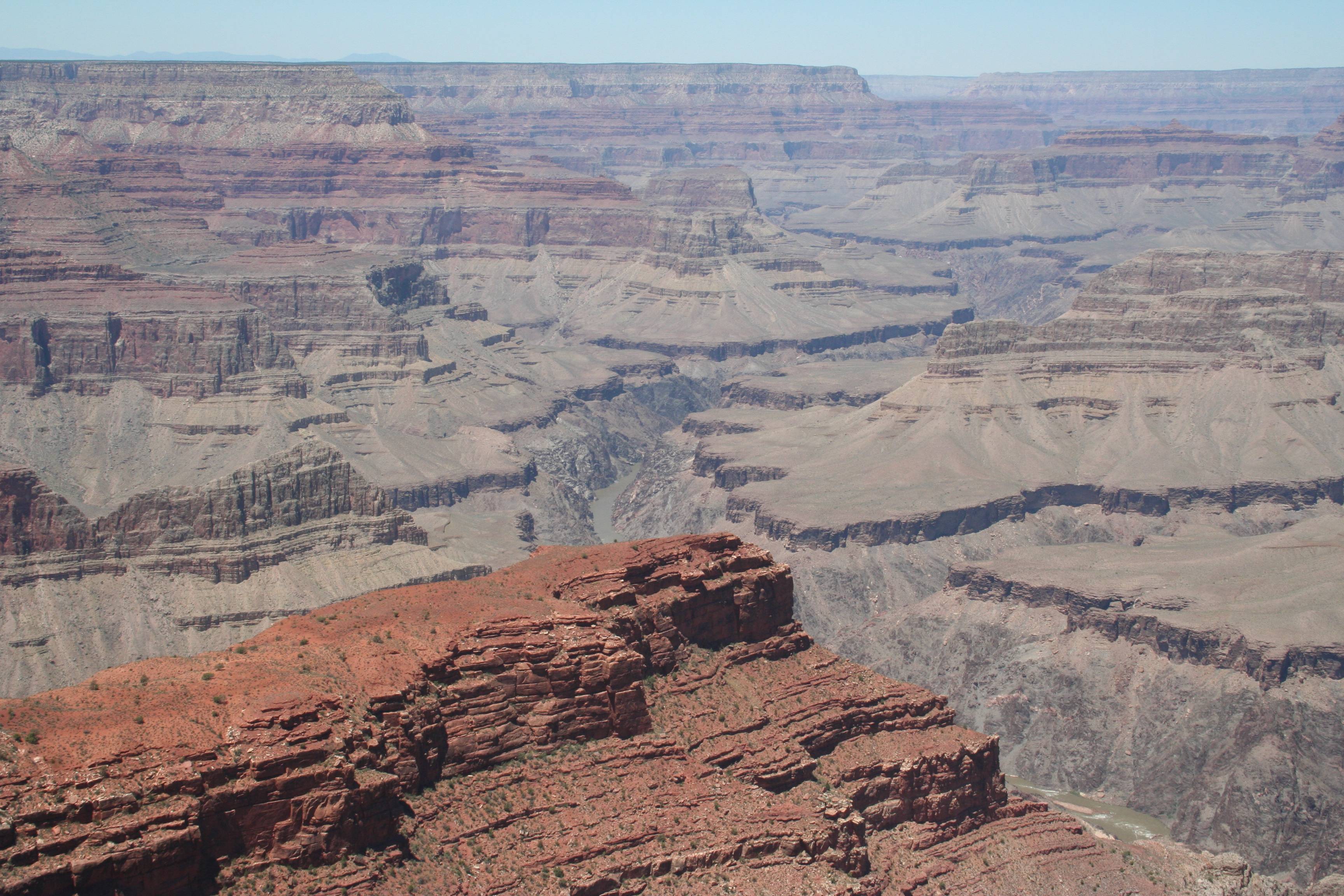
FYI, it also makes great material for years later when your protagonist needs a way to scout a remote desert location.


2 Comments

Filed under Flying, Photography, Travel, Writing

The Real Life Manitou Springs

I’ve mentioned that when writing I find it easiest to describe someplace I’ve been. One of the settings of my current NaNoWriMo work in progress is Manitou Springs, Colorado. While many of the specific places that I mention are imaginary and are meant to invoke a feeling for the place in general, others, such as the police station and the Pikes Peak train station, are very real. We were there in 2008.

IMG_6294 smallThe Pikes Peak Cog Railroad Yard

IMG_6301 small


Bear WarningJust what you want to see walking from the parking lot.

IMG_6686 smallI thought they were hummingbirds. Nope. We were told that they were the biggest freakin’ moths we had ever seen. (I still think they were hummingbirds.)

IMG_6691 smallThese were definitely hummingbirds!

IMG_6697 smallAnd bees. Lots and lots of bees.

IMG_6642 smallGoing to dinner after we had gone up to the Pikes Peak summit, we came out to this HUGE thunderhead, spectacularly lit as the sun set. With the tops still brilliant white, the bottoms black and shooting out lightning, and the middles various shades of red and orange, it was gorgeous to watch.

IMG_6649 small

IMG_6653 small

IMG_6660 small

Leave a comment

Filed under Photography, Travel, Weather

The Grand Canyon (Part Six)

The Long Suffering Wife and I had spent a most wonderful first day at the Grand Canyon, taking a bus tour out to the west with stops at Hopi PointMohave Point, and Trail View Point (see below). I walked along the rim in the village. We had a wonderful anniversary dinner and saw many nocturnal mule deer after a wonderful sunset. We stayed in one of the cabins  near the rim and the train station, then prepared for Day Two. (FYI, if you don’t feel like walking around in the dark, they have taxis. But if you’re a walker, it’s not that big of a place, it’s safe, and it can be marvelous at night.)

On the second day we had hours to go before the train left to go back to Williams, so we caught a different bus (but with the same driver — and the same jokes) that went out to the east along the rim.

Google Maps Capture Yaki PointGoogle Maps

You can see the points to the west of the village where we stopped on Day One but to start Day Two we’re waaaaaay out there on the right. (Check the scale on the map. “Waaaaaay” is all of about two miles and might have taken five minutes on the bus…)

IMG_0624 smallYaki Point, looking back to the west. The Village is out of sight from here, but at the bottom of the picture you can see one of the many scrub jays that will hang out around the viewpoint areas. They didn’t seem too intimidated by people, so I’m guessing they were looking for handouts. Like “Grand Canyon pigeons”.

IMG_0626 smallLooking east from Yaki Point.

IMG_0628 small

IMG_0642 smallMany, many, many, many, many, many, many layers of sedimentary rock laid bare.

IMG_0643 smallAt the lower left of this picture you can see a trail’s switchbacks winding down that promontory of rock and then heading out across that lower mesa. I believe that’s the South Kaibab Trail.

IMG_0645 smallThese bristlecone pines have a tough existence up here on the rim. It’s arid and dry, windy, hot in the summer, freezing in the winter, and there’s no soil, only rock. This one might have been hundreds of years old, but I think it finally lost this fight.

IMG_0646 smallAnywhere a seed can land and get a foothold, some tough plant or the other will give it a shot.

IMG_0649 small

IMG_0673 smallAt most of the viewpoints we just looked around at the conventional viewing sites next to the parking lots. Here I wandered off along the rim for a bit, being very careful and watching out for rattlesnakes. (You have your phobias, I have mine.) There weren’t any signs saying that I couldn’t or warning me that I would die if I did, but I didn’t get all that close to the edge, just in case.

It’s not the fall that kills you, it’s the sudden stop at the end, and I don’t bounce as well as I used to.

Leave a comment

Filed under Photography, Travel

The Grand Canyon (Part Five)

It had been a long first day at the Grand Canyon. We had ridden the train up from Williams (did I forget to tell you about that and show those pictures?), followed by a bus tour  to the west of the South Rim Village, including stops at Hopi PointMohave Point, and Trail View Point. Then I took a small hike for a quarter mile or so (maybe a little more) along the rim in the village itself.

I had mentioned that there are some shows and historical buildings in the village.

Grand Canyon Village MapGoogle Maps

IMG_0835_smallI had mentioned that there are historical buildings in the village. (There are also some “southwestern style” commercial shops and restaurants as well, but even *I* didn’t take pictures of them.) This is the Hopi House.

IMG_0892_smallKachina Lodge

IMG_0836_smallThere were outdoor theaters with shows.

IMG_0599_smallToward sundown we headed to Kolb Studio, which sits atop a promontory of  rock that sticks out from the rim at the west end of the village. (You can see another picture of it in Part Four.) The art studio and shops are up on top, but there are two or three terraces down below that you can go down to. Fair warning — the terraces are not exactly “handicapped accessible”. There are stairs and they’re not particularly steep or hard, but they are irregular, narrow, and cut into the rock face, so if you have mobility issues they may be a challenge.

IMG_0608_smallToward sunset the canyon takes on a completely different view.

IMG_0597_smallHere’s that lower plateau and canyon with the Bright Angel Trail crossing it, now deep in shadow.

IMG_0566_smallIt starts to cool quickly, even in the summer, and the sky gets hazy.

IMG_0579_smallYou start to see more blues, purples, and bright oranges as the reds and browns fade.

IMG_0582_smallThe dynamic range needed on your photos starts to go through the roof. How do you deal with that? (Hint: Digital photos are cheap, so…)

Following this we had a great anniversary dinner at one of the first rate restaurants there. (Make reservations for one of the good restaurants if you don’t want to be eating at a coffee shop or fast food place.) The food was fantastic and they gave us a window seat looking right out over the canyon as darkness fell.

When it gets dark, first of all, be careful you don’t do something rash and go over the edge, it’s a long way down. There are guardrails, of course, but they’re just waist high and they were no doubt built before I society became so litigious and forgot what common sense was. But stay up by the rim in the village if you can. Find a place to sit and relax.

If it’s not cloudy, the stars will be freaking fantastic! There are a few lights in the village so it’s not quite an astronomically dark spot, but compared to any big city, you will see orders of magnitude more stars. In the summer, you’ll see how the Milky Way got its name. If you’ve never been in a dark sky location, you’re in for a treat that rivals the Canyon.

What caught us by surprise after dinner were the deer. Once it gets dark, the mule deer come out to feed. They love the plants and flowers that the landscaping staff at the village work so hard on and they’re used to people being around. They’re not tame – leave them alone, don’t try to pet them or something silly. But don’t freak out when all of a sudden you notice a dozen or more ghost-like, horse-sized shapes shuffling around you just at the edge of the lights. Yet another aspect of a totally mesmerizing place!


Leave a comment

Filed under Photography, Travel

It’s A Good Day To Be A KC Chiefs Fan

In brief:

  • I grew up in Kansas City
  • I fondly remember my dad taking me to a Chiefs game when I was about ten or eleven years old
  • I’ll be a Chiefs fan for life
  • The Chiefs have not had a real great team for a few years
  • Last year the Chiefs were the worst team in the NFL at 2-14.
  • This year, with a new coach, quarterback, attitude, some good draft picks, and other intangibles, we expected to be “better”, maybe 8-8
  • With today’s win at Buffalo, the Chiefs are improbably now at 9-0, the only remaining undefeated team.

Here are some pictures from the November 23, 2006 game at Arrowhead Stadium in Kansas City. It was Thanksgiving Night, and the first Thursday night game in NFL history, a divisional rivalry game between my beloved Chiefs and the Denver Broncos. (The Chiefs won, 19-10!) We were in the St. Louis area visiting my son for the holiday. (He was stationed at Scott AFB at the time.) My son and The Long Suffering Wife, along with my daughters, conspired to surprise me with tickets to the game instead of the traditional Thanksgiving dinner.

It was colder than hell, but the Chiefs won, 19-10. It was spectacular!

IMG_7271_smallThe Truman Sports Complex, with Arrowhead on the left and Kaufman Stadium (where the Royals play) on the right.

IMG_7273_smallTailgating. Everyone tailgates in college and pro football – no one does it better than the Chiefs fans at Arrowhead!

IMG_7286_smallMy son and I, selfie-ing, ready for victory.

IMG_7292_smallArrowhead lit up like a Christmas tree as we were leaving after the triumph.

Leave a comment

Filed under KC Chiefs, Photography, Sports, Travel

The Grand Canyon (Part Four)

Once we finished our first afternoon’s bus tour heading west from the South Rim Village, including stops at Hopi PointMohave Point, and Trail View Point, we took a stroll along the rim in the village itself. Back away from the rim are all of the lodges, parking lots, camping sites, and visitor centers. Along the actual rim are plenty of parks and open seating areas, as well as museums, theaters, historical buildings, restaurants, cafes, and shops. I started at the west end of the village just to the east of Kolb Studio and proceeded to walk east (a little bit uphill, not bad) about three-quarters of a mile, which put me up along the rim near the train station.

Grand Canyon Village mapGoogle Maps

IMG_0429_smallThe sinuous nature of the rim and the way the village is located at the center of a giant horseshoe-shaped curve are obvious here. On the tip of the plateau seen here (upper right) is where Maricopa Point is located, with Hopi Point off in the distance around the other side from there. About half way out on that escarpment you can see Trail View Point. (In Part Three we were there looking back here — this is the reverse of that.)

IMG_0430_smallSticking out on a finger of rock is the Kolb Studio. Right on the far side of the studio is the trailhead for the Bright Angel Trail going down into the Canyon. It’s worth walking down to the studio to see the artwork there, as well as the views from the lower terraces you can see.

IMG_0441_small

IMG_0447_smallWay out in the distance, at the bottom of the Canyon, you can see bits and pieces of the rapids and river bed. The water appears brown or greenish-grey due to the large amount of silt and sediment being carried. White spots on the river mark where the rapids are.

IMG_0480_small

IMG_0496_smallHaving walked up to the east a ways, you get a slightly different perspective. It’s amazing how different things can look just by moving a few hundred yards, as well as having a bit of time passing with the shadows shifting and colors changing with the light.

IMG_0498_smallThe landscape view…

IMG_0501_small…and the portrait view of the side canyon that the Bright Angel Trail runs through. The trail is the lighter, almost white line that tracks across the lower plateau for several miles before again plunging a couple thousand feet. At the bottom of the side canyon, just where the path starts to go into the trees, you can barely see a few outbuildings. These are about the only buildings currently down in the canyon, there to provide a minimal amount of help and a resting area to hikers.

IMG_0502_smallIt doesn’t take long at the Canyon to figure that you could live there year-round for a long, long time and never get tired of seeing it.

Leave a comment

Filed under Photography, Travel

Juicy Chunks O’ Wisdom For Friday, October 25th

‘Cause Fridays used to be better, that’s why.

  • What is it about this time of month? (Just realized a possible answer as I used that turn of phrase…) I noticed that the “Juicy Chunks” posts for August and September were on the 27th and 25th respectively.
  • It sounds like they’re having a good time at the football game at the high school two blocks away. I wonder who they’re playing?
  • Last night there was a really loud owl somewhere in the trees either in our back yard or the neighbors’ back yard. It was beautiful listening to it hoot once a minute or so for over an hour.
  • We can always tell when there’s a big rivalry game at the high school because our street fills up with overflow parking.
  • This whole passive-aggressive thing with Joey Chan (the cat) is really getting old. She sits under my chair and whines and begs to be on my lap, refused to jump up on her own, but if I reach down to pick her up and put her there, she takes a swipe at my hand.
  • I’ll bet the noise from the football game scares the owl away tonight.
  • It occurs to me that Joey Chan and I might be playing different games. She might be totally uninterested in sitting on my lap. Instead, she might really wants to claw me up for whatever feline reasons her almond-sized brain has.
  • The passive-aggressive thing is just what she’s figured out to get me to put my hand down there where she can get at it. I mess with her head using the laser pointer, she messes with mine by pretending that she wants on my lap. Ahh, perspective…
  • I wonder how big that owl was and if it was big enough to take out one of our full-sized raccoons. Maybe not. But squirrels or rats, for sure. Probably could take out a cat as well.
  • When I was seventeen I really wanted to take the summer between my junior and senior years of high school and go to Europe.
  • I was going to stay at hostels, get a Eurail Pass, and backpack through a dozen countries.
  • I did not go to Europe when I was seventeen. I did not backpack through a dozen countries.
  • My mother informs me that she has gotten another dog, a Yorkshire terrier of some sort. I’m glad it makes her happy and it’s great that she rescued an abandoned critter. But I still look at it as just a pair of “little rat dogs”.
  • Our high school football team was not very good. From memory, I think we were 1-7 and 0-8 in my junior and senior years.
  • That wasn’t the reason I wanted to go to Europe.
  • Imagine our surprise at the 35th anniversary high school reunion when the current football team rolled by in the parade carrying the state championship trophy.

Remember to keep some “emergency” rockin’, upbeat music at hand for when it’s time to feel better.

Leave a comment

Filed under Cats, Critters, Dogs, Juicy Chunks, Travel

The Grand Canyon (Part Three)

On our bus tour on our first day at the South Rim of the Grand Canyon, we visited Hopi Point and Mohave Point. From there, the bus headed back to the Grand Canyon Village and stopped at Trail View Point.

Trailview Point mapGoogle Maps

IMG_0396_small

IMG_0398_smallThe squiggly white line across the lower mesa is the Bright Angel hiking trail down to the bottom of the Canyon from the South Rim Village. As you can see, you descend a couple thousand feet to get down to this lower plateau, hike a couple of miles, then pretty much drop over that far cliff and down another few thousand feet. The total hiking distance is only 9.3 miles, but the total vertical drop is over 5,000 feet – and then you get to hike back up. I would love to do it someday, but I’ll need to be in better shape than I am now.

IMG_0401_small

IMG_0407_small

IMG_0415_smallThe South Rim Village is built at the edge of the Canyon, near the center of a huge horseshoe-shaped bend, so that there are “arms” of land sticking out to both the east and west of the Village. Trailview Point is on this western arm of land, and here we can look back and see the Village, perched on the edge.IMG_0423_smallEmbiggenate this picture to see most of the South Rim Village on the top of the mesa, with the Canyon falling away below it. You can also clearly see the Bright Angel trail descending down from the Village. Even if you can’t hike all the way down to the river, it’s not too terribly strenuous to hike down a half mile or so (YMMV!) always keeping in mind that you have to go back up.

IMG_0426_small

IMG_8404_smallAs spectacular as the scenery was, one of the best highlights of the day was seeing a pair of condors soaring in the thermals rising up just off the edge of the cliff. The both came within fifty feet or so of us as they circled up from below the rim, riding the thermal until they were way over our heads. I had never seen on in the wild – they were spectacular, and HUGE. Watching them was special.


Leave a comment

Filed under Photography, Travel

The Grand Canyon (Part Two)

When we last saw our vacation couple at the Grand Canyon, we were at Hopi Point on the afternoon bus tour. From there, we went to Mohave Point.

Mohave Point MapGoogle Maps

IMG_0391_small

IMG_0387_small

IMG_0385_small

IMG_0368_smallRemember to click on any picture to get the full-sized version.

IMG_0366_small

IMG_0354_small

IMG_0353_small

IMG_0350_smallAs you can see, every view at every stop is new and different. Endless variety in how you see the canyon, the outcroppings, the geologic layers. Infinite changes to it all as the lighting changes from hour to hour, minute to minute.


Leave a comment

Filed under Photography, Travel

The Grand Canyon (Part One)

I’ve recently shared photos from northern Arizona showing Oak Creek Canyon on Arizona Route 89A and the town of Sedona. When the Long-Suffering Wife and I were in those places, we were taking the long way home coming from the Grand Canyon.

I can not emphasize this enough — if you never visited the Grand Canyon, it MUST be on a trip somewhere in your future.

The Grand Canyon, even in a two-day visit to just hit the most popular, easily accessible sites on the South Rim, is way, way too big of a subject for just one post. (I take a lot of pictures.) We’ll spread these out a bit.

We made reservations for one of the lodges at the South Rim and rode the train up from Williams, Arizona. (This is a great way to do it, highly recommended.) But you can also just drive up there in your own car and camp or stay at a lodge. (Well, you can’t right now because of the Freakin’ Idiots in Washington, but once all of our “leaders” all get back on their meds you’ll be able to.) Once you get to the village there, you can take a couple of different bus tours that go to different parts of the South Rim, all within a couple dozen miles east or west of the Village.

For the record, there are a ton of other ways to see the Canyon and other things you can do there, depending on your schedule and physical conditioning. You can walk trails down to the bottom of the Canyon – but then you’ve got to walk back up. (This is seriously non-trivial.) You can also just walk down a trail a quarter mile, half mile, a mile or two, whatever, and then walk back up. You can camp out (with permits) at the bottom of the Canyon.

You can go to the North Rim instead of the South Rim – much more out of the way, a much longer drive to get there and get back out, much more isolated, but a truly incredible place to visit in its own right.

The areas around the two rim villages are just a tiny part of the park itself. There are plenty of other camping, hiking, and sightseeing places in the park. But the South Rim Village area is where about 95% of the tourists go. (I can’t even get links to work right now to send you to the appropriate National Park Service web sites because of this idiocy in DC – google it when the sites come back online.)

These pictures are from the first area that our first bus stopped at, Hopi Point.

Hopi Point MapGoogle Maps

IMG_0304_small

IMG_0306_small

IMG_0308_small

IMG_0322_small

IMG_0324_small

IMG_0327_small

IMG_0329_small

IMG_0330_small

IMG_0334_small

Leave a comment

Filed under Photography, Travel