Category Archives: Flying

Steel Rising

Yesterday morning they started raising the steel superstructure for our two new hangars at the CAF SoCal in Camarillo.

File Aug 13, 16 36 58 small

In addition, today was Media Day at the hangar in preparation for the “Wings Over Camarillo 2015” airshow, next weekend, August 22nd and 23rd.

File Aug 13, 16 37 45 small

If you’re looking for a great place to spend a day with planes on the ground and planes in the sky, come out and join us. If you swing by the CAF hangar, say hello!

Leave a comment

Filed under CAF, Flying, Panorama, Photography

BTV To ORD

Last Thursday morning, returning home from Vermont, flying out of Burlington into Chicago. What do I see from the air? Not surprisingly, I see a lot of airports.

IMG_0142 small

It was fairly early when we left Burlington, so the low sunlight made the contours in the broken cloud layer stand out.

IMG_0146 small

The Finger Lakes of New York, just north of Lake Placid.

IMG_0152 small

Approaching the St. Lawrence River, separating the United States from Canada. Just to the lower right of center is Fishers Landing, New York. The major roadway there is US I-81 turning into Canadian Highway 137 as it crosses Wellesley Island.

IMG_0162 small

Kingston, Ontario. The harbor on the right and the Kingston Airport on the left make it easy to identify. At the bottom is Simcoe Island in New York.

IMG_0171 small

This is the Bay of Quinte, an offshoot of the St. Lawrence River. The community at the top is Trenton (along with Trenton Airport) and at the far left of the Bay you can see the entry/exit point of the Murray Canal, which connects the Bay of Quinte with Presqu’ile Bay on Lake Ontario.

IMG_0184 small

Whitby, Ontario on the left, Oshawa, Ontario on the right, with Oshawa Airport at the top center. As you can see, we were flying the length of Lake Ontario. I was sitting on the right side of the plane so I was looking at the southern border of Canada. The Long-Suffering Wife was on the left side of the plane and could have been looking at the northern border of New York (Rochester, Buffalo, Niagara Falls) if she hadn’t had the good sense to close her window and get some sleep.

IMG_0191 small

We flew right over the northern part of the Toronto area. The south end of the rail yards at Vaughan can be seen at the top left, while the north end of the runway at Toronto Downsview Airport can be seen at the bottom center.

IMG_0197 small

After crossing the southern tip of Lake Huron, we’re back over the United States. Heading west across Michigan, we passed just south of the Grand Rapids area, where the Kent County International Airport makes a great landmark.

IMG_0202 small

Approaching the eastern shore of Lake Michigan, we passed over Holland, Michigan. At the very bottom center you can see the Tulip City Airport, while there’s a much smaller airport (Park Township) on the northern shore of Lake Macatawa.

Lake Michigan is freakishly huge when you fly across it. I can see why it’s often recommended that small, single-engine planes take the long route around the southern tip rather than risk having an emergency over Lake Michigan.

Leave a comment

Filed under Flying, Photography, Travel

Control Issues

In many ways, it would have been easier if I had just gotten a phone call that said, “Get on the next plane you can.” Then I would have been forgiven for simply casting aside most of my normal daily responsibilities and simply reacting. I might even have been expected to do that. Don’t think, just keep putting one foot in front of the other.

But in being asked to be there in a week and stay for an uncertain duration, my brain wants to somehow take that as a reprieve, a chance to retain some modicum of control. If I do this and that, then I can minimize the impact on my absence from the hangar for a couple of weeks. If I can get A, B, and C done, then I can minimize some of the impact at home on things I normally keep up on. Of course, with that “reprieve,” I can take on numerous additional tasks to prepare for the trip and be able to help more when I get there.

I can plan. I can make checklists and double check them. I can leave little yellow sticky notes all over the place. I can fool myself into believing that I’m on top of the situation.

Um, yeah, about that…

Again, in thinking about this as I write, letting my brain roam freely as my fingers roam across the keyboard, I realize that there are parallels in flight training. (I find that a lot if I go looking for it, and since flight training is a really good thing and an excellent model for situational awareness, multitasking, and planning, I like to think those skills can carry back over to daily life.)

When operating normally, the number one rule is to stay ahead of the plane. Wherever possible, anticipate what’s coming up next and be ready for it.

Travelling cross country? Know in advance during your planning phase what your route is, and where there are alternative places to land along the way if you get into trouble. If everything’s fine, know in advance where and when you need to throttle back and start descending. Have a list of the anticipated radio frequencies that you’re going to switch between as you travel, and as soon as you sign off from #1 and start talking to #2, load the expected frequency for #3 into the radio – as soon as you switch from #2 to #3, load #4, and so on. Know what your landmarks are or navigation points and know when to expect them.

Stay ahead of the plane.

But when things go catastrophically wrong, i.e., the engine quits or your fuel tanks are empty or you hit a bird or you’re getting ice on the wings… Then the number one rule changes.

Fly the plane!

You may want to find a way to get down and land ASAP. You may want to call for help. You may want to try to restart the engine or switch fuel tanks or something else. But while you’re busy doing that, you can lose control of the plane and turn a bad situation into a fatal one.

Don’t worry about anything else until you’re following rule #1 – fly the plane!

That’s the equivalent of being told to get on the next plane. You don’t have to worry about anything else – just fly the plane. Just react. Just keep moving.

But now, it’s like bad weather moving in when you’re flying. Those accidents don’t start off catastrophic, but they end up that way because they’re the result of a string of little errors that add up. Break the chain and the accident’s avoided.

Weather’s looking spotty? Divert to one of those alternatives you planned for. They’re looking spotty as well? Turn around and go back. But you need to get there and you’re pretty sure you’ll be OK? Famous last words. Now you’re in conditions you’re totally not prepared for but you’re going to press on anyway? Fine, but what happens when you get off course and start to run low on fuel? Worrying about the course and navigation and fuel and you don’t notice the ice on the wings, or the oil temperature rising? It’s okay, I’m in control, there are just a few issues to deal with.

Really?

One little thing at a time that add up, none of them critical by themselves, but in a string they’re a disaster.

So now I think that I’m maintaining some control by working like a demon to get days and days and weeks of stuff done in just four or five days. I won’t miss anything.

But if I do miss anything, I’ll have the tools I’ll need to handle them on the fly. I can do that because I’m connected via phone and computer and internet and finances and everything can be taken care of that way.

But if it turns out that small towns in Vermont don’t have 4G cell service and I find out that I won’t have internet access where I’m staying, well, that’s still okay because…

And if I find that something else is an issue then I’ve got a contingency plan, except that maybe there’s a problem there…

Somehow I’ll figure something out and just deal with it, which is great until…

Just. Fly. The. Plane.

Important to remember that.

2 Comments

Filed under Family, Flying, Paul, Travel

Curve Ball (And Trouble Therewith)

Too many crises, not enough neurons.

This will serve as a little “heads up” that things may get a bit squirrely around these parts over the next two or three weeks. I’ll be making a trip back to Vermont next Thursday, and as much as I love Vermont, the reasons for the trip are considerably less than delightful. One of those things we all have to deal with sooner or later, usually several times in our lives, but it’s never pleasant and it’s never something anyone’s really prepared for.

Anyway, time might be in very short supply and schedules might be changing and updating and tumbling sort of like those chaotic moons of Pluto. If given the chance I may slap together some “generic” draft blog posts with photos or whatever that I can post with a minimal amount of internet connectivity (parts of Vermont are not a bastion of high-speed access) and time. If something here seems out of context, sort of like the way the original “Serenity” episodes were shown, you’ll know that it’s one of those days.

In short, the next few weeks might be a bit short on space stuff and long articles and deep thoughts and long on “Oooh, look at this pretty picture!”

Like tonight, when I was thinking I had done everything I absolutely had to get done and I was this close to collapsing into bed – only to remember my site… So tonight you get to admire this picture of the North American XB-70 Valkyrie from the National Museum of the United States Air Force in Dayton, Ohio.

OLYMPUS DIGITAL CAMERA


2 Comments

Filed under Family, Flying, Photography, Travel

Images & A Story Saved For Today

There was something else penciled in for today’s post and a special set of pictures saved for some other special day, but then the world changed and I realized that today was the special day.

Two months ago when I had spent a week in Washington for the Hubble 25 NASA Social, I flew back to Los Angeles through Dallas Fort-Worth. As anyone who has flown through DFW knows, weather can be a factor there. Large thunderstorms are not uncommon and they can snarl traffic throughout the nation and the world as delays and cancellations start to cascade through the air traffic control system. This was one of those days.

Just out of Washington we were informed that instead of a direct route (over West Virginia, Kentucky, Tennessee, and Arkansas) we would be diverted north in order to avoid storms. We would be going across Indiana, Illinois, Missouri, Kansas, and Oklahoma. This would make us late, most of us would miss our connections, blah blah blah, except that the connections were just as screwed up as we were, so…

As is my wont, I took pictures out the window while flying. After bouncing through some significant storms and turbulence on our downwind leg over Mesquite, we turned to base south of DFW, then turned north on final, broke through underneath the clouds and found this:

IMG_8897A double rainbow off to the east! The clouds were in layers with rain falling between them, and the sun setting in the west was in a perfect position to make a spectacular display.

IMG_8912As we turned and dodged thunderstorms, the rainbows turned with us, sometimes fading as the sun would go behind a cloud off to the west.

IMG_8919But they always came back again, just as strong, the second (outer) rainbow just about as bright as I’ve ever seen one.

IMG_8921Then I looked up…

IMG_8922…and contorted in my seat as best I could to look back. Not only did we have a double rainbow, but we had a full-arc rainbow! It was the first time I had ever seen such a thing. I wanted to get the entire rainbow into one picture, but the full arc is too wide for anything but a wide-angle lens.

Wait! I could shoot multiple frames and combine them into a panorama! I was shooting pictures with my iPhone and really wanted to get to my DSLR to get a better set of pictures to combine into the panorama. But on short final, trays up, seat backs in a full and upright position, my good cameras safely buried under the seat in front of me, and only seconds to go before the rainbow would fade, I knew that wasn’t going to happen.

Then it occurred to me that my iPhone has that panorama mode. We were bouncing all over the place in the turbulence – would the iPhone’s panorama software handle that?

IMG_8932Click on this and the picture below to get the full-sized images. Look at them full screen and in all their glory.

IMG_8933Not only was the rainbow a full arc, but it was a double! The outside arc was more visible on the ends near the ground, but the dark area between the two arcs was quite distinct and the full outside arc could be seen dimly.

This was a fantastic end to a fantastic trip. There were all of the flight delays to deal with, but that just gave me a chance to go through these pictures and start tweeting and emailing copies to American Airlines and several prominent online science journalists and photographers.

It should be obvious why a story about rainbows, especially a story full of excitement, passion, and beauty, would be so appropriate today. It was a very good day when I caught the images of this complete arc double rainbow – it was a very good day today as well.

Today deserves these rainbows.

1 Comment

Filed under Flying, Photography, Travel, Weather

Cloudy, Gloomy Day On The Ramp

I spent this Saturday as I spend almost all of my other Saturdays when I’m not travelling – at the CAF SoCal hangers in Camarillo. Today it was grey and gloomy, borderline chilly, despite the fact that at home, thirty miles away, it was sunny and pushing 90°F. That’s what you get when you’re just a couple miles from the coast during “June gloom.”

We were setting up for a wedding in the museum hangar (renting it out for events is a big source of revenue for us) and we had the EAA holding their monthly meeting in our maintenance hangar (we’re building two more hangars, a portion of which they’ll lease from us, but for now we’re sharing) so almost all of the planes were out on the ramp. Also out there were five or six of the small general aviation aircraft belonging to the flight school that leases tie-down space on our ramp.

All in all, gloomy or not, there were a lot of aircraft sitting around. What better time to take a couple of panoramic pictures?

IMG_9477

On the west side of the ramp I was between two of the flight school aircraft. Out in the middle, from left to right are one of our SNJ’s (blue with white tail), our PT-19 (blue with yellow wings), our C-46 “China Doll” (the honkin’ big one in the back), our A-2 trainer, our F8F Bearcat (dark blue, hiding behind the P-51), our P-51 Mustang (red nose & tail), and our other SNJ (yellow).

IMG_9479

Over on the other side and looking back, from left to right are “China Doll,” one of the flight school planes, the F8F Bearcat, the A-2 in front of the P-51 Mustang and the yellow SNJ, our F6F Hellcat (dark blue with the wings folded back), our Navion trainer (white on top, blue on bottom, yellow stripes),  the PT-19, and the blue SNJ. Over behind all of the planes, running from the far hangar out to the taxiway on the right, you can see a chain-link fence covered with green tarps. On the other side is where the grading is going on for our new hangars.

Not the best day for flying, but a good day to get a lot of catch-up work done on the accounting and paperwork. You take what you can get.

Leave a comment

Filed under CAF, Flying, Panorama, Photography, Weather

NASA Social For LEAPTech At NASA Armstrong (Part Five)

All good things must come to an end. After four days of writing about the NASA Social a week ago, showcasing the LEAPTech project at the NASA Armstrong Flight Research Center, it’s time to wrap things up.

Remember, you can see what LEAPTech is (“Leading Edge Asynchronous Propeller Technology”), go along as we went out onto the Rogers Dry Lake to see a LEAPTech live data collection run using HEIST, visit the F-15 hangar as well as the Subscale Flight Research Lab and the Lunar Landing Research Vehicle.

42_IMG_7880 small

Our next stop was at the Global Hawk hangar. These vehicles are modified military remotely-piloted vehicles that can be loaded up with whatever instruments are needed to gather data for extended periods of time. Often the data comes from places that are unsafe for a piloted aircraft, such as in or near or above a hurricane, thunderstorm, or volcano. Many of the observations that the Global Hawks are used for are done in concert with the National Oceanic & Atmospheric Administration (NOAA) to study extreme weather events and to gather data to make better weather predictions. While the Global Hawk is not rugged enough to fly into a hurricane, it can be fitted with a whole cluster of radiosonde buoys which it drops into a hurricane from above, monitoring the data as the buoys descend through the storm.

43_IMG_9104 small

This panoramic view shows how long the wings are on the Global Hawk. The almost glider-like wings combined with a high-efficiency jet engine allow the Global Hawk to stay in the air for up to twenty-four hours. That requires three separate shifts of controllers and remote pilots, who can be based out of Edwards on the US west coast, Wallops on the US east coast, or in a remote mobile station.

The design similarities to a glider give the Global Hawk a great glide ratio, meaning that it can fly a long way if there’s an engine failure. That, combined with the fact that the Global Hawk flies at up to 65,000 feet, well above the commercial airliners, means that in an emergency it can reach a wide range of potential landing sites. While nominally controlled remotely, in an emergency that results in a communication failure, the Global Hawk has pre-programmed contingency procedures and limited autonomous abilities to keep itself safe and out of the way of other aircraft.

44_IMG_9110 small

Frank Butler is the Global Hawk program manager and was gracious enough to spend some time with us answering questions about the program.

While we were in here, where “here” is a big, hollow, echo-y, metal hangar, we heard two sonic booms. There is a high-speed corridor over the base in which military and test aircraft can be cleared to break Mach One, rattling those on the ground beneath them. Frank didn’t seem too bothered, but the rest of us jumped pretty good. That big, hollow, metal hangar really rings and rattles when the sonic boom hits! (I love hearing sonic booms, by the way. I know, big duh, huh?)

45_IMG_9113 small

Our last stop was in the Adaptive Compliant Trailing Edge project. Back in November we saw this program at the beginning of its testing. Now it’s finished that initial step and they’re getting ready to move on to the next, longer, and more complex step.

Also back in November, a tweet of mine (with a view very similar to this one) was picked up by CNN Online. My fifteen minutes of fame!

46_IMG_9115 small

The ACTE test pilot, Tim Williams, was there to answer our questions, as well as members of the engineering and design team. ACTE could be another revolutionary technology in how planes fly, replacing today’s flaps with surfaces that can flex and bend more like a bird’s wing. Not only could this be yet another factor in significantly reducing aircraft noise, but it could also make planes more efficient, reducing fuel used by several percent.

In the first testing phase, the flexible section of the wing was set to one position before each test flight was performed to collect data. In the next phase, a much more sophisticated and complex structure will be installed on the wing, which will allow them to not only change the shape in flight as needed, but also to change it in multiple sections. You might need the outside twisted up or down while the inside twists down or up, for example. This could move aerodynamic loading off of the wingtips where vortices are formed and drag is created and on to the wings near the plane’s body, where they’re much more efficient.

This next phase will be a three-year project but it should be fascinating to watch.

47_IMG_2974 small

Finally, I want to thank all of the speakers who shared their passion and projects with us. This is JoeBen Bevirt, the founder of Joby Aviation. Joby is one of the key partners in private industry working closely with NASA Armstrong to develop the LEAPTech system.

48_IMG_7769 small

We also got to meet and ask questions from a whole lineup of Joby and NASA Armstrong engineers and scientists. Here, from left to right, are Benjamin Schiltgen, David Cox, Bruce Cogan, Jeffrey Viken, Sean Clarke (Principal Investigator, designed the LEAPTech power train), Trevor Foster, Mark Moore (Principal Investigator), Andrew Gibson, JoeBen Bevirt (Joby Aviation founder), and Scott Berry (Joby Aviation).

Some of the “big picture” ideas put forward by JoeBen Bevirt and Mark Moore are truly revolutionary. (I’ll probably share them a bit and rant and speculate at some later date.) These are not people who dream small dreams.

49_IMG_7823 small

I’ve mentioned how much I love the work of Robert McCall. This is the second work of his that I’ve found in the NASA Armstrong buildings.

50_IMG_7821 small

This was in a lobby entrance area to one of the buildings. If I worked here, I imagine that I might often be found at lunchtime, just sitting and admiring all of the wonderful details here. Unless there was an airplane flying around, in which case I would be out watching it.

51_IMG_9123 small

Following the end of the NASA Social, after we got brought back off base and to our cars, some of us got together for dinner with our NASA Social hosts and hostesses. This particular place (Domingo’s Seafood & Mexican Restaurant) has been a haunt to astronaut crews training at Edwards and returning to Earth during Shuttle landings at Edwards. The walls contain many signed pictures of astronauts, test pilots, and flight crews. The fajitas were HOT, the atmosphere was fantastic, and the company was even better!


As always, a million thanks to the NASA Armstrong staff, lead by Kevin Rohrer, Kate Squires, and Kate Squires. They’re the ones who make these spectacular events happen and make it look seamless. (They are powerful wizards!) I also want to thank all of my fellow NASA Social attendees, who allowed me to pick their brains and learn from their experience as well, while also making new friends.

I look forward to my sixth NASA Social – soon.

Leave a comment

Filed under Flying, Panorama, Photography, Space

NASA Social For LEAPTech At NASA Armstrong (Part Four)

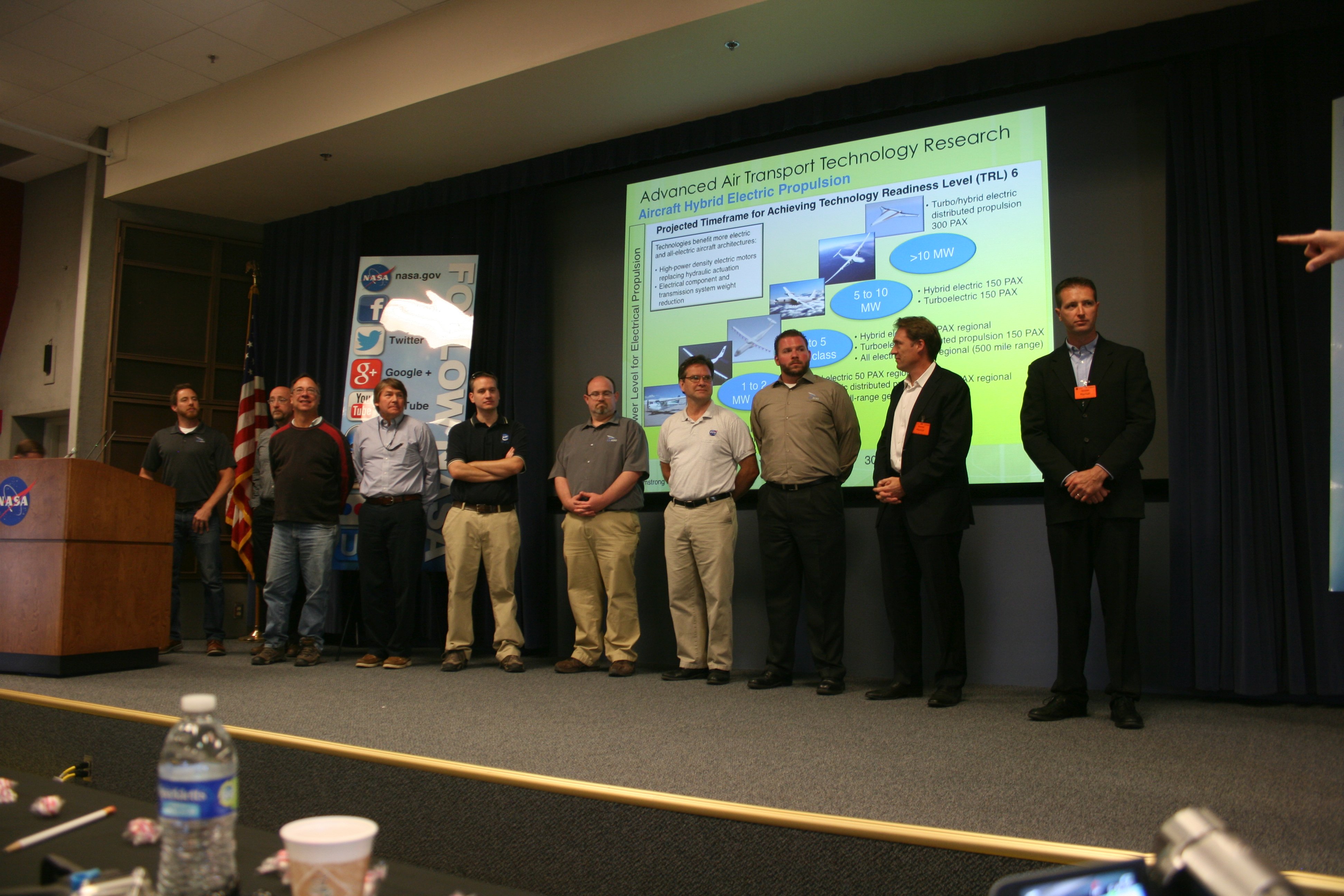
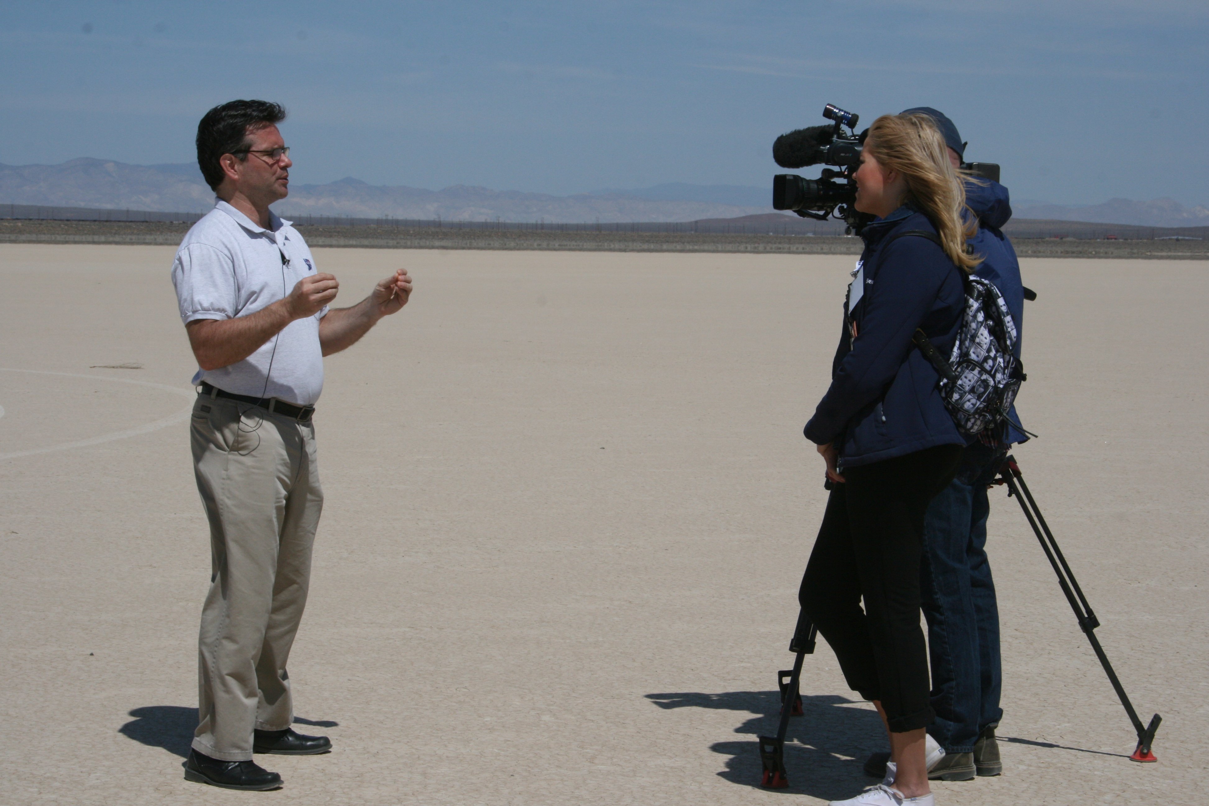
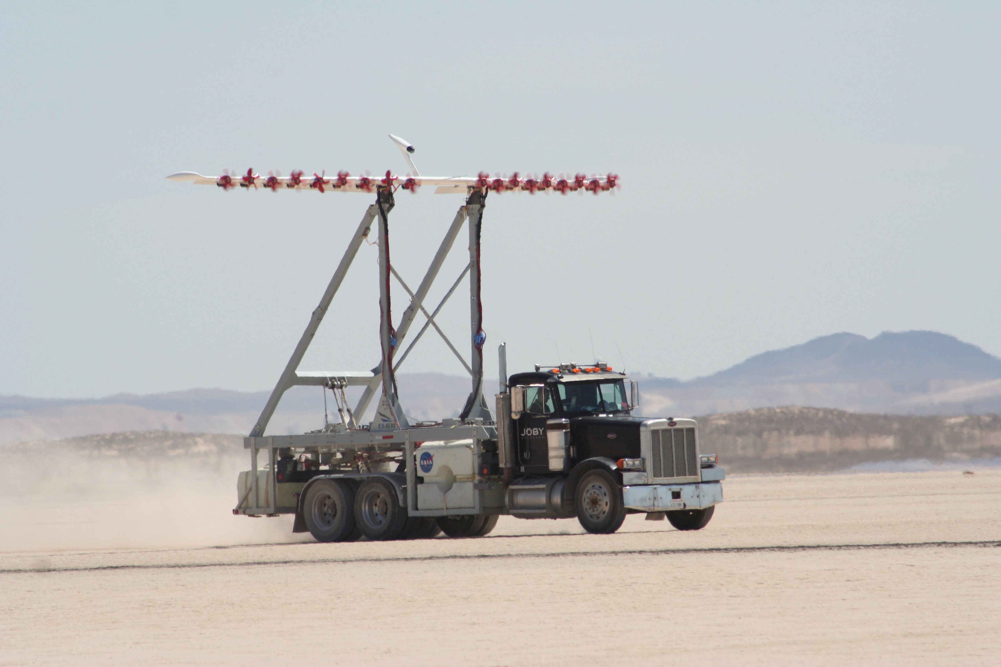
If you get a chance to go to a NASA Social, I recommend taking it. They’re wonderful! Last week I was lucky enough to attend my fifth. For this event we saw demonstrations of the LEAPTech project at the NASA Armstrong Flight Research Center. Friday I showed what LEAPTech is (“Leading Edge Asynchronous Propeller Technology”), Saturday I tried to take you along on our trip out onto the Rogers Dry Lake to watch a LEAPTech data run using HEIST, and yesterday our visit to the F-15 hangar was covered.

32_IMG_7846 small

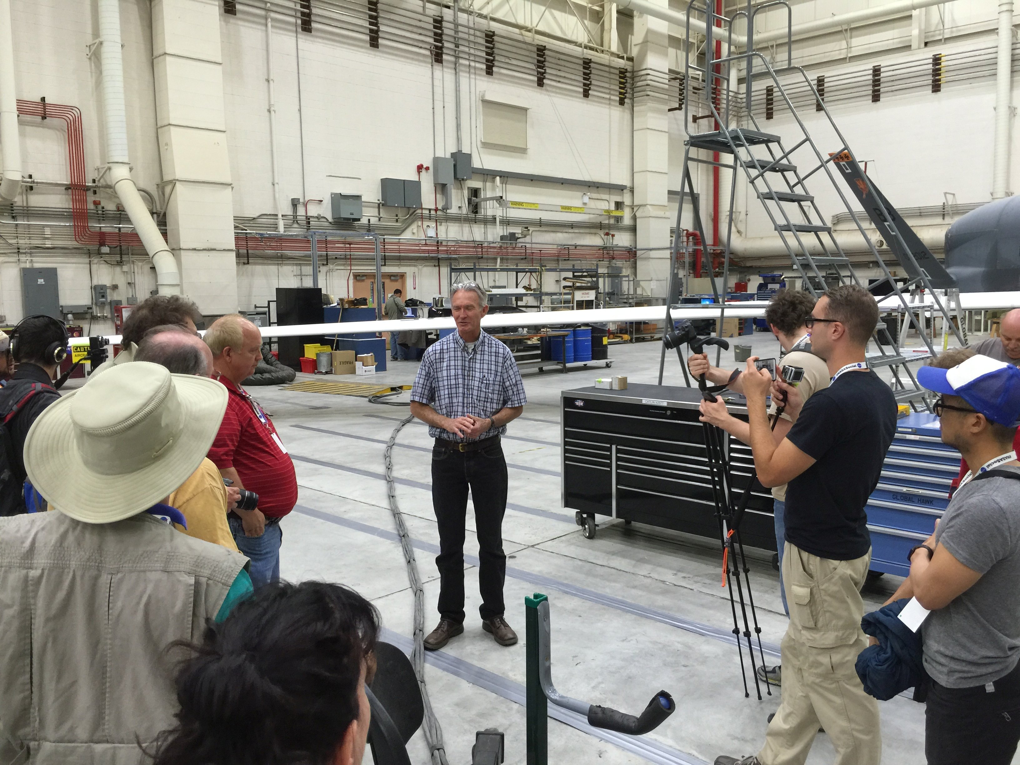
The next stop was a wonderful place I first saw last November on my first NASA Social. Robert “Red” Jensen invited us into the Subscale Flight Research Lab (SFRL), where he’s been building remotely piloted, scale model aircraft for many years. If a mission or experiment is too dangerous, too untried, or too expensive to try with a full-sized, piloted aircraft, Red and his crew will build and fly a model to test the concept until it matures enough to step up to the full-sized, piloted stage.

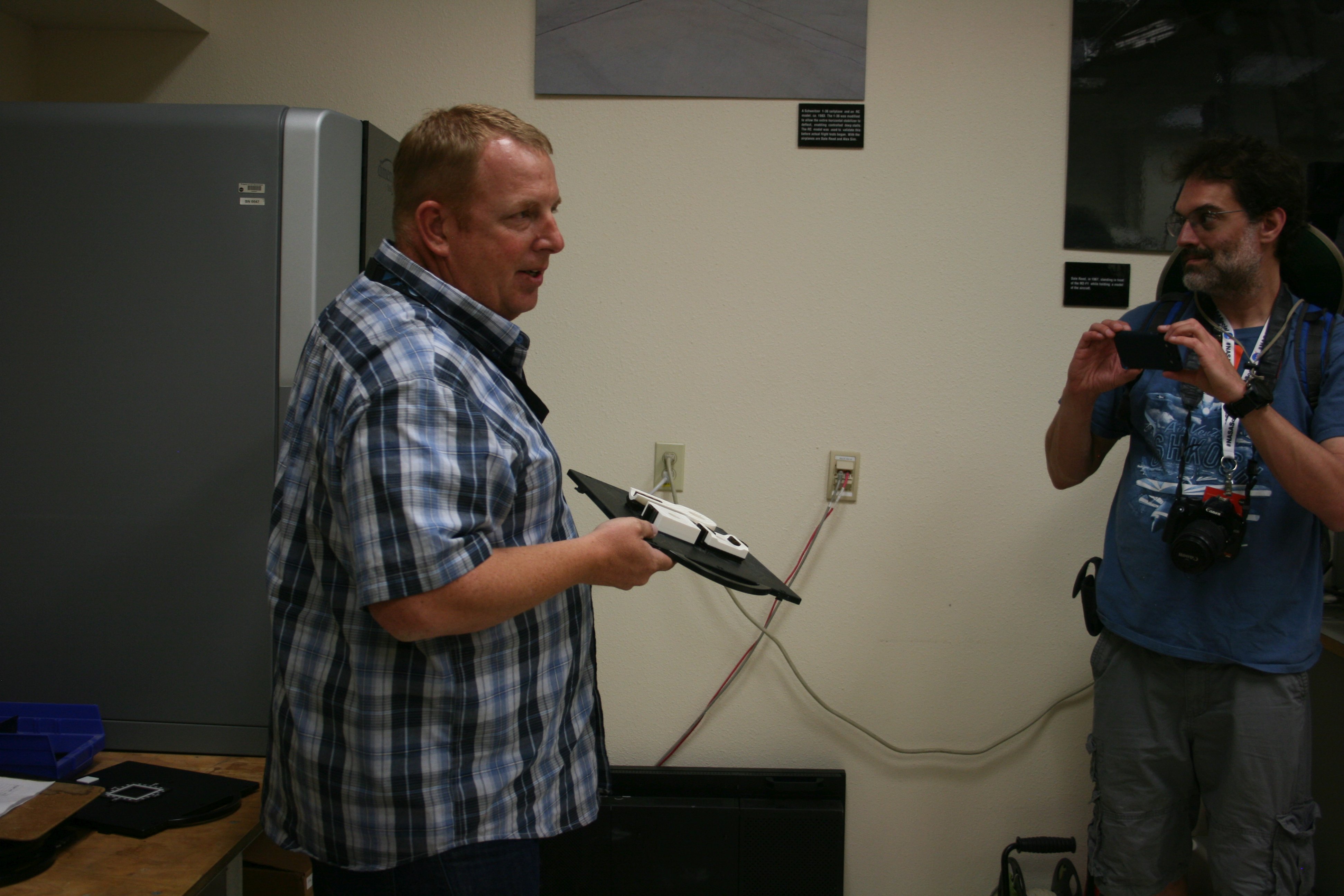
In doing this, there are constantly needs for unique parts. Whether it is a structural part for a plane or just a case to hold some equipment in the plane, the SFRL is using 3D printing to quickly and cheaply build and test parts. Even if a part will eventually need to be machined, building it first with 3D printing lets you make sure that it’s correct, and make changes if necessary.

Behind Red in this picture you can see their 3D printer. It’s a big one, with a 10 x 10 x 10 inch printing cavity, and a manufacturing resolution of 1/10,000 inch. Not something that the average hobbyist will have, but it lets them do in hours or days what would take weeks or months if they had to do everything in steel or aluminum.

33_IMG_7850 small

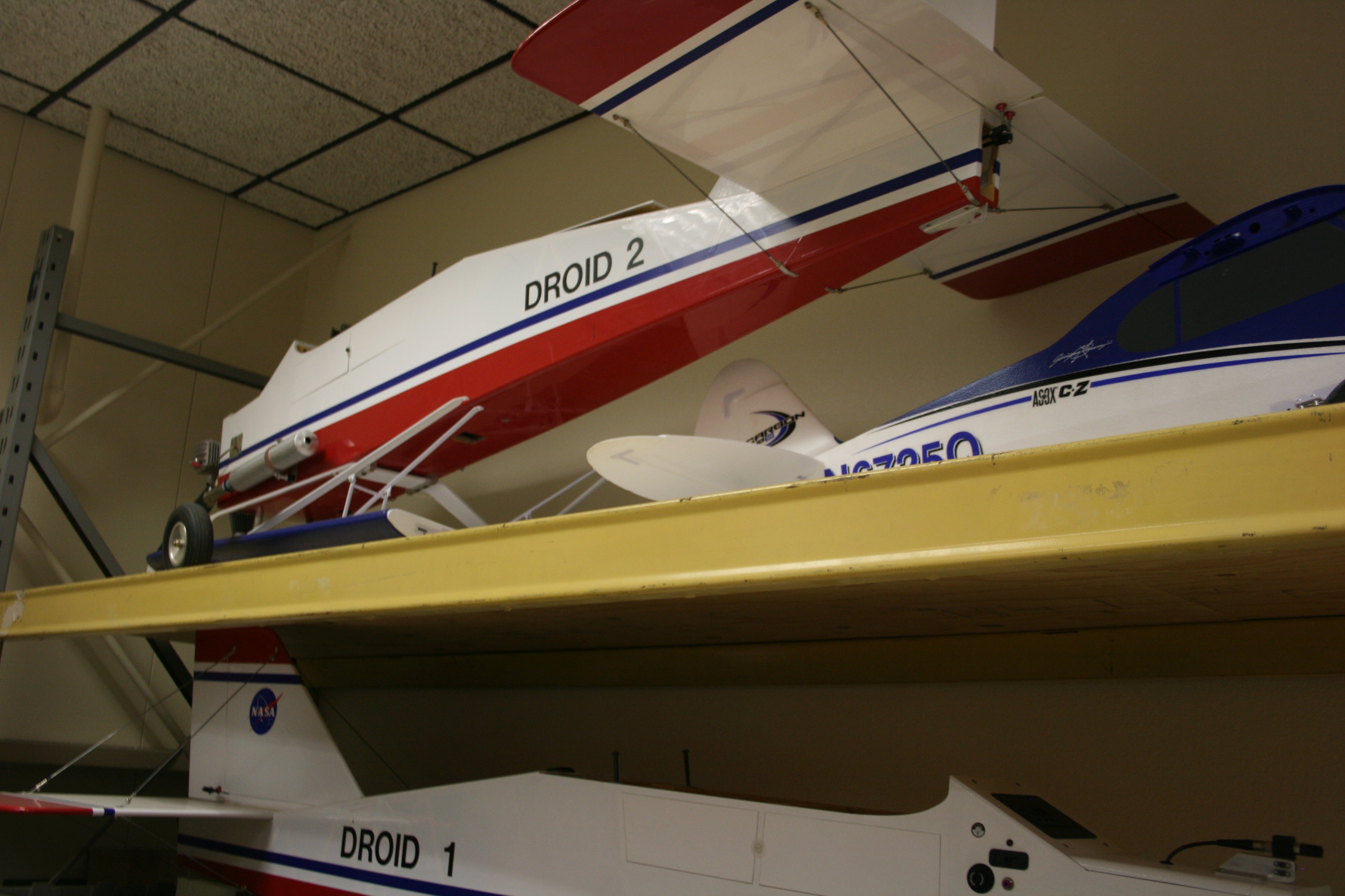
Shelved for the moment in the SFRL are “Droid 1” and “Droid 2,” used in numerous previous experiments. There’s an excellent NASA video here that shows how “Droid 2” was used in development of AutoGCAS. (That’s “Automatic Ground Collision Avoidance System” to you and me.)

I went into the AutoGCAS system at some length in my previous article, but the short version is that software has been developed to work with a plane’s autopilot and keep track of where the plane is compared to a 3D map. When a ground collision is imminent, AutoGCAS takes over from the pilot and flies the plane to safety (usually in a matter of seconds) before returning control to the pilot.

When the system was developed using “Droid 2” (see that video) the software and 3D map of the entire planet were put on a cellphone, which was used to control “Droid 2.” Yeah, a cellphone. One. No mainframes, no PCs, no huge, fancy computer systems. A cell phone.

This software is currently flying in many US military jets. Red told us that it has been credited with at least two “saves” in the past few months in aircraft involved in the Middle East, and there may be more that they don’t know about. In addition, a version is being worked on that will be available to private pilots (like myself) and while it won’t interface with the autopilot to take control, it will run on a tablet or smartphone to warn the pilot of imminent danger and to tell them which way to go to escape.

34_IMG_7852 small

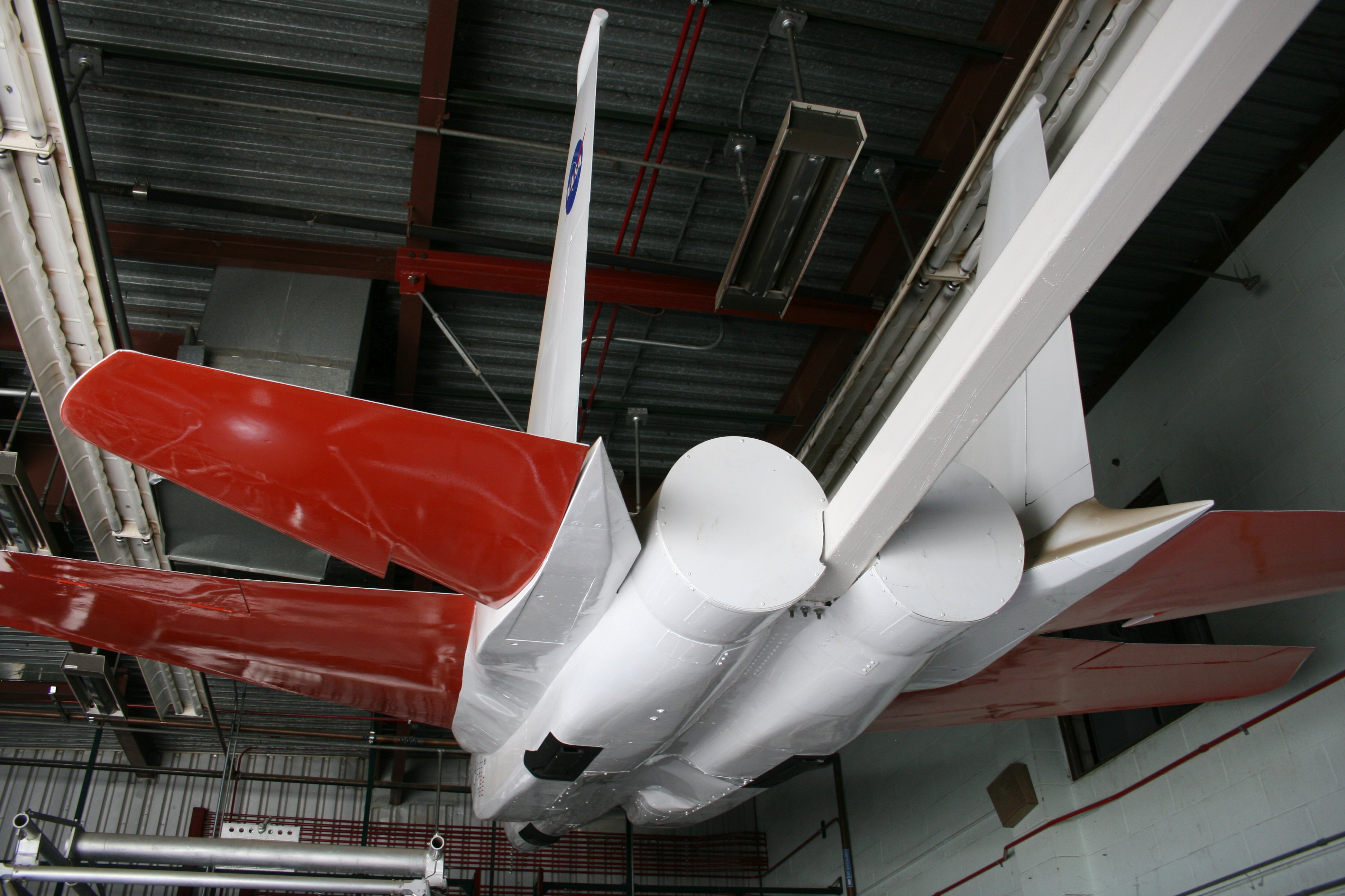
Behind Red in this picture you can see his current big project, a newer, larger model to test the Prandtl wing design. (We’ll talk more about that below.) Student interns have opportunities to work in the SFRL (under staff supervision) to build models such as this. The Prandtl design is an interesting one and I’m looking forward to seeing where this next series of tests goes.

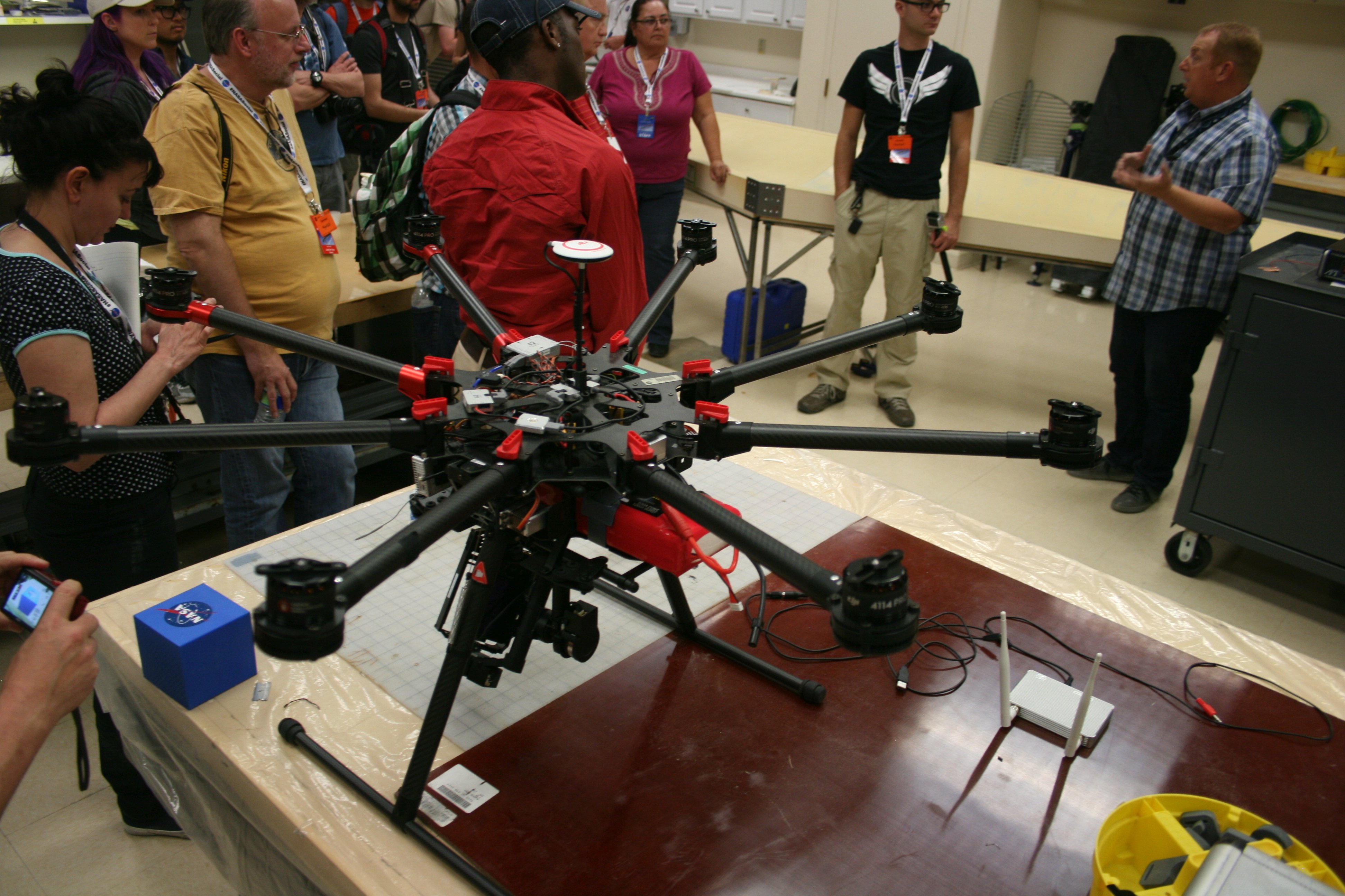
In the foreground you can see a octagonal (eight rotors) drone which is being assembled to monitor test flights from a new perspective. For example, the F-15’s we saw yesterday, flying at 600 mph, aren’t very good at chasing a scale model flying at 60 mph. But a drone like this could do it quite nicely.

35_IMG_7856 small

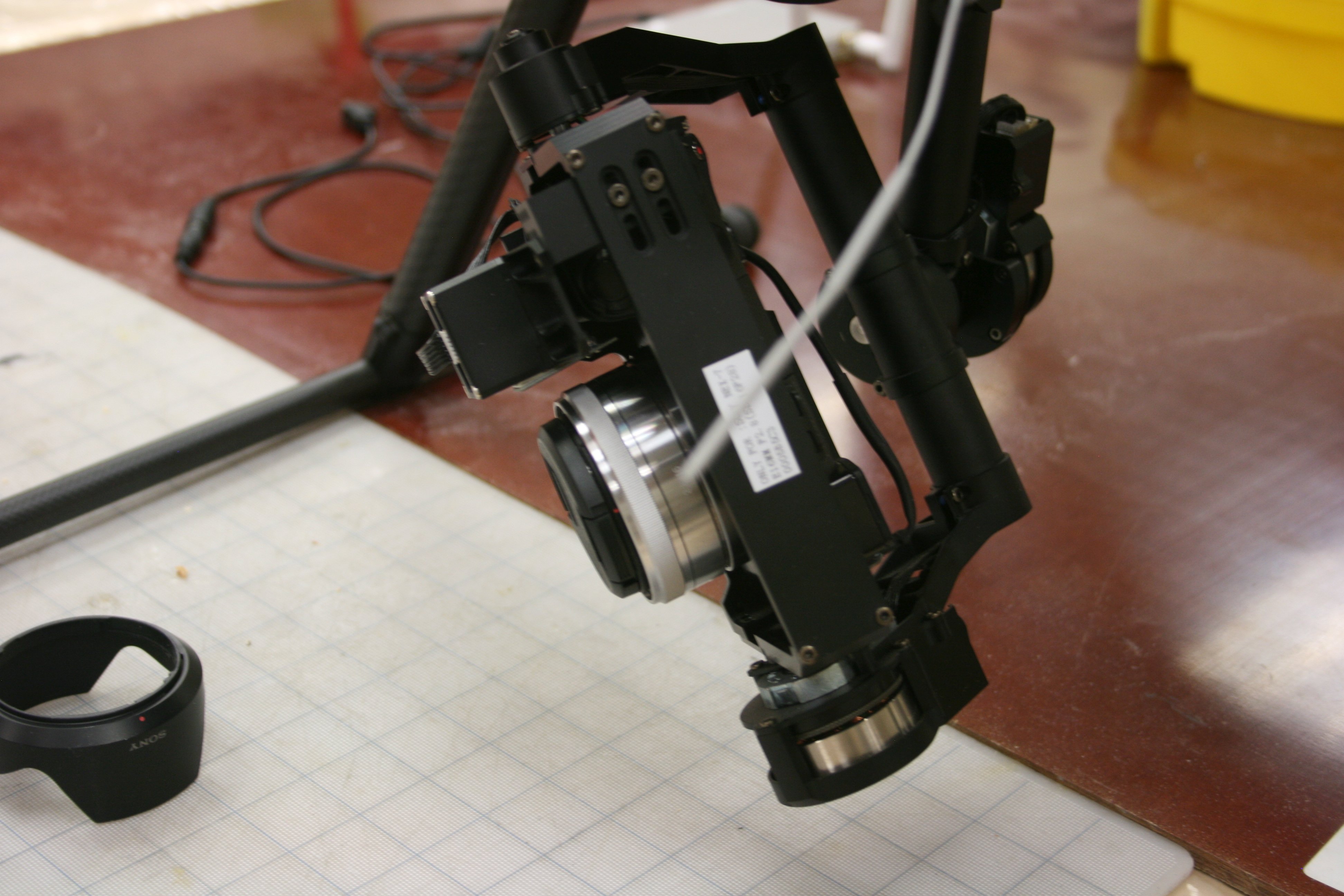
Here’s the camera rig on the bottom of the octagonal drone. These guys get to do the coolest things with the neatest toys! How do I get a job here?

36_IMG_7862 small

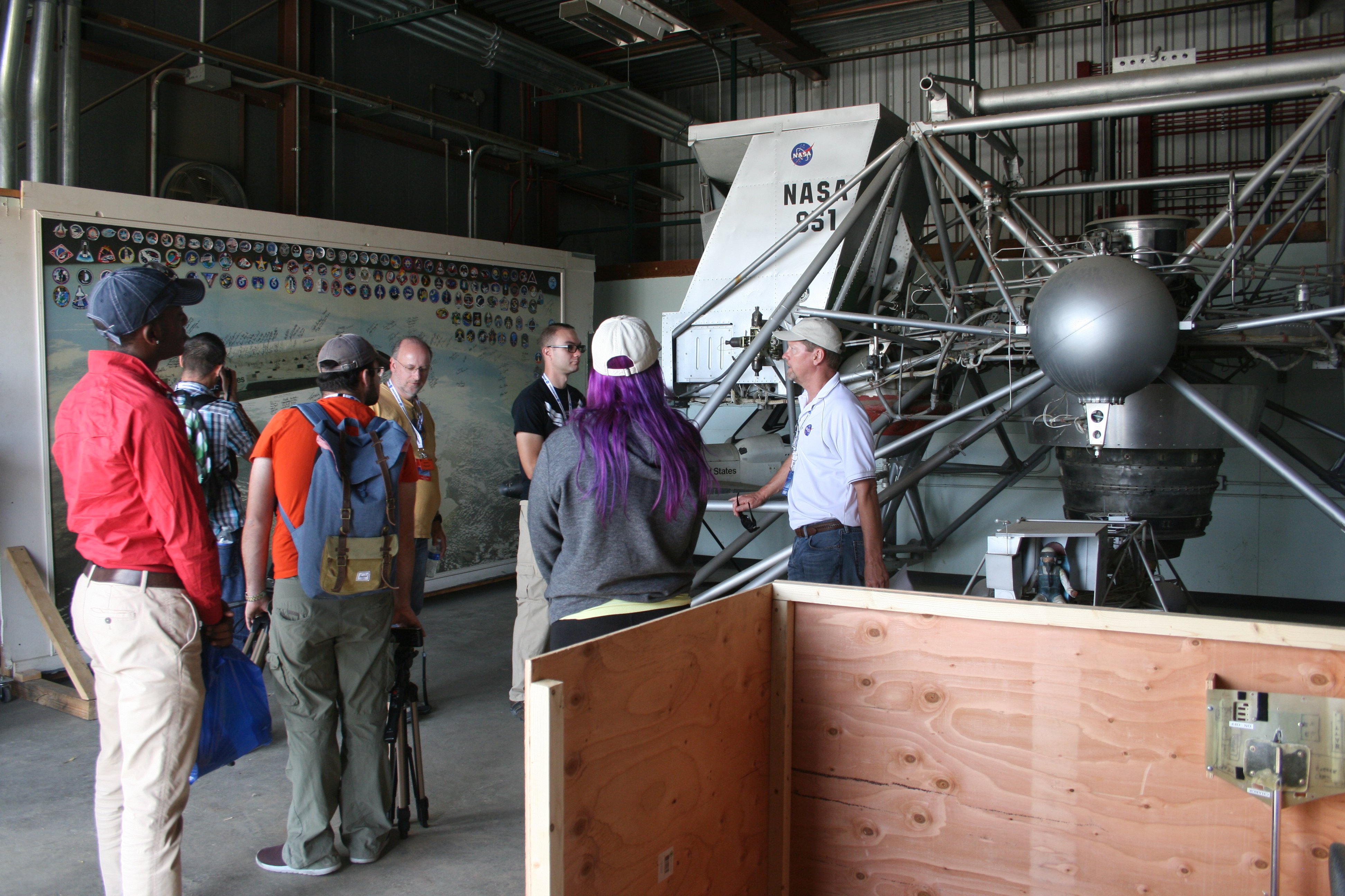
Following the SFRL tour, we were taken to get a close look at the Lunar Landing Research Vehicle (LLRV). Again, this is something that I had seen in November, but then it was mostly hidden back behind the original M2-F1 lifting body. That pioneer aircraft is now at the Museum of the Air Force in Dayton, so we got to get a much clearer view of the LLRV.

In that previous article I have links to a couple of videos about the history of this vehicle as well as other details. In brief, five of these aircraft were used during the Apollo program to train the astronauts to land on the moon. Neil Armstrong almost died when one went out of control (he ejected out, his parachute opened when he was just feet above the ground, he went back to his office and finished the afternoon as if nothing had happened) and all of the astronauts who landed on the moon trained in this vehicle or one of the others in Houston. In total, three of the five were destroyed in crashes, but they got the job done. Flying the LLRV turned out to be an excellent simulation for landing on the moon.

37_IMG_7864 small

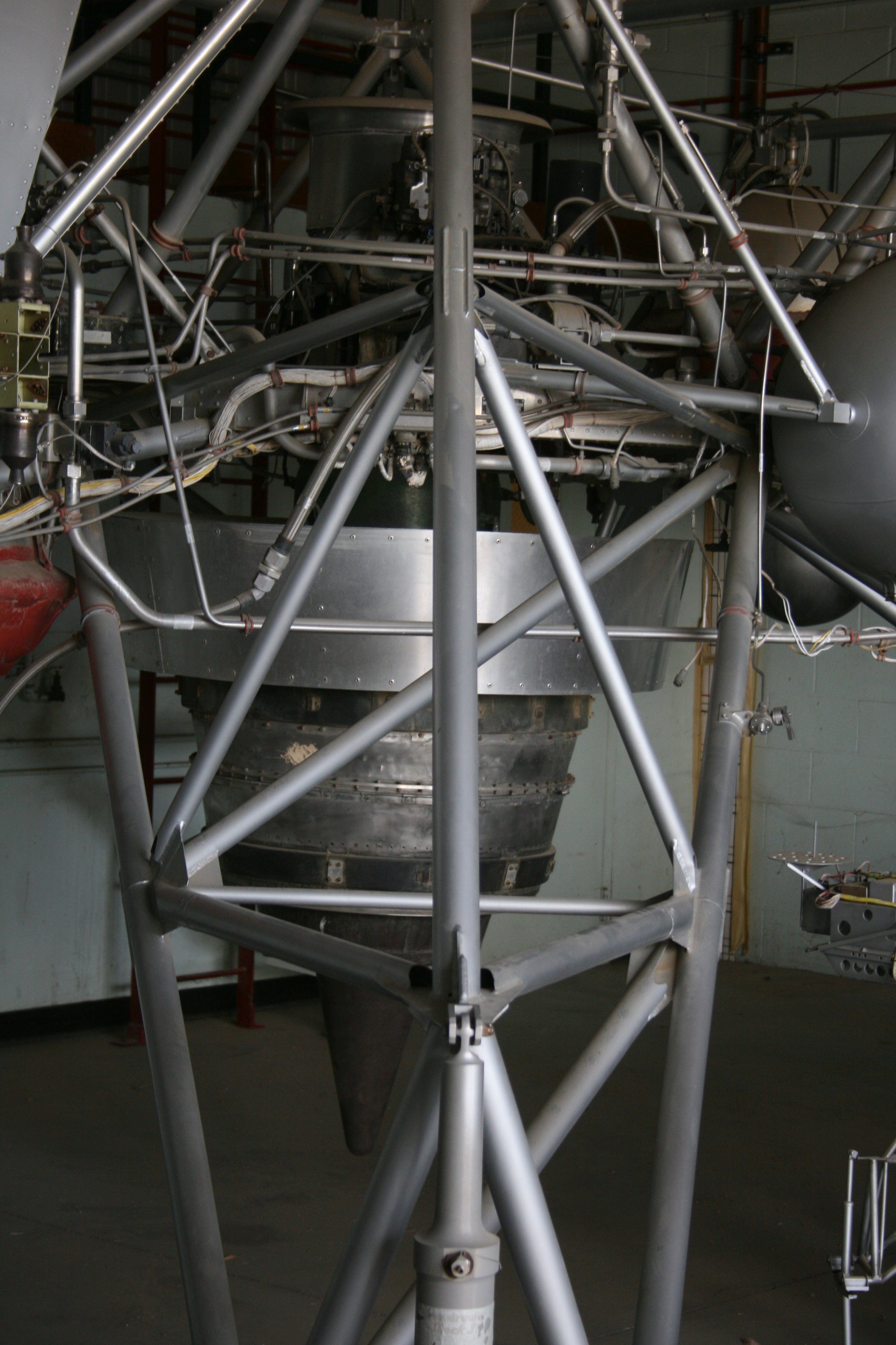
The LLRV was powered by this General Electric CF-700-2V turbofan engine. It was mounted to point downward on a gimbal so that it could be pivoted and aimed through a wide range. There were also some very clever hardware-based simulation modes, which would automatically compensate for factors such as wind gusts, which of course would not be found on the lunar descent.

The engine had 4,200 pounds of thrust, but the LLRV with a pilot and fuel weighed almost 4,000 pounds, so the LLRV could barely get off the ground more than 500 feet, hover, maneuver, and land. The total time of a flight was usually only five to seven minutes, with a total flight endurance capacity of just ten minutes. After using all of the engine’s thrust to take off and climb to several hundred feet, the engine was throttled back to hover and simulate a descent to the lunar surface.

38_IMG_7866 small

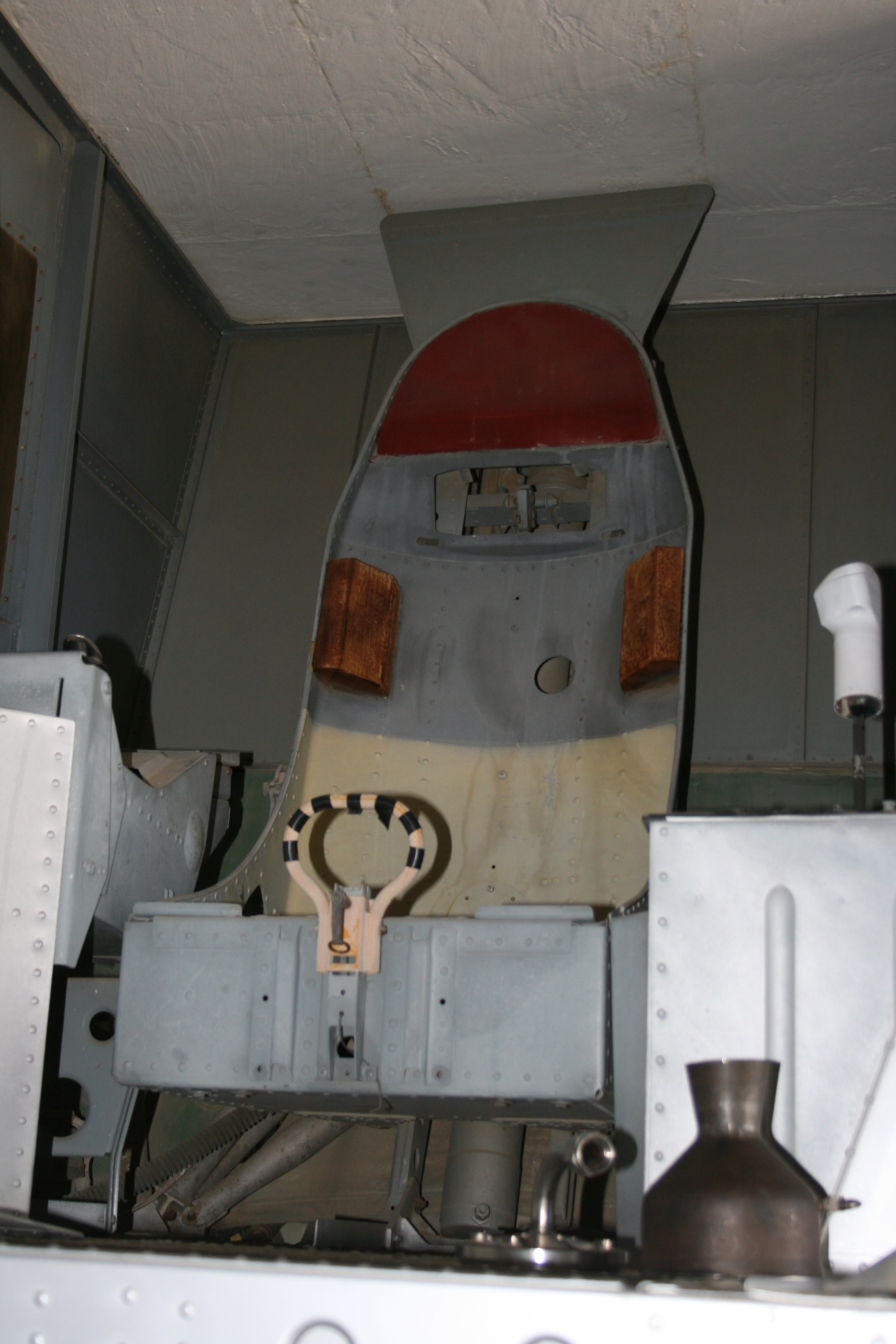
The pilot’s compartment on the LLRV was sparse and designed to simulate the Apollo Lunar Module as much as possible. The controls were as close to the LM’s as possible. You can see how visibility in the pilot’s compartment was deliberately restricted, to closely match what the pilot would see on descent to the moon. Pitch, roll, and yaw were controlled by sixteen small hydrogen peroxide thrusters, mounted in pairs.

Large yellow and black striped handle connected to the ejection seat. In an emergency (three of the five vehicles had them and used the ejection seat) it would take the pilot out at 14 Gs to about 250. The seats developed for the LLRV were the first “zero-zero” ejection seats, meaning that they were designed to work on a vehicle with zero altitude and zero airspeed. Up until that time, ejection seats in military fighters primarily used small rockets or spring systems to simply get the pilot clear of the aircraft, assuming that once separated from the plane the plane would get out of the pilot’s way and there would be significant altitude for parachute deployment. A zero-zero seat on the other hand uses a much larger rocket and drives the pilot up and away from the aircraft, immediately and rapidly deploying the parachute, allowing it to be used even from a resting position.

39_IMG_7868 small

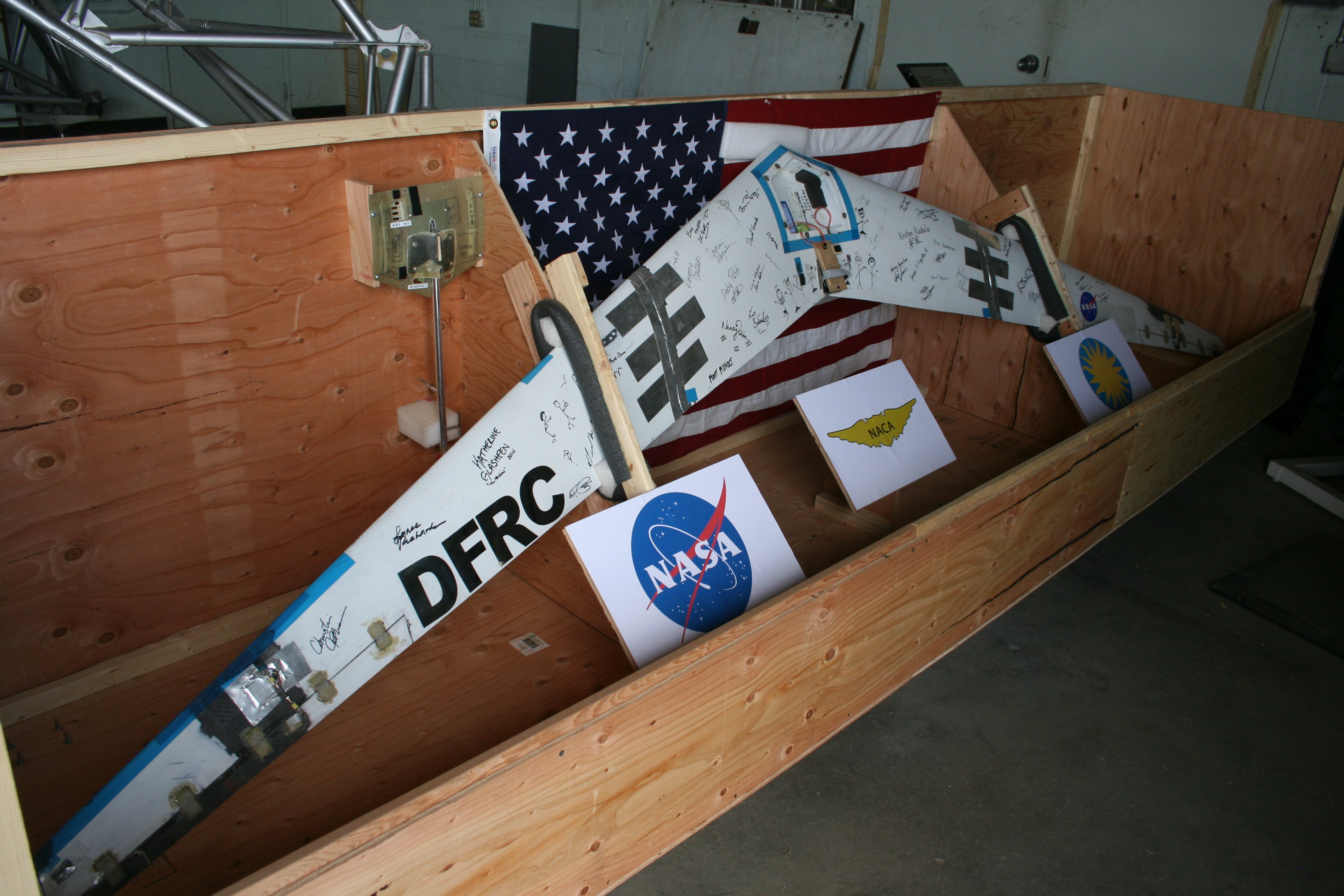
Above I talked about the new, larger Prandtl wing being built by Red Jensen in the SFRL. Here’s the smaller one, which was built by students in the SFRL in 2013 and recently finished its test program. This one is being boxed up to be sent to the Smithsonian Air & Space Museum in Washington, DC.

The Prandtl wing attempts to correct a basic flaw in every wing built, from the Wright Brothers onward. There’s a phenomenon known as “adverse yaw” which will swing the nose of the aircraft in the direction opposite of the direction of turn when the aircraft banks. In other words, if you turn left, the nose will try to swing right, and vice versa. In a conventional airplane, this is countered by use of the rudder or very fancy computer controls. (Think of the B-2 bombers for the latter.) If this isn’t done correctly, you get an “uncoordinated” turn, which can make your passengers queasy or be quite dangerous a low speeds. (Why am I hearing my flight instructor repeating “Step on the ball!!” over and over?)

On the other hand, as we were asked, have you ever seen a bird with a vertical stabilizer or rudder? Obviously not – so how do they do it? The answer might have been found by Ludwig Prandtl in the 1920s. Prandtl was a pioneering engineer and mathematician who developed many of the key concepts we use today in aerodynamics. His theoretical wing controls adverse yaw by using wingtip controls instead of a rudder. (Birds do it by using their muscles and feathers to warp and change the shape of the wing, creating a similar effect.)

NASA Armstrong will be testing their larger model in the upcoming months. Depending on how it goes, in thirty years your commercial airliner from LA to Dallas might be shaped more like an oversized B-2 flying wing instead of the standard “tube & wings” design. (Gee, wouldn’t it be more efficient in that design to use a LEAPTech design to power it? Hmmm… I’m seeing some synergies here.)

40_IMG_7872 small

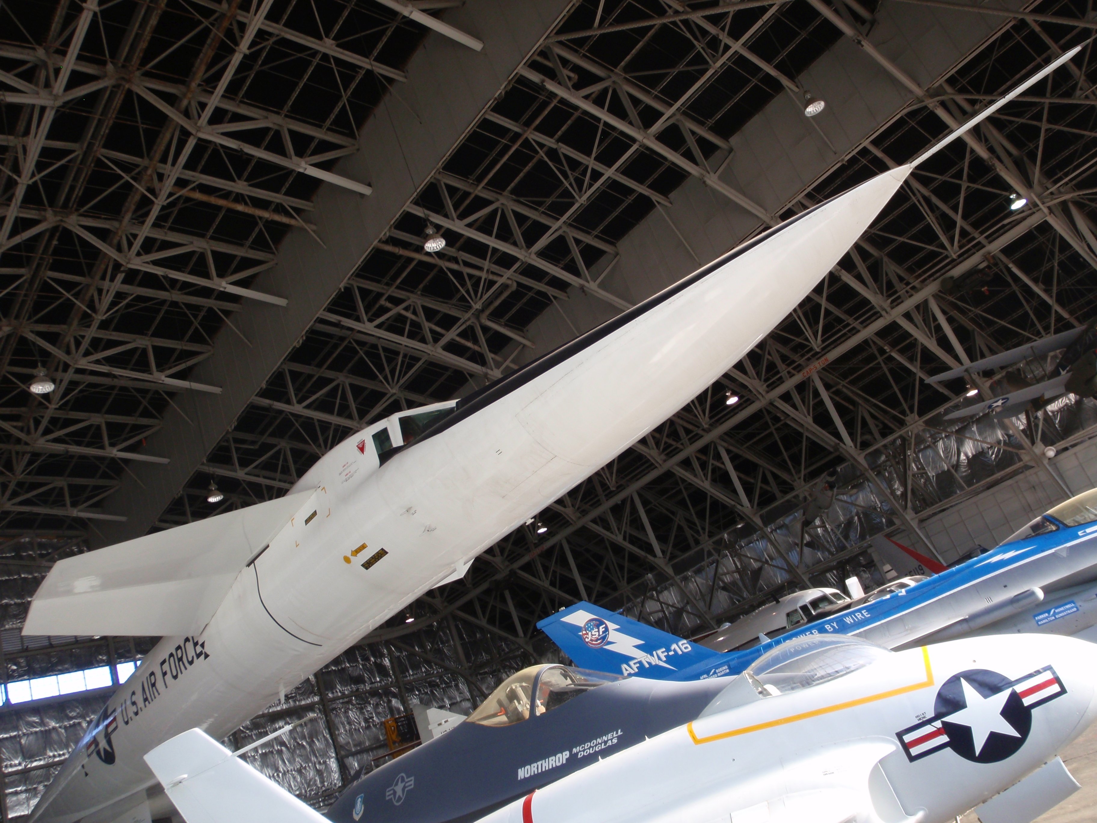
This scale model of an F-15 fighter (1/4 scale?) was built and flown remotely to test multiple advanced systems that are now in everyday use on the aircraft still in service.

41_IMG_7870 small

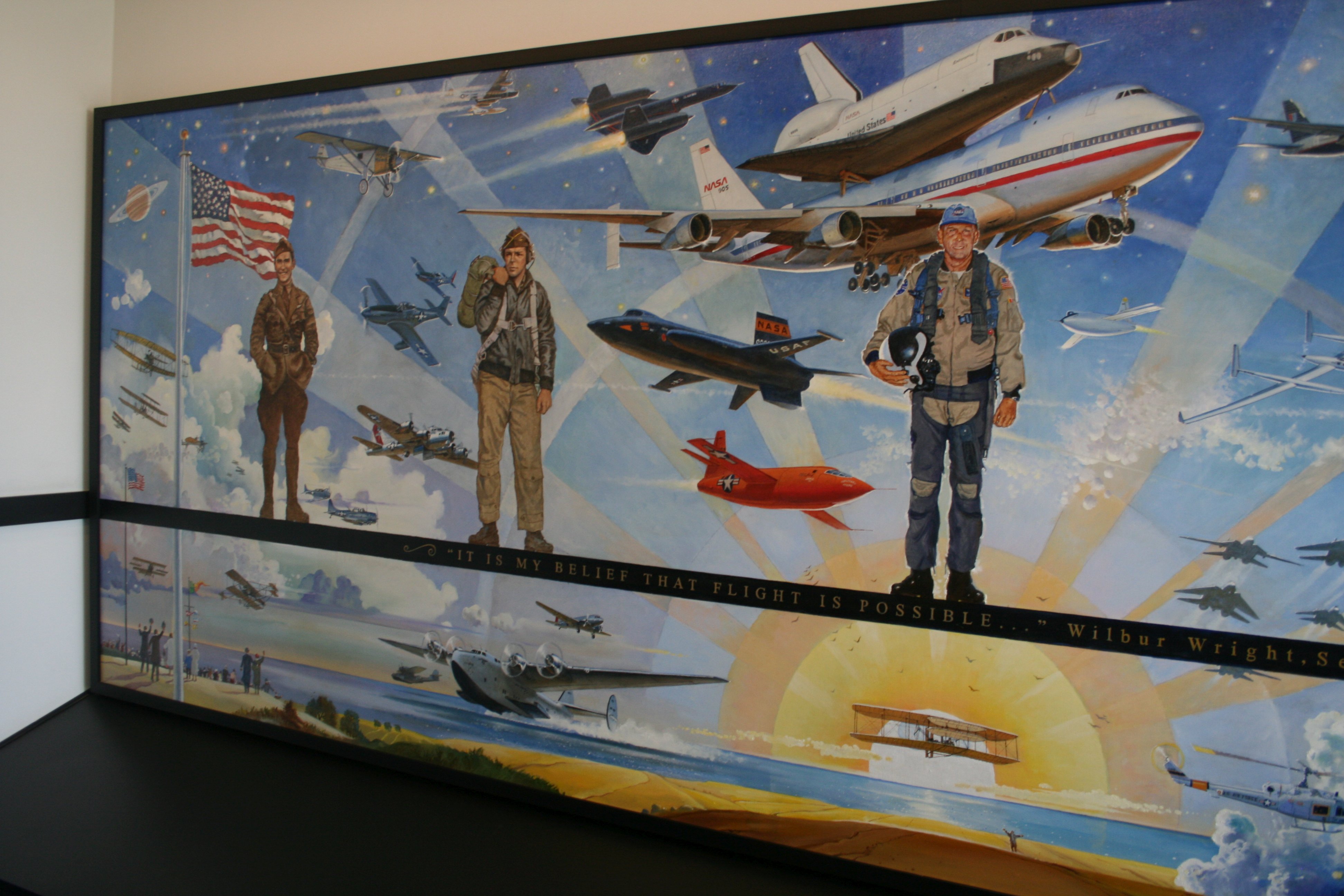
The final thing in this hangar is that large wall mural you can see over on the far side behind the other NASA Social attendees in our group (and Kevin Rohrer leaning on the LLRV telling us about it). I wish that I had gotten a better picture of it, but the story we heard about it was just fascinating to me.

The mural was put together (it’s a composite photo) and from the start of the Shuttle program at Edwards it gathered mission patches and crew signatures. Beginning with the earliest “free flight” drop tests of Enterprise, all the way through the final Shuttle landing at Edwards with Discovery finishing the STS-128 mission in September 2009, crews and support staff would celebrate a successful mission by applying mission logos along the top and finding a place to sign.

To a geeky space cadet like myself, this makes the mural invaluable. To everyone at NASA Armstrong (then named NASA Dryden) it was something that was sort of in the way when they were remodeling. They of course didn’t just trash it, but it got cut out of the wall and stored here until they can figure out where to put it. It might go to another museum, such as the Museum of the Air Force, or to some other NASA facility. For now, it’s just gathering dust here with the LLRV.

(If they end up not being able to figure out what to do with it, they have my number. I’m thinking it would look FANTASTIC in my house somewhere. Just sayin’.)

(And no, I’m not sure that The Long-Suffering Wife would agree with that decorating choice, but she loves me and I’m sure we could figure it out. Right, dear?)

Tomorrow, I’ll finish up with two more stops on our tour of the Center and some final comments.

Leave a comment

Filed under Flying, Photography, Space

NASA Social For LEAPTech At NASA Armstrong (Part Three)

I had the honor and the privilege of attending my fifth NASA Social last Tuesday. The presentations we saw regarding the LEAPTech project were done at the NASA Armstrong Flight Research Center. Friday I wrote about what LEAPTech (“Leading Edge Asynchronous Propeller Technology”) is and what the project is trying to discover and develop. Yesterday I wrote about our trip out onto the Rogers Dry Lake to see the HEIST experimental rig and two trips to collect LEAPTech data.

18_IMG_7802 small

In addition to the social media attendees at the Social, there were members of the more conventional media there. Here we see Mark Moore, the Principal Investigator for the LEAPTech project, being interviewed out on the lake bed by a reporter and cameraman from one of the local television stations.

23_IMG_9086 small

Photo by NASA Armstrong Flight Research Center

Before we went back to the conference center and main NASA Armstrong Center, all of the NASA Social attendees, the LEAPTech engineers and scientists, the NASA Armstrong staff, and everyone else got together in front of the HEIST for a group photo. (I’m standing, three or four folks to the right of center, in a light tan shirt, blue jeans, and my goofy “adventure” hat.)

24_IMG_7791 small

The surface of Rogers Dry Lake is bentonite, a rock-hard clay layer thousands of feet thick, left after these lakes dried up around 10,000 years ago. The surface is incredibly flat, varying less than eighteen inches over a distance of 30,000 feet. There are 44 acres of it on Rogers Dry Lake, and another 22 acres at the nearby Rosamond Dry Lake.

The Antelope Valley is a desert (as is Los Angeles, but that’s a different rant) so it’s almost always dry here. “Almost” is the key word. When it does rain for a couple of days, the water coming from much of the Antelope Valley pools on the lake bed, closing the “drawn” runways (the ones on the clay surface) temporarily, while the main concrete runway is always open.

If a significant portion of the lake stays under water for more than seven days, a local species of brine shrimp starts to hatch. That in turn brings huge flocks of birds in, including seagulls from the Pacific Ocean about seventy miles away. Those birds are in turn can be a major hazard to flight operations, since bird strikes on high speed aircraft are extremely fatal to the bird and dangerous to the plane and pilot. Next, the birds can cover everything in the area with droppings, another mess for planes and facilities. Finally, when the lake starts to dry up again, the shrimp lay their eggs to become dormant for the next rainy season — then the shrimp die, start to rot in the heat, and we’re told that the stench can be most powerful.

25_IMG_7799 small

Here you can see how the runways and other markings are “drawn” on the clay surface. It looks like some kind of tar or rubbery compound, and the lines are several feet wide. Not only are the runway lines drawn this way, but Edwards contains the world’s largest compass rose, which has been declared to be a National Historic Landmark.

26_IMG_7817 small

After lunch and some more Q&A with the LEAPTech scientists and engineers, we headed out to see some of the other activities at the NASA Armstrong Flight Research Center.

This is the entrance to the main building, and it might look vaguely familiar to anyone who grew up on 1960’s television. This building entrance was used by the “I Dream Of Jeanie” show as NASA Headquarters whenever they needed an establishing shot.

27_IMG_7819 small

There are legendary research aircraft all over the site, many of them in or near the parking lot, up on sticks. This is the Bell X-1E, the big brother of the Bell X-1 which Chuck Yeager used to break the sound barrier in 1947. The X-1 is on display in the main hall of the Smithsonian Air & Space Museum in Washington, along with Lindbergh’s “Spirit Of St Louis,” Spaceship One from Scaled Composites and Virgin Galactic, John Glenn’s Freedom 7 Mercury spacecraft, the Gemini IV spacecraft used for the first US spacewalk, and the Apollo 11 Command Module.

The X-1E flew from 1955 to 1958, piloted first by legendary USAF test pilot Joe Walker and later by NACA test pilot John McKay. Its maximum known speed was Mach 2.24, but it was chasing Mach 3 near the end of 1958. Its maximum known altitude reached was 73,000 feet, but again, it was chasing 90,000 feet.

28_IMG_7825 small

First stop on the Center Tour was the F-15 hangar. This is one of the newer aircraft, an F-15D. It will be flying for many years to come in support of NASA missions since there are hundreds of this model F-15 still flying. Most of them fly for other countries, but they’re still supported with spare parts and the information needed by the mechanics to keep them running safely.

29_IMG_7833 small

On the other hand, this F-15B model is older and has many fewer flying today, so parts are getting harder and more expensive to find. This is the oldest F-15 in NASA’s fleet, handed down from the Air Force when they stopped flying the F-15Bs. This is how NASA gets most of its aircraft of this nature – hand-me-downs from the military. On the other hand, it saves the taxpayers millions and avoids throwing away millions on a perfectly good plane that the military doesn’t want.

Because of the age and increasing difficulty in finding parts, this plane will likely be retired from NASA soon. I offered to see if the CAF could take it off their hands as a donation when the time comes – I got a blank stare. Seriously, guys, when the time comes, give me a call, let my people talk to your people. This would look GREAT flying out of Camarillo with our P-51, Spitfire, Zero, Bearcat, PBJ, and Hellcat! (Seriously!) It would be so much a better fate than putting it up on a stick in a parking lot!

30_IMG_7836 small

The business end of the F-15B. This probe sticks out about ten feet in front of the aircraft to get air data in still air, prior to the air being roiled up by this honkin’ huge plane flying through it at Mach something-or-the-other. All of those fluorescent orange and red pennants are connected to safety locks and plugs in or covering openings. Those locks, plugs, and covers keep the aircraft safe when it’s on the ground an not being used for long periods — but they MUST be removed before the plane can go fly again. That’s why all of the pennants say “Remove Before Flight!” (Even little planes use them.)

These F-15s are used for collecting data for instruments designed by others as well as flying NASA missions as chase planes for other experimental aircraft. For example, when the early Space Shuttle “free flight” drop tests were performed at Edwards, as well as the first Shuttle landings from orbit, planes such as these would fly alongside to watch for problems and radio information to the pilots. Today these planes (along with others in the NASA fleet) are used to monitor other test flights and experimental aircraft.

As far as collecting data goes, other groups working with NASA (such as universities or corporate partners) design instruments to collect their data, with their experiments sized to fit into the F-15 or under the wings. NASA pilots will fly the pre-arranged mission to wherever the data needs to be collected, depending on the needs of the researchers.

31_IMG_7835 small

Finally, this was a point of considerable interest and fascination to several Social attendees. Yes, this picture is oriented correctly, that is an exit door forty or fifty feet up in the air.

This hangar has a single, huge door that swings up out of the way to let planes in or out, or to let roaming packs of NASA Social attendees peer in at the planes. When the huge hangar doors are closed, there are exit doors built into what is now a huge fourth wall of the hangar. When the doors open up, the exit door just dangles up there like a low-tech predecessor to a “Portal” door. (Even at NASA, the cake is still a lie. But we did have doughnuts and cookies.)

Tomorrow, more stops on the tour of the NASA Armstrong Flight Research Center.

Leave a comment

Filed under CAF, Flying, Photography, Space

NASA Social For LEAPTech At NASA Armstrong (Part Two)

This week I attended my fifth NASA Social. At the NASA Armstrong Flight Research Center the main focus was the LEAPTech project. Yesterday I wrote about what LEAPTech (“Leading Edge Asynchronous Propeller Technology”) is and what it has the potential to mean in the not-so-distant future. Once we had seen presentations from several of the project scientists and engineers, we headed out onto Rogers Dry Lake to see a test run of the initial LEAPTech test rig.

Due to the nature of the work being done there by the Air Force and NASA Armstrong, one does not normally get access to the lake bed at Edwards Air Force Base unless one works there, has a security clearance, and has a reason to be out there. As has happened at every NASA Social I’ve attended, this was a point where the “geeky, über-cool” factor ratcheted up a couple of notches.

12_IMG_7778 small

Once out on the lake bed runway, we got our first opportunity to see the test rig up close and personal. As you can see, it’s a basic, heavy-duty truck rig that’s been modified quite a bit. The two primary modifications in the HEIST (“Hybrid-Electric Integrated System Testbed”) serve to lift the wing up out of “ground effect” and into “clean air”, and to dampen out almost all of the vibrations and bumps coming from the rolling truck body.

13_IMG_9081 small

From the front you can see that this test setup has eighteen props. It’s quite a departure from the normal one or two big engines on today’s propeller-driven airplanes. It’s hoped that the difference will allow a 500% increase in power efficiency, a huge increase in low-speed maneuverability and stability, and a drastic reduction in the noise created by the propellers.

14_IMG_7775 small

This is what a couple dozen NASA Social members look like taking pictures, taking selfies, tweeting, Instagramming, FaceBooking, and so on.

We were fortunate that it was only about 75°F out there, although the wind was a real pain. As with any desert locale, in the winter it can be brutally cold out here, and in the summer it can be way, way over 100°F.

15_IMG_2980 small

Here you can see the propellers on one side of the test wing. Notice that the propellers on alternating blades are counter-rotating. Also notice the video camera rig on the top and all of the data cables coming down the support framework.

If this wing seems small, note that one of the aspects of LEAPTech is that the added efficiency of the design in generating lift will hopefully allow a significant reduction in the size of the wing. The wing, propellers, and test rig here are smaller than they would be on a two- or four-person aircraft, but not by much.

16_IMG_2981 small

As mentioned yesterday, in designing their tests to be carried out this way in the real world, the LEAPTech team is able to quickly test a whole range of variables quickly and much more cheaply than they could using a wind tunnel.

For example, in testing for noise reductions or power output, does it matter if the blades counter-rotate? Does it matter if every other one counter-rotates or is there another pattern that gives better performance? Is it better to have all the props the same size, or should they be larger on the inside, or on the outside? How does changing the arrangement and size of the propellers affect the loading on the wing and the amount of lift generated?

These are all questions that can be put into mathematical models, but models all have assumptions and approximations built in them. By comparing the models’ predictions against the real world data, the models can be refined and improved. The models in turn can then be counted on to give more reliable predictions. This feedback between the two systems is a powerful way to make significant progress quickly.

17_IMG_7800 small

Once we’re all done taking pictures, it’s time to back off a few hundred meters for safety reasons. Safety is a key component of everything they do at NASA Armstrong and Edwards Air Force Base. We saw this all the time during our stay – FOD removal & control, safety briefings, insistence that we all slather ourselves in sunblock before going out onto the lake bed, and other precautions were constantly in place to make sure everything went smoothly and safely.

It obviously paid off. We didn’t have a single casualty among the NASA Social attendees!

19_IMG_2996 small

The HEIST rig trundled off a mile or more down the runway, soon visible only the the tiny cloud of dust that it was kicking up. It was soon lost in the mirage on the lake bed surface. After we all got our camera gear ready, we got the heads-up from one of the test engineers that the run had started. Again we could see that tiny plume of dust, but now it was coming toward us.

20_IMG_3004 small

There was a wicked wind coming from the north (our right) and on this run the HEIST was running almost directly into the wind. This was a relatively low speed test as measured by the rig’s ground speed, 40 mph. By going directly into the 27 mph wind, the effective speed of the air over the wing was 67 mph.

21_IMG_3007 small

After disappearing into the distance to the north, after a minute or so we got the word that the HEIST was coming back. This time with the wind at their back, they were driving along at 65 mph, but with the 27 mph wind at their back, their effective speed of air over the wing was only 38 mph. That gives them a nice range of data sets. From our vantage point standing still near the runway, we saw only the difference between the 40 mph first run and the 65 mph second.

22_IMG_7812 small

After the runs were over we got one more chance to take pictures and ask questions out on the lake bed. Then it was back on the bus (in a non-sunburned conditioned we hoped, after putting on all of that sunblock goop and, as one person put it, “smelling like the crowd at Santa Monica beach”) and back to the conference center for lunch and more Q&A with the project engineers and scientists.

Tomorrow, a couple more notes on the lake bed, then we’re off to see some of the other aircraft and projects being run by NASA Armstrong.

Leave a comment

Filed under Flying, Photography, Space