Category Archives: Travel

ORD To LAX – The Scenery

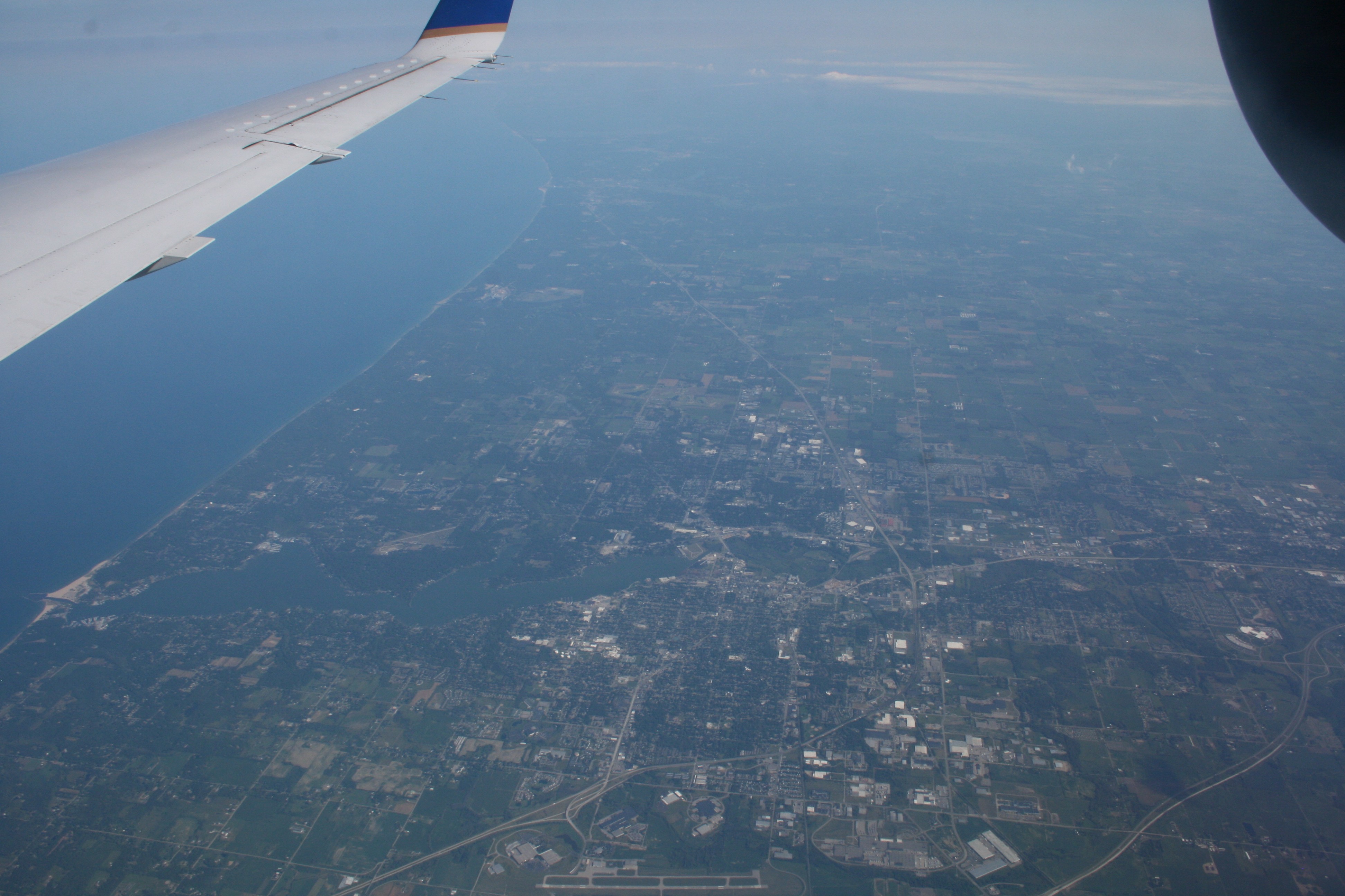
Yesterday I showed pictures of airports (and their associated towns and cities) as seen from my recent flight from Chicago O’Hare Airport (ORD) to Los Angeles International (LAX). Today, let’s look at other stuff you can see on the ground, not necessarily all aviation related.

IMG_0222 small

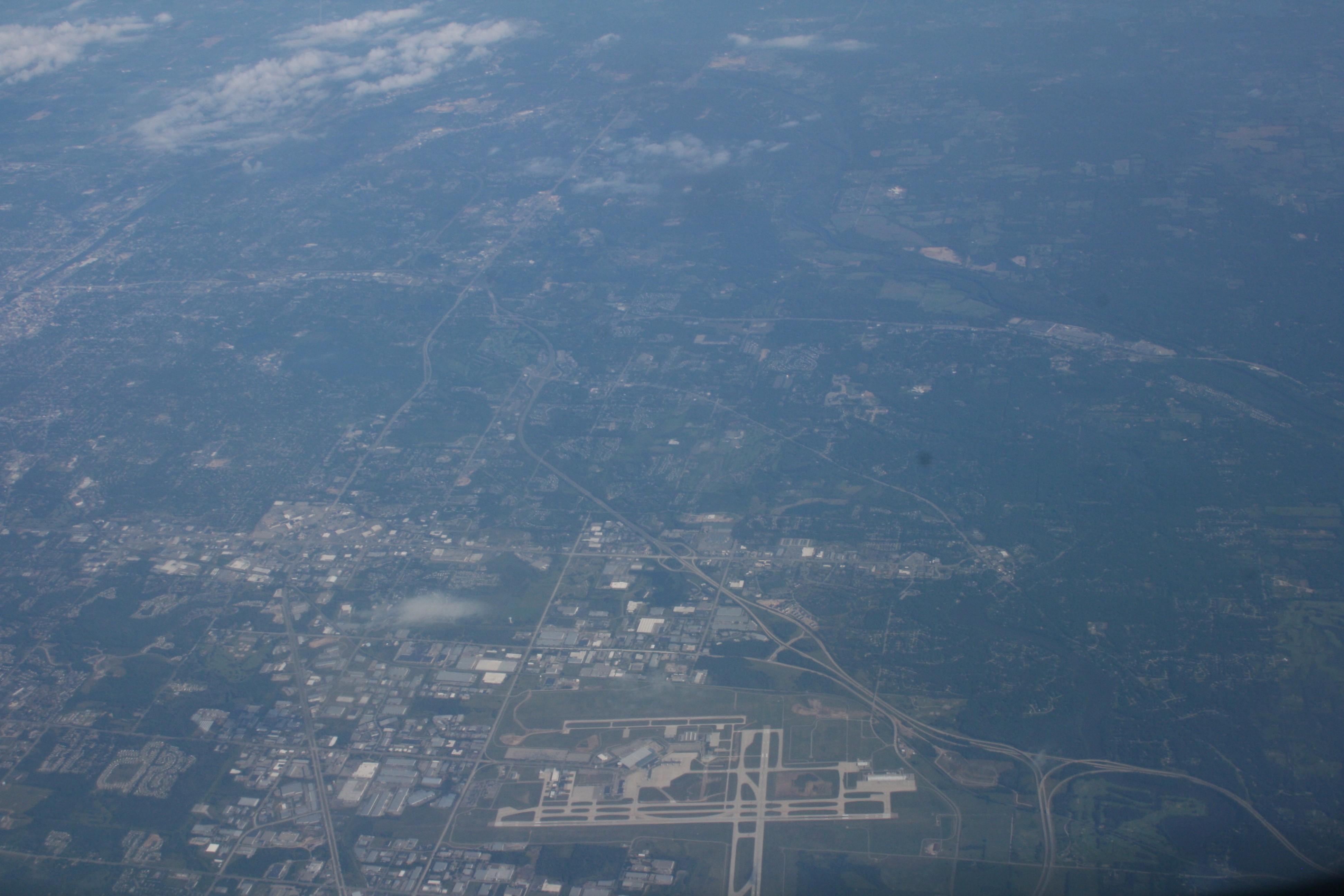
OK, so O’Hare is another airport, but this view of only a portion of it shows just how freakin’ huge it is. We had just taken off on one of those runways before turning left and left again to head southwest toward Los Angeles.

IMG_0253 small

The Mississippi River is an easy landmark to spot. We passed over it just north of St. Louis.

IMG_0269 small

When it’s clear below you, you can just follow the interstate highway system to keep track of where you are. I know, the folks up front in the big commercial jets all use GPS and an autopilot with backup systems to the backup systems’ backup systems. But for a little guy like me, if I’m flying at 8,000 feet instead of being up with the jets at 38,000 feet (probably a good thing, because I could get sucked into an engine and then we’d both have a bad day) with minimal backup systems and high tech, all of these nice, straight, divided highways are very useful.

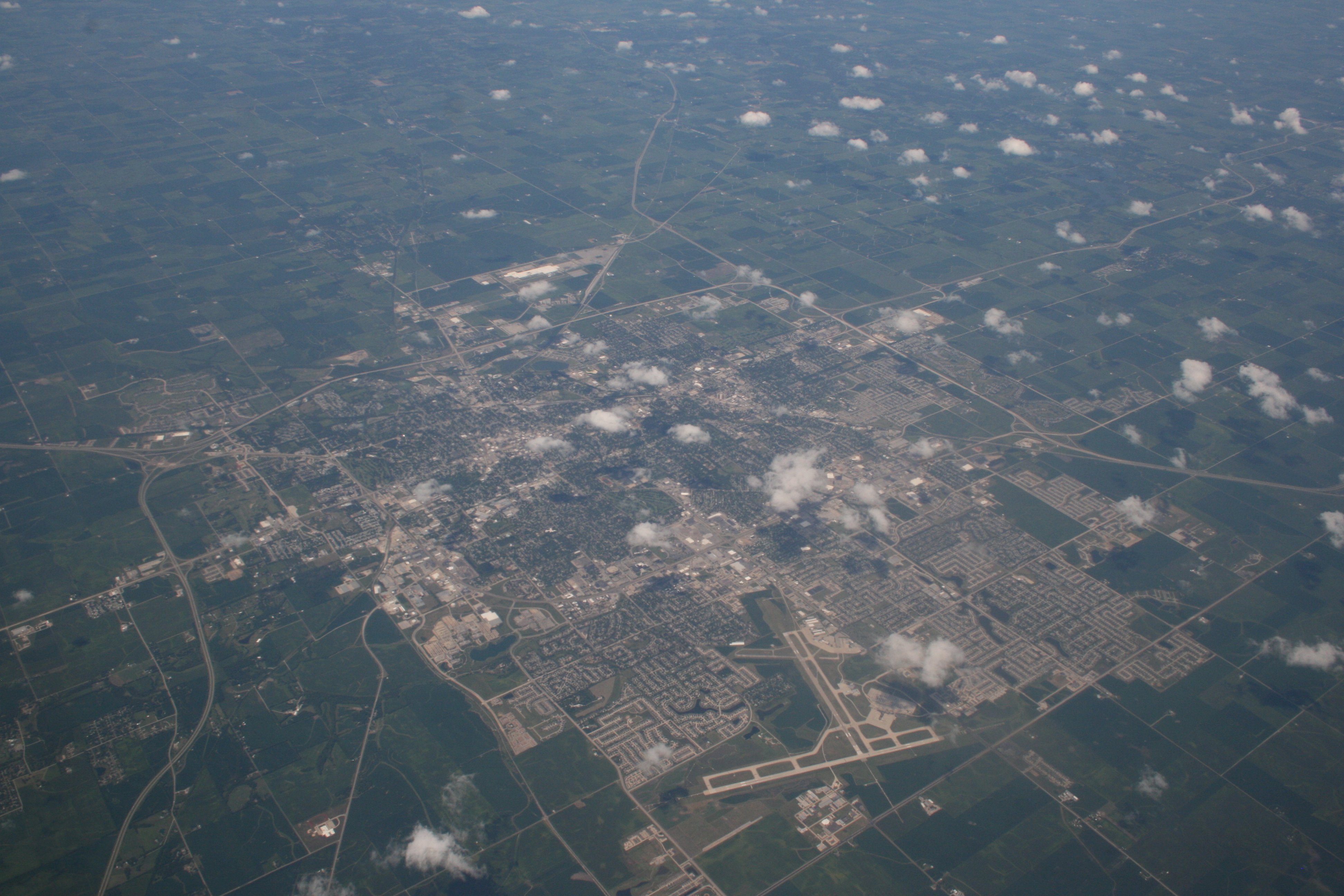
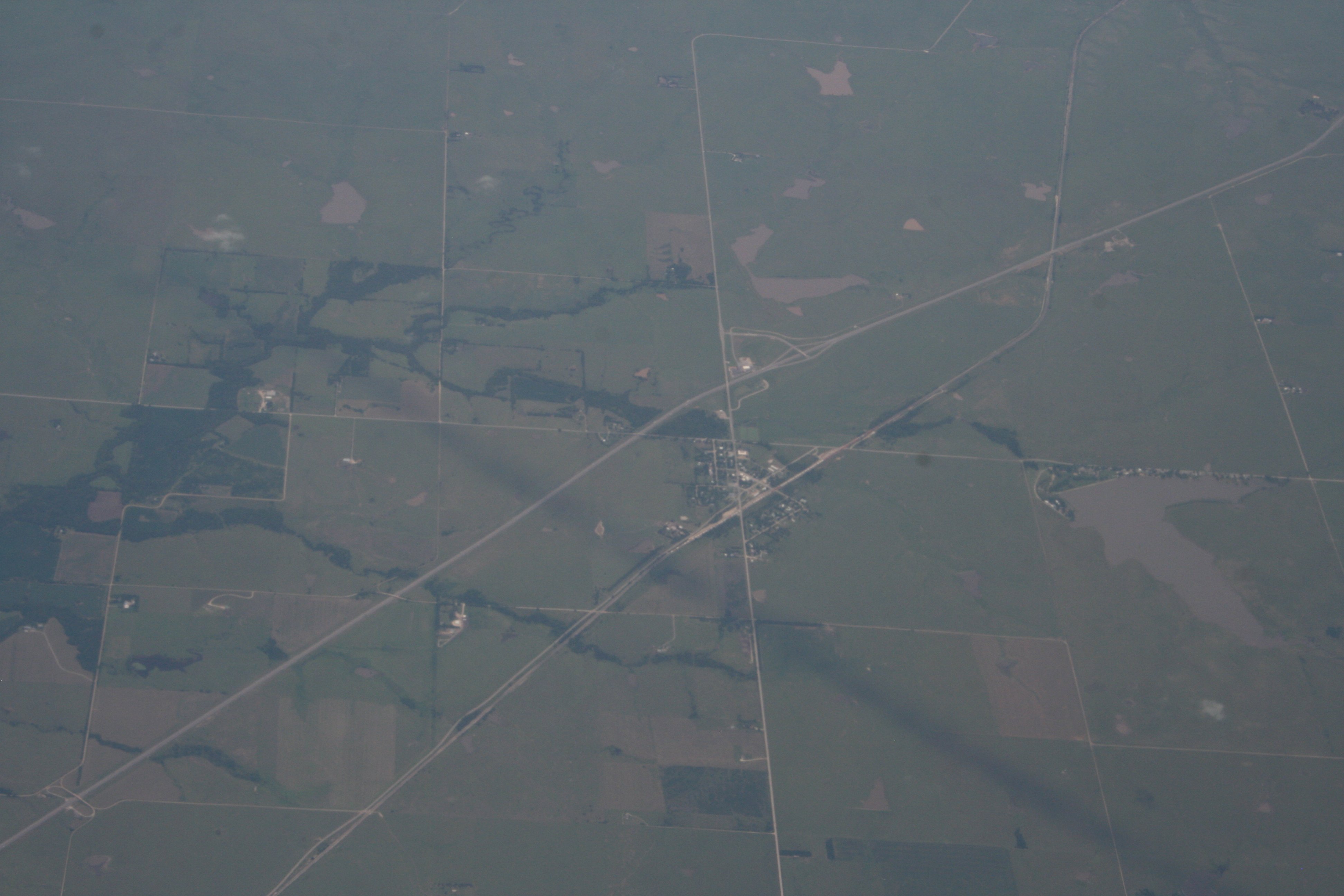
The big highway here is I-35, the town is Cassoday, Kansas (population 128), and the smaller road running parallel to it and then crossing it is Kansas Highway 177. The small V-shaped lake at the right is Fox Lake.

IMG_0288 small

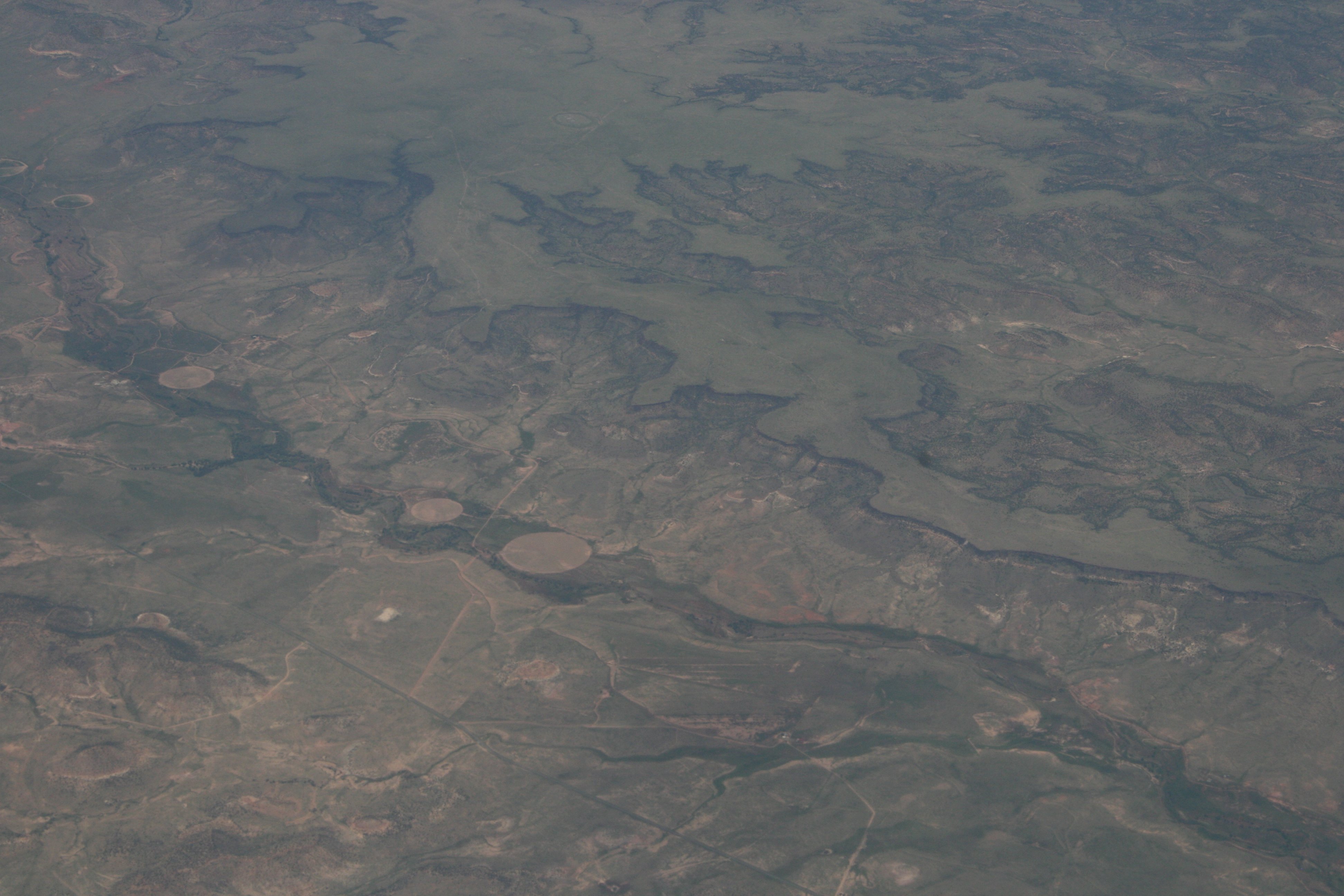
Once you get into far western Oklahoma the plains start to vanish and the landscape gets carved up. These canyons are near Kenton Oklahoma, where the New Mexico, Kansas, and Oklahoma borders all meet.

IMG_0292 small

Once you cross into New Mexico, it’s still relatively flat (for the moment) but it’s a chaotic landscape.

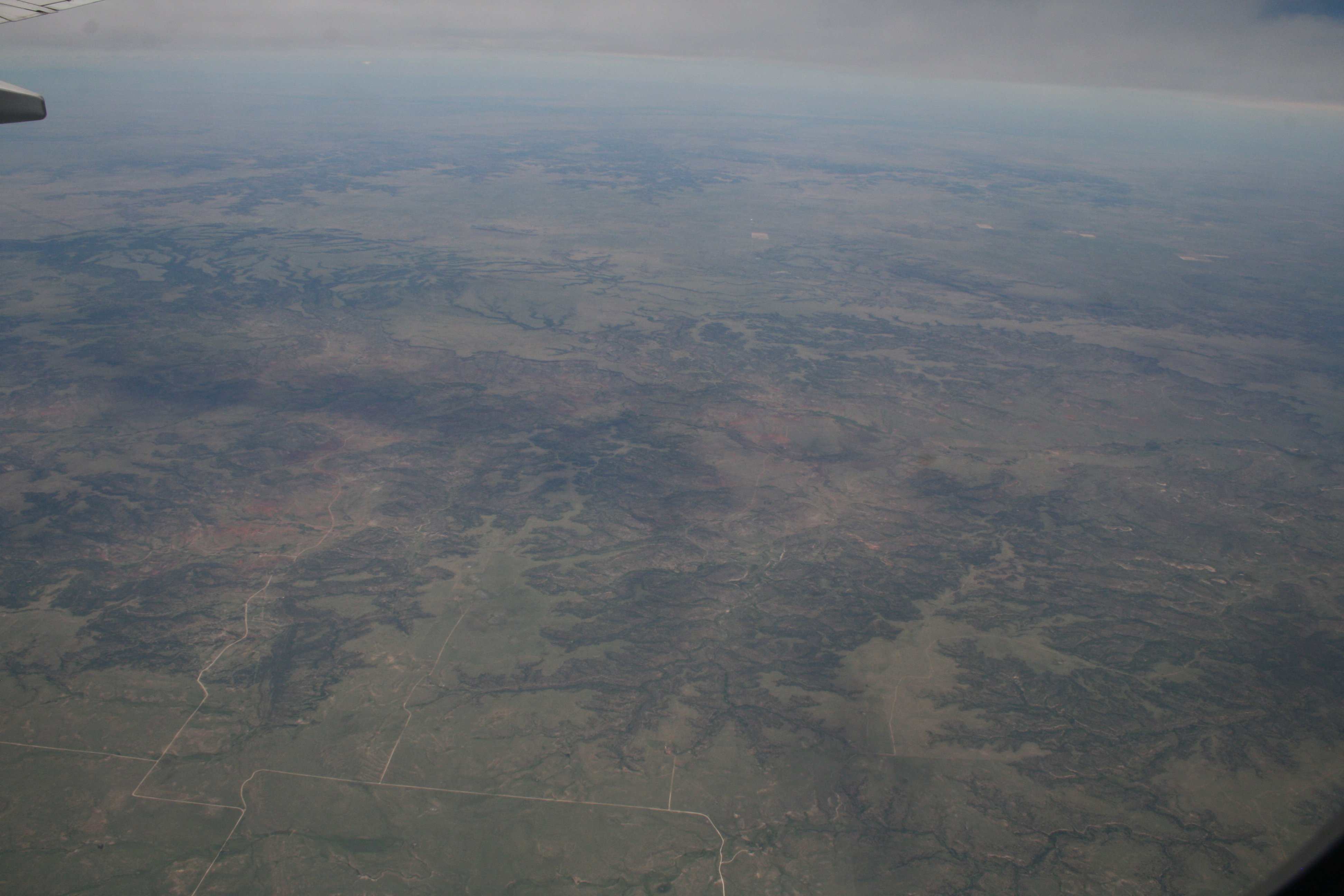
Easy to fly over at 38,000 feet, 425 knots, and air-conditioned comfort – must have been a real pain to travel in a wagon behind a pair of mules. Keep that in mind the next time you want to bitch about the TSA or not getting as much leg room as you used to.

IMG_0301 small

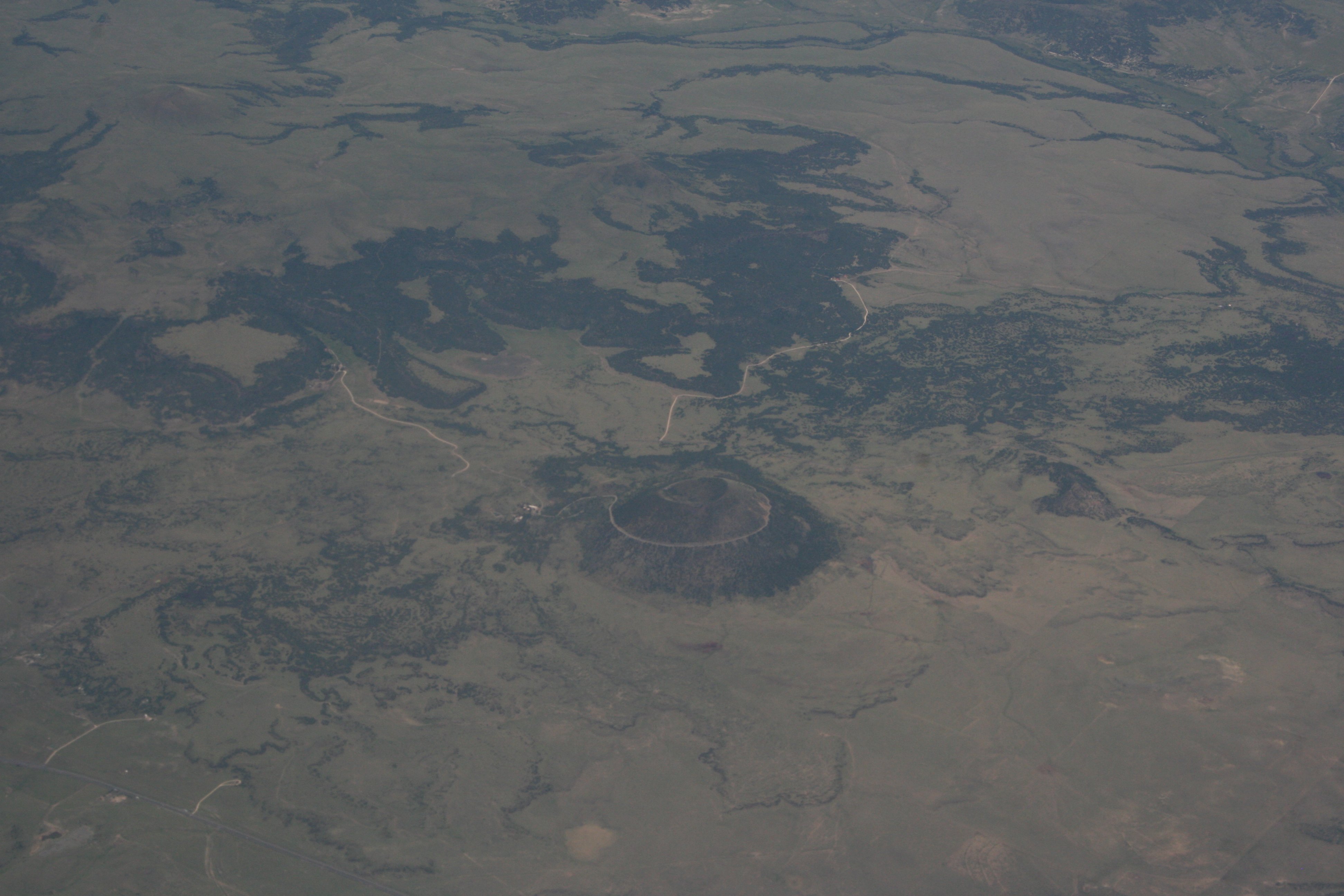
This feature stuck out like a sore thumb, but even though I knew more or less where we were when I took it, it still took some hunting on Google Earth to find it. It’s the Capulin Volcano National Monument, sixty miles northwest of Clayton, New Mexico, just south of the Colorado border.

IMG_0307 small

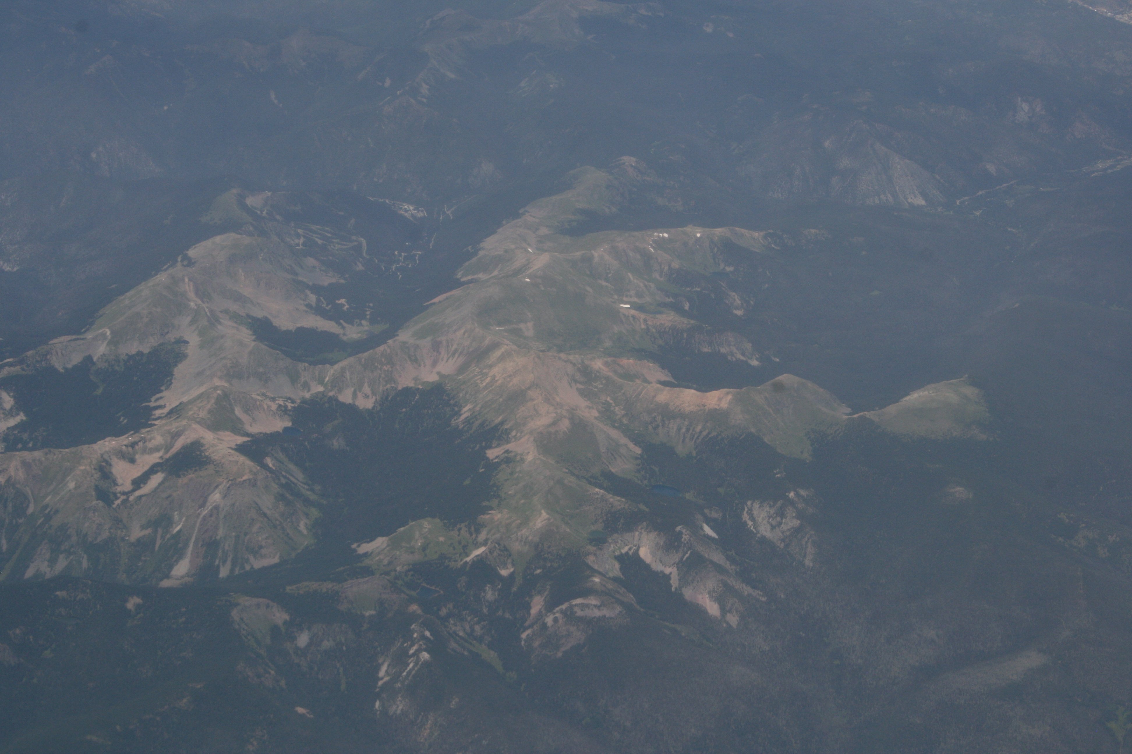
Just to the east of Taos, New Mexico, the Sangre de Cristo Mountains push up to well above 10,000 feet, with several peaks above 12,000 feet. Wheeler Peak is the highest point in New Mexico at 13,161 feet.

At first I thought there were patches of snow up there, but I doubt it now, even given that altitude. I guess it’s possible (anyone in the Taos region able to correct me?) but I suspect these are buildings of some sort, masquerading as patches of snow.

IMG_0317 small

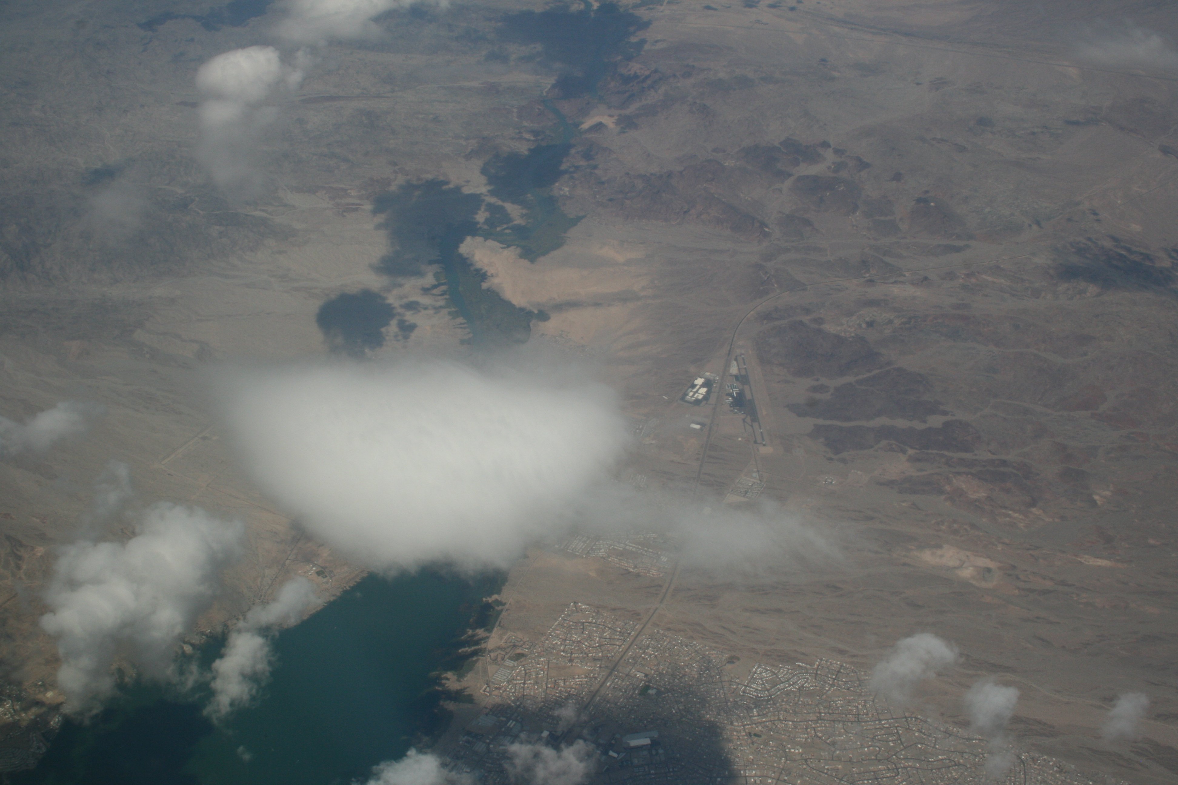
Once you get into Arizona it’s lots of land suitable only for lizards and snakes. (In my humble opinion.) Out here, water is more precious than gold, even before you get into a four-year drought. The dried up river beds still have some moisture, so that’s where you see the tiny swaths of green, often alongside a distinct flood plain.

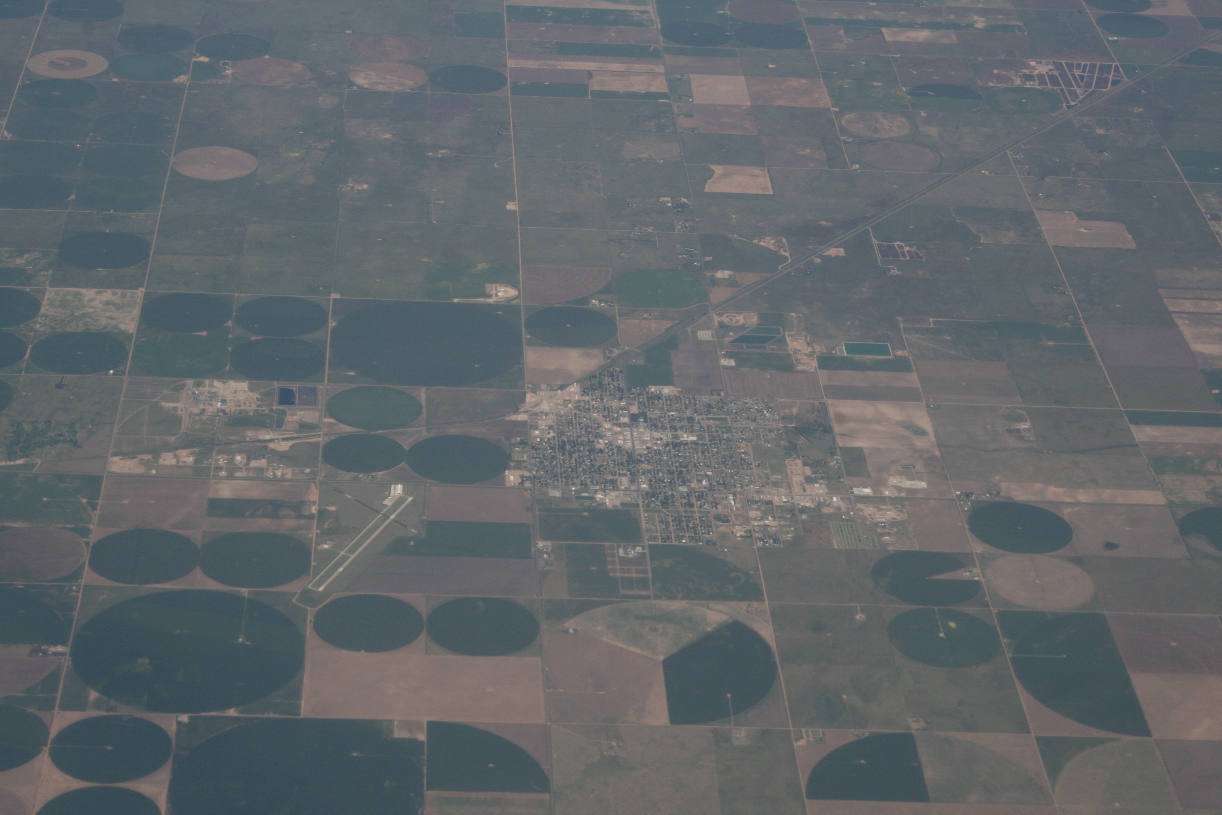
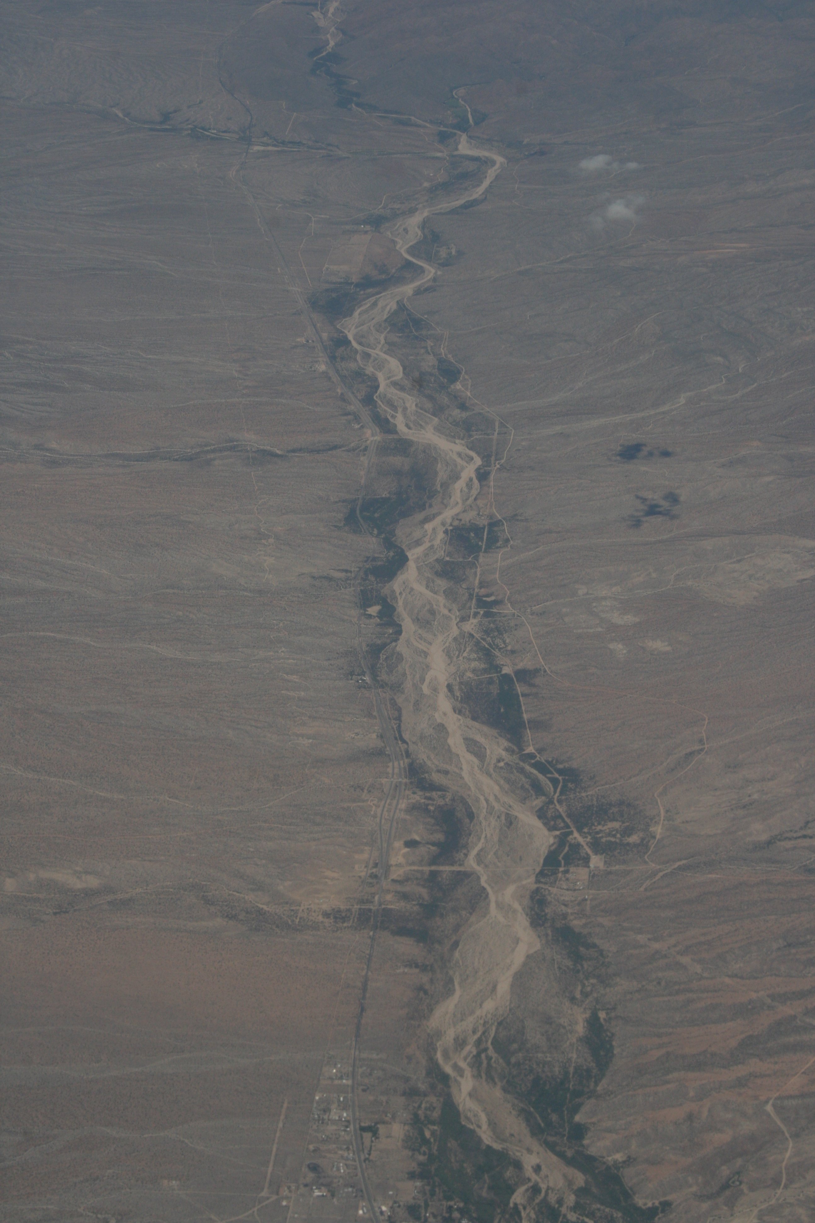
This one is the Big Sandy Wash, notable enough to be a landmark listed on VFR flight charts. The small town at the bottom is Wikieup, Arizona (population 305) and the highway running alongside the left (west) side of the Wash is US Highway 93.

IMG_0331 small

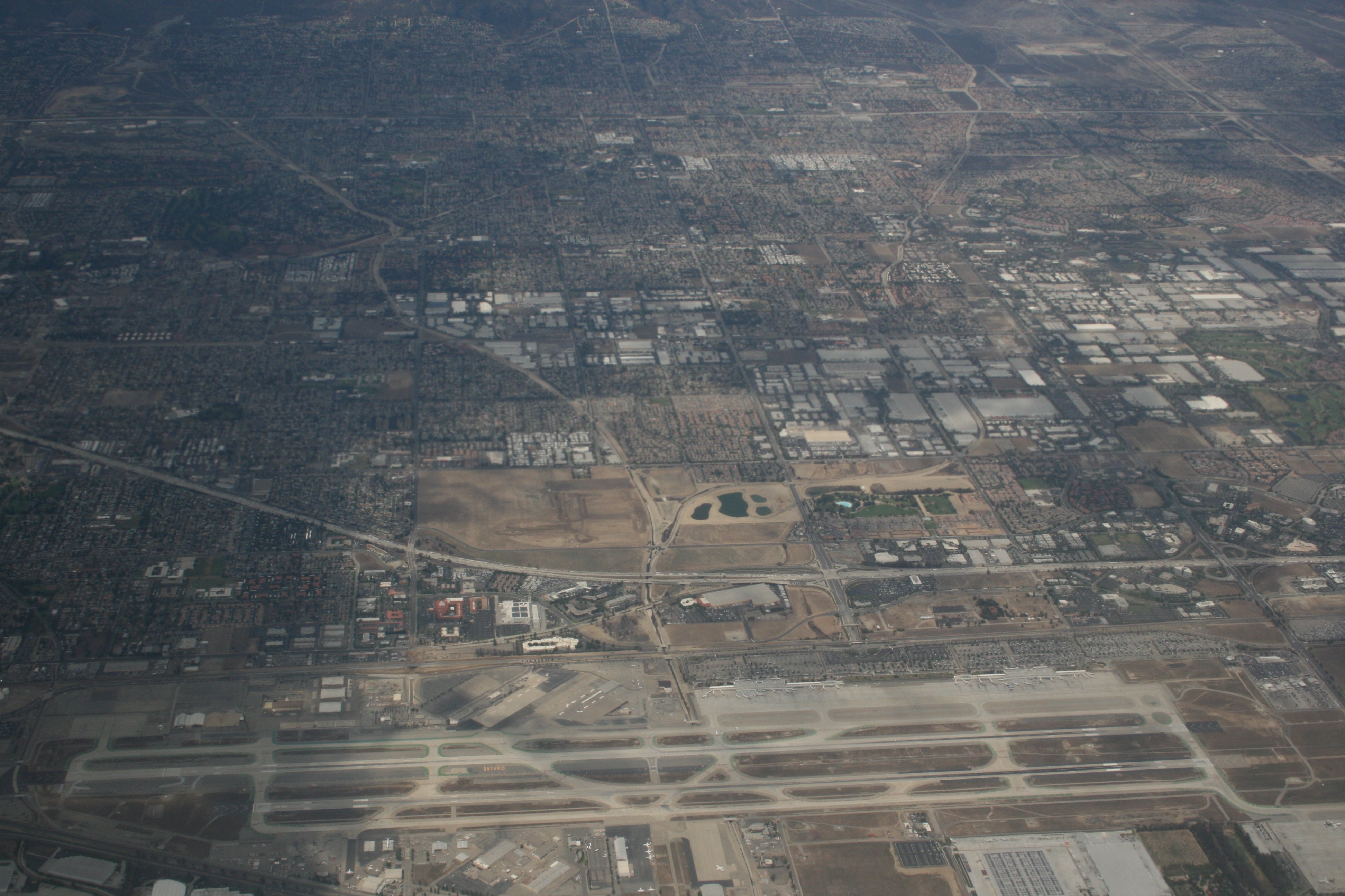
Finally back over California, the Mojave Desert stretches from the Colorado River to the metropolitan areas of Los Angeles and San Diego along the coast. The only reason the Mojave is “shrinking” is because people keep building cities in places like Palm Springs and irrigating the crap out of them in order to build golf courses.

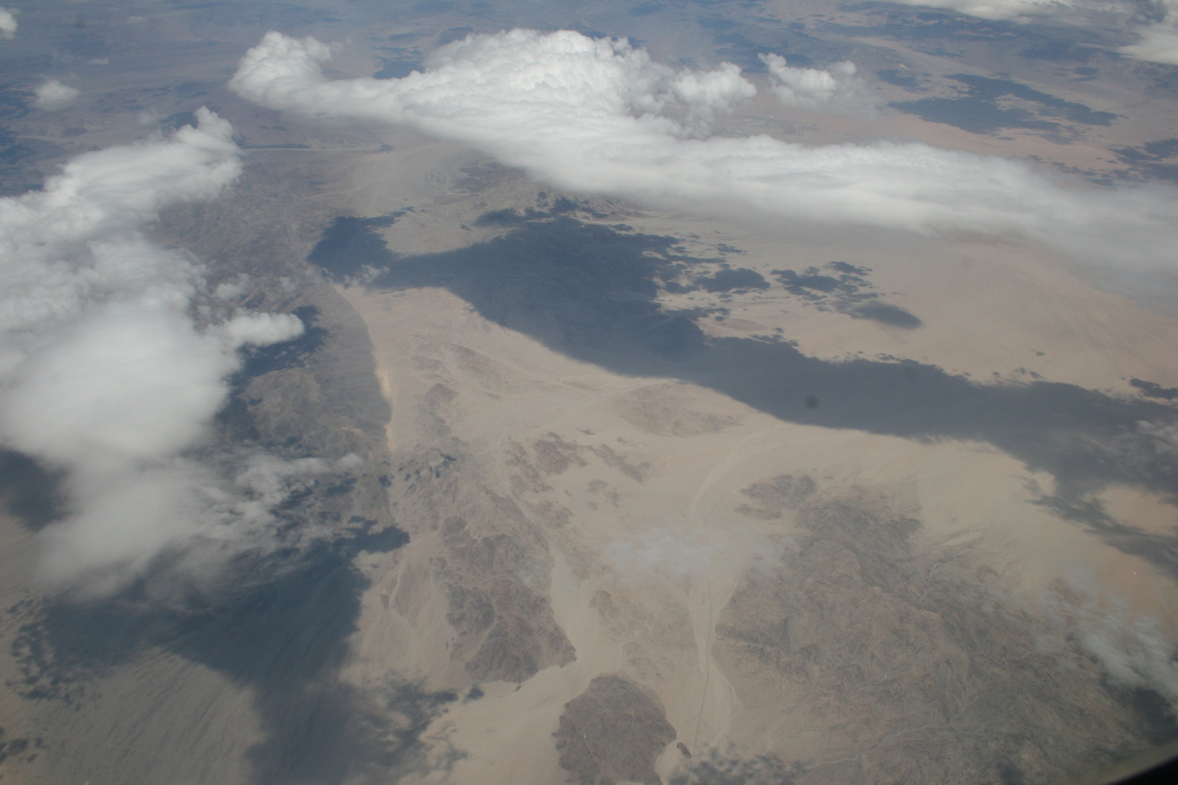
Here we were north of Twenty-Nine Palms, above the Cleghorn Lakes Wilderness Area. (Cleghorn LAKES? I can only assume this is someone’s idea of a joke. Perhaps they have a yacht club as well?) In the upper right corner, just above that long cloud, you can see the Twenty-Nine Palms Salt Evaporation facility. Just beyond is the historic Route 66 and the ghost town of Amboy.

I’ll give credit to all of those who traveled this course on foot, on horse, and in covered wagons. They were tougher men (and women, and children) than I am. A comfy window seat at 35,000 feet works just fine for me, thanks.

2 Comments

Filed under Flying, Photography, Travel

ORD To LAX – The Airports

Give me a window seat on a four-hour flight in decent weather during daylight and there might be just a few pictures taken. Some of those might not suck.

There’s a lot to see if you pay attention out of the plane window. Let’s start with the airports and their towns.

IMG_0242 small

Bloomington, Illinois. I actually lived here for six months when I was four years old. I’m assuming you can see our house from here.

The airport to the bottom right of center is the Central Illinois Regional Airport At Bloomington-Normal (KBMI). The big runway (running left to right) is 8,000 feet, the slightly smaller one (top to bottom) is 6,525 feet. No sweat!

For reference, a Cessna 172 or the like can land easily in 4,000 feet. Something like a small business jet needs 5,000 feet or so (they fly out of Camarillo at 6,013 feet all the time) and a Boeing 737 needs about 5,700 feet. Note that all of these types of planes can, and often do, land routinely on shorter runways. The figures I’ve given are ballpark figures for what is “easy,” but given preparation, acceptable weather and location, and pilot preparation, they can all land in something like 75% to 80% of that distance.

IMG_0247 small

Springfield, Illinois. I lived in one of the other Springfields (the one in Vermont) but have been here to see the state capital.

Abraham Lincoln Capital Airport (KSPI) has three big runways, 8,001 feet, 7,400 feet, and 5,300 feet. Being pointed off in different directions it’s easy to pick one that close to being in the same direction of the wind, with minimal crosswinds.

IMG_0257 small

Columbia Regional Airport (KCOU) in Columbia, Missouri. The two runways are 6,501 feet and 4,401 feet.

IMG_0274 small

Central Kansas has a lot of big airports. Near Hutchison, Kansas you can see the Sunflower Aerodrome (SN76) in the lower left and the Hutchison Airport (KHUT) just to the right above center.

Sunflower is a private airport operating as a glider port with three runways, the longest being 7,000 feet. Originally built as a Naval Air Station during World War II, it is now apparently a great place to go gliding, something I have yet to try. “Yet,” I said.

Hutchison has major runways of 7,004 feet and 6,000 feet, with a small third runway of 4,252. (Little guys like me usually get the smaller runway if it’s busy, but if the weather or the situation demands it we can ask for, and get, any of the runways. Even at a place like LAX or ORD.)

IMG_0282 small

Pratt Regional Airport (KPTT) in the upper right, the town of Pratt, Kansas in the lower left. The only active runway is the big 5,500 foot one. The smaller runway that goes off at an angle is closed and out of service. My favorite comment in the official FAA listing of the airport is, “Do not mistake lighted cattle pens for lighted runway.” Good advice, that.

The triangular layout (even though only one of the runways is still in use and one is gone completely) makes me think that this is another WWII training base. A little research shows that indeed, this was the site of the Pratt Army Air Field where B-29 crews trained. Given that, it’s not surprising that there is an All Veterans Museum Complex being built, dedicated to the “Bombers On The Prairie.”

That’s the kind of thing that I just love digging up and discovering.

IMG_0285 small

Hugoton Airport (KHQG), just north of the Oklahoma border, has a big 5,000 foot runway and a smaller 2,626 foot one.

In 1952 a Braniff DC-4 en route from Denver to Dallas made an emergency landing here with an engine fire. When the plane burned to the ground after landing there were some injuries, but no fatalities. Favorite comments from the incident report are, “…one of the hostesses advised the crew that the right wing was on fire,” and, “the nr. 3 engine fell from the aircraft and a pronounced buffeting was experienced.” Sounds like the captain did a hell of a job that day!

IMG_0320 small

The airport in Lake Havasu City, Arizona (KHII) can be seen just to the right of center. While I’ve never flown in there (one of these days, it’s going to happen) I’ve driven by a couple dozen times, having been a regular visitor to Lake Havasu in the past. The Colorado River runs from top to bottom in this view, with California on the left, Arizona on the right, and Lake Havasu in the middle, formed by the backup in the Colorado River caused by the Parker Dam (just out of view to the lower left).

IMG_0357 small

Ontario International (KONT), on final approach into Los Angeles International (LAX) but still about fifty miles out, in San Bernardino County. Ontario is a commercial airport, capable of handling all of the big jets. It’s fun to land a Cessna there, you could almost land sideways on the runway they’re so wide. It’s also fun to be out taxiing around with jumbo jets – as long as they don’t roll right over you or suck you into an engine. (Unlikely, but…)

IMG_0361 small

Over the Los Angeles megalopolis, you can see a handful of small general aviation airports where once there were dozens and dozens. Just to the upper left of center here you can see Cable Airport (KCBB) in Upland. It’s a charming place to fly into, even if it’s only to have a “$100 hamburger” at Maniac Mike’s Cafe.

To clarify for the non-pilots, the food doesn’t cost $100. Pilots have to fly regularly to stay current, and flying around in a circle at your home airport doing touch-and-goes, while it will qualify, is sort of boring. Instead, pick a place and go for lunch. Lots of small airports have restaurants or cafes and it’s much more fun (and better practice) to fly somewhere different. It helps to keep you sharp on your navigation, radio skills, landing and taking off in different conditions and circumstances, and so on. But, by the time you fly off for a half-hour to an hour (Cable is about twenty minutes from my usual “home” airport, Whiteman) and then fly back, it can cost about $100 for fuel, plane rental, insurance… Thus, the “$100 hamburger.”

All of this makes me wonder – how can people NOT be looking out of the windows on a cross-country commercial flight? I know I’m in a very, very small minority on this one, but I’ll stick with my belief that I’m the sane one and that vast majority is the group that has forgotten how übercool it is to see the world from 38,000 feet.

Leave a comment

Filed under Flying, Photography, Travel

BTV To ORD

Last Thursday morning, returning home from Vermont, flying out of Burlington into Chicago. What do I see from the air? Not surprisingly, I see a lot of airports.

IMG_0142 small

It was fairly early when we left Burlington, so the low sunlight made the contours in the broken cloud layer stand out.

IMG_0146 small

The Finger Lakes of New York, just north of Lake Placid.

IMG_0152 small

Approaching the St. Lawrence River, separating the United States from Canada. Just to the lower right of center is Fishers Landing, New York. The major roadway there is US I-81 turning into Canadian Highway 137 as it crosses Wellesley Island.

IMG_0162 small

Kingston, Ontario. The harbor on the right and the Kingston Airport on the left make it easy to identify. At the bottom is Simcoe Island in New York.

IMG_0171 small

This is the Bay of Quinte, an offshoot of the St. Lawrence River. The community at the top is Trenton (along with Trenton Airport) and at the far left of the Bay you can see the entry/exit point of the Murray Canal, which connects the Bay of Quinte with Presqu’ile Bay on Lake Ontario.

IMG_0184 small

Whitby, Ontario on the left, Oshawa, Ontario on the right, with Oshawa Airport at the top center. As you can see, we were flying the length of Lake Ontario. I was sitting on the right side of the plane so I was looking at the southern border of Canada. The Long-Suffering Wife was on the left side of the plane and could have been looking at the northern border of New York (Rochester, Buffalo, Niagara Falls) if she hadn’t had the good sense to close her window and get some sleep.

IMG_0191 small

We flew right over the northern part of the Toronto area. The south end of the rail yards at Vaughan can be seen at the top left, while the north end of the runway at Toronto Downsview Airport can be seen at the bottom center.

IMG_0197 small

After crossing the southern tip of Lake Huron, we’re back over the United States. Heading west across Michigan, we passed just south of the Grand Rapids area, where the Kent County International Airport makes a great landmark.

IMG_0202 small

Approaching the eastern shore of Lake Michigan, we passed over Holland, Michigan. At the very bottom center you can see the Tulip City Airport, while there’s a much smaller airport (Park Township) on the northern shore of Lake Macatawa.

Lake Michigan is freakishly huge when you fly across it. I can see why it’s often recommended that small, single-engine planes take the long route around the southern tip rather than risk having an emergency over Lake Michigan.

Leave a comment

Filed under Flying, Photography, Travel

Modern Day Static Compasses

While traipsing around Vermont and New York for the past couple of weeks (and I was “traipsing,” not “wandering,” “meandering,” “sashaying,” “ambling,” “strolling,” “strutting,” “prancing,” or “galavanting”) I was often getting all turned about and uncertain exactly which way I was headed. That part of the world has lots of twisty, turny roads.

If the sun is setting or rising it’s pretty easy to find east or west and go from there, but if it was cloudy (as it often was) or mid-day with the sun overhead, it could be more difficult to figure out directions from first principles.

As a Boy Scout in these very mountains, I was taught things like looking for moss growing on the north side of trees and other subtle tricks of nature to help in staying oriented. Not always that useful when driving, but hey, if I absolutely run out of other options, there are plenty of trees and plenty of moss – we’ll take a vote over a few hundred trees and see if we can come to a consensus on which way North lies.

However, there’s a much easier and more reliable piece of today’s landscape that will always tell you which way you’re facing.

IMG_2991 small

This is in Los Angeles and not Vermont (obviously) but the principle is the same. See those satellite dishes on top of the building? If you’re in the Northern Hemisphere, those dishes are always pointed south. If you’re in the Southern Hemisphere, they’re always pointed north.

That’s because they’re all pointed at geosynchronous satellites which are out in space directly above the Equator. Since the Equator is to the south of you if you’re in the Northern Hemisphere, the dishes point south. Once you know where south is, everything else falls into place.

In this picture I was obviously facing north. (The antennas are facing toward me.) In the fourth picture here (looking between the apartment buildings), I was obviously facing east. (The antennas are facing from right to left.)

In that second picture, the shadows from the sun setting behind me would confirm that I was facing east. But on the picture above where it’s cloudy and there are no shadows, the antennas will still give your orientation away.

There you go! If you’re out in the boonies in the woods, look for mossy trees. If you’re anywhere civilization, and that means just about anywhere you can find even a single building, look for the satellite dish.

With one caveat – if you’re at the Equator and all of the dishes are pointed straight up, you’re screwed.

Leave a comment

Filed under Travel

Insanity Plea

This is what I left behind this morning:

IMG_9077 small

File Aug 06, 19 21 06

File Aug 06, 19 54 52

File Aug 06, 19 21 41 small
File Aug 06, 19 41 36

File Aug 06, 19 54 00 small

File Aug 06, 19 50 35

File Aug 06, 19 51 39

File Aug 06, 19 53 33

This is what I returned “home” to this afternoon:

IMG_0361 SMALL

File Aug 06, 19 16 37

As always – why? Why? WHY? WHY? WHY? WHY??

Good thing that the dog is here. And the bed. The bed in that hotel kinda sucked a little. So the bed is good.

1 Comment

Filed under Photography, Travel

Timelapse Vermont Clouds

It’s almost time to leave Vermont again. Of course I’ll be back – perhaps very soon, perhaps on a regular basis a couple times a year for an indeterminate amount of time. That’s out of my control.

The clouds were rolling by and as we packed and prepared to leave, I set up my iPad in the window running the “Timelapse” app. I’ve used it once or twice and this seemed like a good chance to play with it a bit.

I’m quite pleased with the results for a very early effort. The original HD version is gorgeous, but a ginormous, huge file. This version has been compressed by QuickTime Pro and still looks pretty good, even in full-screen mode.

Enjoy.

We’ll see you back in Los Angeles.

Leave a comment

Filed under Travel, Video, Weather

Quechee Gorge

Quechee Gorge (pronounced “Kwee-chee”) is a wonderful place to visit in east-central Vermont. Located on the Ottauquechee River just west of White River Junction, Vermont, it’s easily accessible on US Route 4, just a few miles off of either I-89 or I-91. There are parking lots on either side with pedestrian walkways which allow you to look down several hundred feet into the Gorge. If you have the time, you can follow an easy hiking trail down into the Gorge. We’ll have to do that next time.

IMG_9982 small

Looking north.

IMG_9995 small

Looking south.

Leave a comment

Filed under Photography, Travel

Clouds, August 3rd

Scattered thunderstorms almost every day right now in northern Vermont – lots of great clouds, some spectacular, but little if any actual rain right where we happen to be. But when it does rain, it really pours.

Our attitudes toward the weather have similarities to our attitudes toward life – it’s changing constantly, sometimes calm, often threatening, occasionally stormy. Anticipating and preparing for the really bad parts takes up so much of our time, but the actual really bad parts are rare and short-lived. There’s a rainbow after the storm passes.

In my case, I prefer the stormy weather to the calm. Okay, I’m not 100% sure the analogy holds that far, but I’m intrigued by the possibility.

IMG_3856 small

IMG_3858 small

IMG_3864 small

IMG_3869 small

IMG_3872 small

IMG_3876 small

IMG_3879 small

IMG_3884 small

IMG_3885 small

2 Comments

Filed under Photography, Travel, Weather

Burlington Waterfront

We took off this afternoon to head north to Burlington, Vermont. We met my brother and his wife for a lovely dinner, but had plenty of time before dinner to wander along Church Street and down to the Waterfront.

Church Street is one of the first in this country to be closed off to vehicular traffic and turned into a pedestrian shopping and entertainment area. It’s four blocks of all kinds of neat things, from the conventional (Starbucks and Ben & Jerry’s) to the odd and unique (tattoo parlors and yoga studios). There are also a wide variety of eating places of all sorts.

This weekend was the “Festival of Fools” and on every block we saw street performers such as magicians, jugglers, singers, and comedians. The festival coincided (I believe not coincidentally) with the annual dragon boat races on Lake Champlain. We had hoped to get there in time to see at least a couple of the races, but visiting with Mom and getting a late (but very good) lunch slowed us down enough to force us to miss them. On the other hand, it meant that there was parking available closer than Winooski, so that’s a good thing.

And, of course, I took pictures. It was a clear day with the Adirondack Mountains in New York clearly visible, row upon row across the lake. The folks out sailing and kayaking seemed to be having the most fun of all.

File Aug 02, 23 05 07

(Click on image to see it full sized.)

Leave a comment

Filed under Panorama, Photography, Travel

A Good Time Was Had By All

As I mentioned, yesterday was my mother’s 80th birthday. She’s had some recent medical issues (thus my current extended and unplanned trip to Vermont) so we had to celebrate at the facility where she’s receiving treatment, but celebrate we did!

01_IMG_9887 small

The facility was fantastic in helping us get the party arranged and letting us decorate a conference room.

02_File Aug 01, 21 26 22

My brother had a laptop and monitor set up to display a slideshow of family pictures, and a small DVD player let us show the 8mm family movies that we’ve transferred.

Two of my brothers were there, as well as The Long-Suffering Wife and my brother’s wife. One of my nieces was there with her kids and husband, one of Mom’s grandchildren was there from California, and several of Mom’s friends from town came. In addition, one of my brothers had come in from Texas for several days last week (even though he couldn’t stay for the party) as did one of my sisters from California (ditto).

03_File Aug 01, 21 27 04

Mom had her hair and makeup done and got duded up to make sure that everyone knew who the Birthday Girl was. We also brought in her dog, Lucy, who was very well behaved and sat on Mom’s lap through the whole affair. (For the record, Mom really was having a good time – she wasn’t nearly as horrified as this picture makes her look!)

04_File Aug 01, 21 28 09

Putting all of that high-tech equipment to good use, we usually had at least three Skype or FaceTime connections going so relatives across the country could say hello. We talked to our two daughters in California, my niece’s kids at the beach in California, and got a phone call from Mom’s brother in South Dakota.

Finally, my NASA Social experience came in handy as I was able to post pictures and events as they happened (more or less) on Twitter and FaceBook. This in turn got a dozen or so of Mom’s nieces from all over the country sending in stories to share and birthday greetings.

05_File Aug 01, 21 28 35My brother, Mark (on the left), and I gave Mom a tremendously touching and personal birthday present. For nearly forty years we’ve kept Mom confused about which of us likes apple pie and which of us likes cherry. (Our family has more than a few running practical jokes going.) Basically, no matter what Mom thinks is correct, we’ll claim it’s the opposite. Sometimes we’ll switch several times during an event like Thanksgiving.

For her 80th, we told her which is truly our favorite. I like apple, Mark likes cherry. (Really, really!) It’s easy to remember, because “A” comes before “C” and Paul was born before Mark, so “Apple” = “Paul” and “Cherry” = “Mark.” Simple! (Or is it the other way around, because “M” comes before “P“, so “Apple” = “Mark” and “Cherry” = “Paul?”)

06_IMG_9903 small

If Mom seems to be groping for the appropriate word here, it’s “bullshit!”

07_IMG_9905 smallOf course there was cake, and candles to be blown out. The coolest part of the whole day was when we sang “Happy Birthday” and Mom sang along. She may have problems speaking right now, but her singing is pretty darn good! Then we had candles to be blown out, perhaps with a bit more technological help.

08_IMG_9910 smallEven the little kids did a great job of making sure that Nana was smiling and enjoying herself. This is Rose and Bella, two of my niece’s daughters, doing either the Disney Princess or the Alien Monster look (could go either way) with Nana.

File Aug 01, 22 10 07

Mark was nice enough to take a picture which finally captured my true inner self. (Don’t say you weren’t warned.)

09_File Aug 01, 21 29 57

We’re sure than Mom slept really well last night, but she was in good spirits this morning, having apparently survived the ordeal. If nothing else, the day proved that she’s still got that “Mom look” and eye roll down pat. (But she’s grinning while she does it.)

Love you, Mom!

Leave a comment

Filed under Family, Photography, Travel