Category Archives: Panorama

Panorama: University of California, Irvine

The University of California campus in Irvine is a relatively new one, having only been founded in 1965. I graduated from there in 1980, and one of my daughters graduated from there in 2011.

This panoramic picture was taken in May, 2006. (Click to enlarge.) It was taken from near the middle of what is now known as Aldrich Park. (Campus map here.) The campus was planned around a 21 acre, bowl-shaped area, with the first buildings in a ring around it. Subsequent construction was to be done in expanding rings and zones around this central core.

When I was there in the late 1970s, the first ring of buildings was just getting completed. A couple of the next ring of buildings had been started and the athletic complex was there, but all of the rest of the buildings in the second and third rings and beyond were just a plan somewhere in a drawer. Only two of the eight housing areas seen here existed in 1980.

Dan Aldrich (“Chancellor Dan”) was the founding chancellor for UCI and was still there when I graduated, retiring in 1984. The story line in my day whenever anyone asked him what his plans were for retirement were along the lines of, “I’m going to get 100 feet of hose and a shovel and whip that park into shape!” (Note that it was not exactly a dump by any means.)

2006_05_06 Panorama (UC Irvine) small

This panorama comes from sixteen images of 3456 x 2304 pixels (8 megapixels each) taken with a Canon Rebel XT DSLR, combined into an image of 19262 x 3137 pixels (60.4 megapixels).

When I was a student there, the joke was that “UCI” stood for “Under Construction Indefinitely.” That obviously hasn’t changed much. Whenever I would visit my daughter and walk around campus, the most common phrase I said was, “That wasn’t here when I was here!”

It’s been four years since she graduated, and she was visiting the campus recently for something or the other. Her comment? “There’s all these new buildings that weren’t there when I was there!”

Time marches on.


Leave a comment

Filed under Family, Panorama, Photography

Cloudy, Gloomy Day On The Ramp

I spent this Saturday as I spend almost all of my other Saturdays when I’m not travelling – at the CAF SoCal hangers in Camarillo. Today it was grey and gloomy, borderline chilly, despite the fact that at home, thirty miles away, it was sunny and pushing 90°F. That’s what you get when you’re just a couple miles from the coast during “June gloom.”

We were setting up for a wedding in the museum hangar (renting it out for events is a big source of revenue for us) and we had the EAA holding their monthly meeting in our maintenance hangar (we’re building two more hangars, a portion of which they’ll lease from us, but for now we’re sharing) so almost all of the planes were out on the ramp. Also out there were five or six of the small general aviation aircraft belonging to the flight school that leases tie-down space on our ramp.

All in all, gloomy or not, there were a lot of aircraft sitting around. What better time to take a couple of panoramic pictures?

IMG_9477

On the west side of the ramp I was between two of the flight school aircraft. Out in the middle, from left to right are one of our SNJ’s (blue with white tail), our PT-19 (blue with yellow wings), our C-46 “China Doll” (the honkin’ big one in the back), our A-2 trainer, our F8F Bearcat (dark blue, hiding behind the P-51), our P-51 Mustang (red nose & tail), and our other SNJ (yellow).

IMG_9479

Over on the other side and looking back, from left to right are “China Doll,” one of the flight school planes, the F8F Bearcat, the A-2 in front of the P-51 Mustang and the yellow SNJ, our F6F Hellcat (dark blue with the wings folded back), our Navion trainer (white on top, blue on bottom, yellow stripes),  the PT-19, and the blue SNJ. Over behind all of the planes, running from the far hangar out to the taxiway on the right, you can see a chain-link fence covered with green tarps. On the other side is where the grading is going on for our new hangars.

Not the best day for flying, but a good day to get a lot of catch-up work done on the accounting and paperwork. You take what you can get.

Leave a comment

Filed under CAF, Flying, Panorama, Photography, Weather

NASA Social For LEAPTech At NASA Armstrong (Part Five)

All good things must come to an end. After four days of writing about the NASA Social a week ago, showcasing the LEAPTech project at the NASA Armstrong Flight Research Center, it’s time to wrap things up.

Remember, you can see what LEAPTech is (“Leading Edge Asynchronous Propeller Technology”), go along as we went out onto the Rogers Dry Lake to see a LEAPTech live data collection run using HEIST, visit the F-15 hangar as well as the Subscale Flight Research Lab and the Lunar Landing Research Vehicle.

42_IMG_7880 small

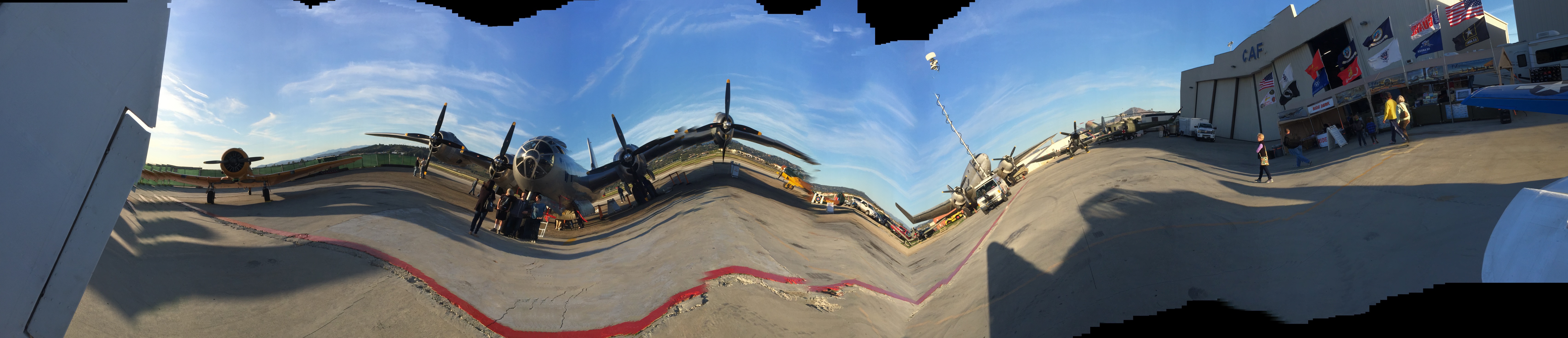
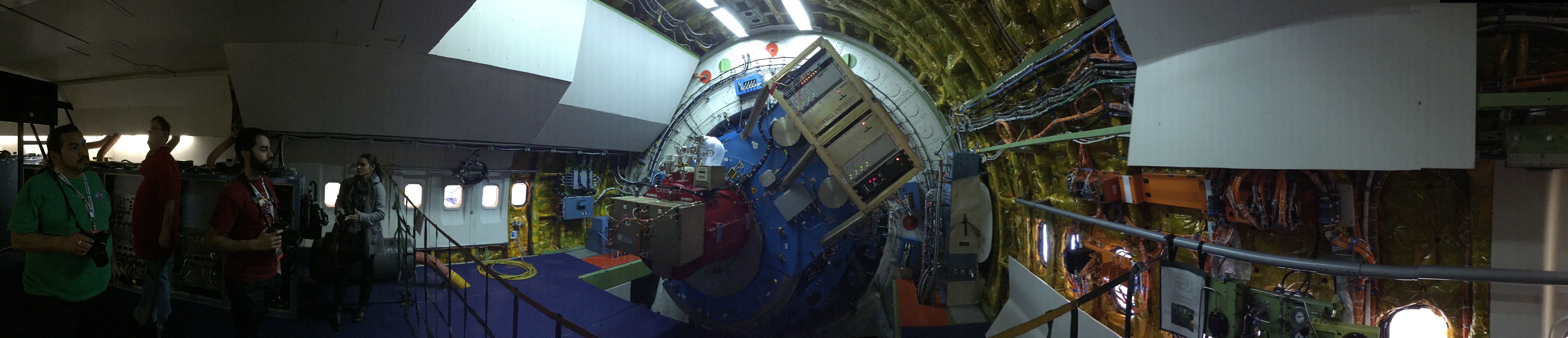
Our next stop was at the Global Hawk hangar. These vehicles are modified military remotely-piloted vehicles that can be loaded up with whatever instruments are needed to gather data for extended periods of time. Often the data comes from places that are unsafe for a piloted aircraft, such as in or near or above a hurricane, thunderstorm, or volcano. Many of the observations that the Global Hawks are used for are done in concert with the National Oceanic & Atmospheric Administration (NOAA) to study extreme weather events and to gather data to make better weather predictions. While the Global Hawk is not rugged enough to fly into a hurricane, it can be fitted with a whole cluster of radiosonde buoys which it drops into a hurricane from above, monitoring the data as the buoys descend through the storm.

43_IMG_9104 small

This panoramic view shows how long the wings are on the Global Hawk. The almost glider-like wings combined with a high-efficiency jet engine allow the Global Hawk to stay in the air for up to twenty-four hours. That requires three separate shifts of controllers and remote pilots, who can be based out of Edwards on the US west coast, Wallops on the US east coast, or in a remote mobile station.

The design similarities to a glider give the Global Hawk a great glide ratio, meaning that it can fly a long way if there’s an engine failure. That, combined with the fact that the Global Hawk flies at up to 65,000 feet, well above the commercial airliners, means that in an emergency it can reach a wide range of potential landing sites. While nominally controlled remotely, in an emergency that results in a communication failure, the Global Hawk has pre-programmed contingency procedures and limited autonomous abilities to keep itself safe and out of the way of other aircraft.

44_IMG_9110 small

Frank Butler is the Global Hawk program manager and was gracious enough to spend some time with us answering questions about the program.

While we were in here, where “here” is a big, hollow, echo-y, metal hangar, we heard two sonic booms. There is a high-speed corridor over the base in which military and test aircraft can be cleared to break Mach One, rattling those on the ground beneath them. Frank didn’t seem too bothered, but the rest of us jumped pretty good. That big, hollow, metal hangar really rings and rattles when the sonic boom hits! (I love hearing sonic booms, by the way. I know, big duh, huh?)

45_IMG_9113 small

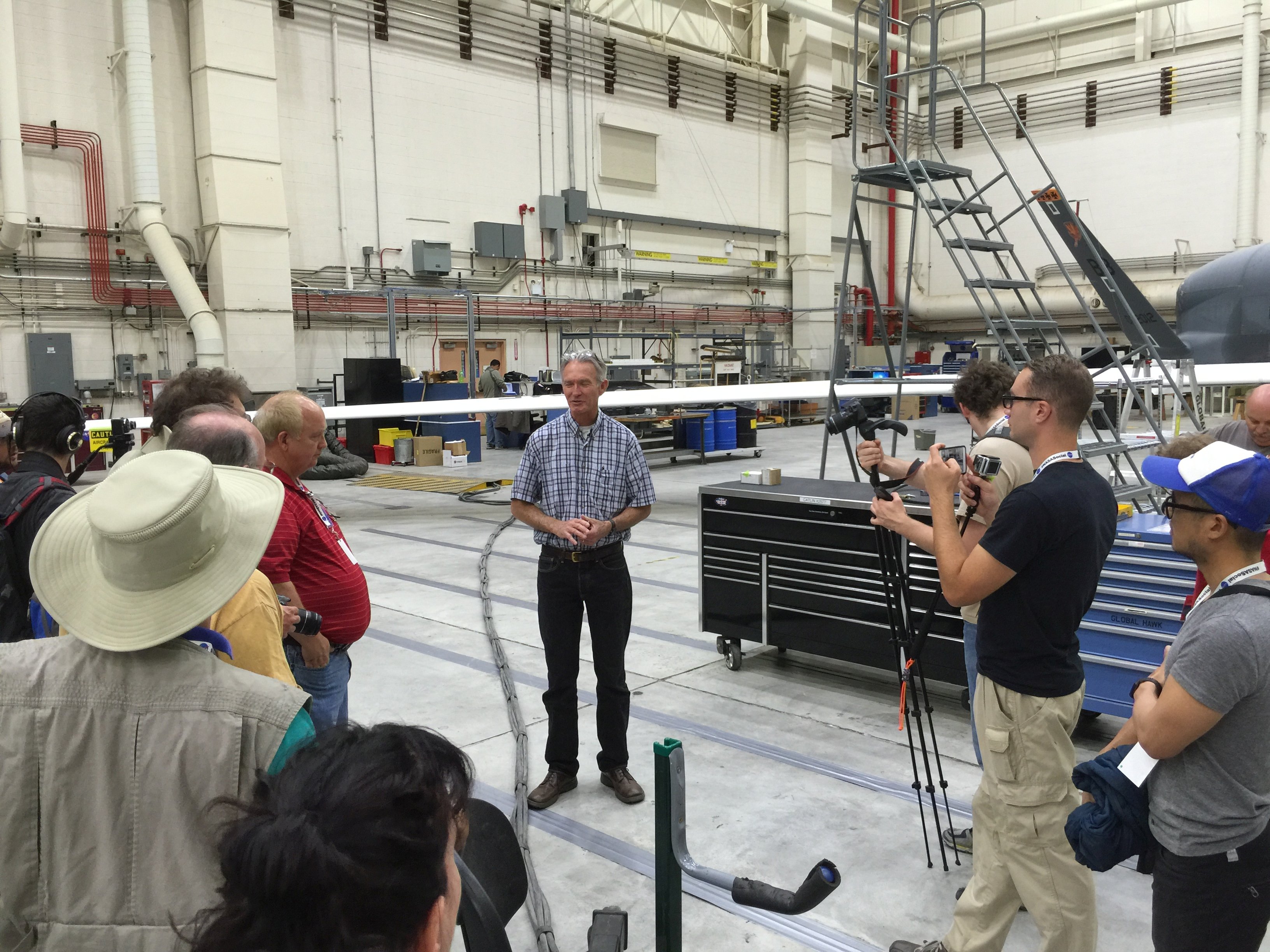
Our last stop was in the Adaptive Compliant Trailing Edge project. Back in November we saw this program at the beginning of its testing. Now it’s finished that initial step and they’re getting ready to move on to the next, longer, and more complex step.

Also back in November, a tweet of mine (with a view very similar to this one) was picked up by CNN Online. My fifteen minutes of fame!

46_IMG_9115 small

The ACTE test pilot, Tim Williams, was there to answer our questions, as well as members of the engineering and design team. ACTE could be another revolutionary technology in how planes fly, replacing today’s flaps with surfaces that can flex and bend more like a bird’s wing. Not only could this be yet another factor in significantly reducing aircraft noise, but it could also make planes more efficient, reducing fuel used by several percent.

In the first testing phase, the flexible section of the wing was set to one position before each test flight was performed to collect data. In the next phase, a much more sophisticated and complex structure will be installed on the wing, which will allow them to not only change the shape in flight as needed, but also to change it in multiple sections. You might need the outside twisted up or down while the inside twists down or up, for example. This could move aerodynamic loading off of the wingtips where vortices are formed and drag is created and on to the wings near the plane’s body, where they’re much more efficient.

This next phase will be a three-year project but it should be fascinating to watch.

47_IMG_2974 small

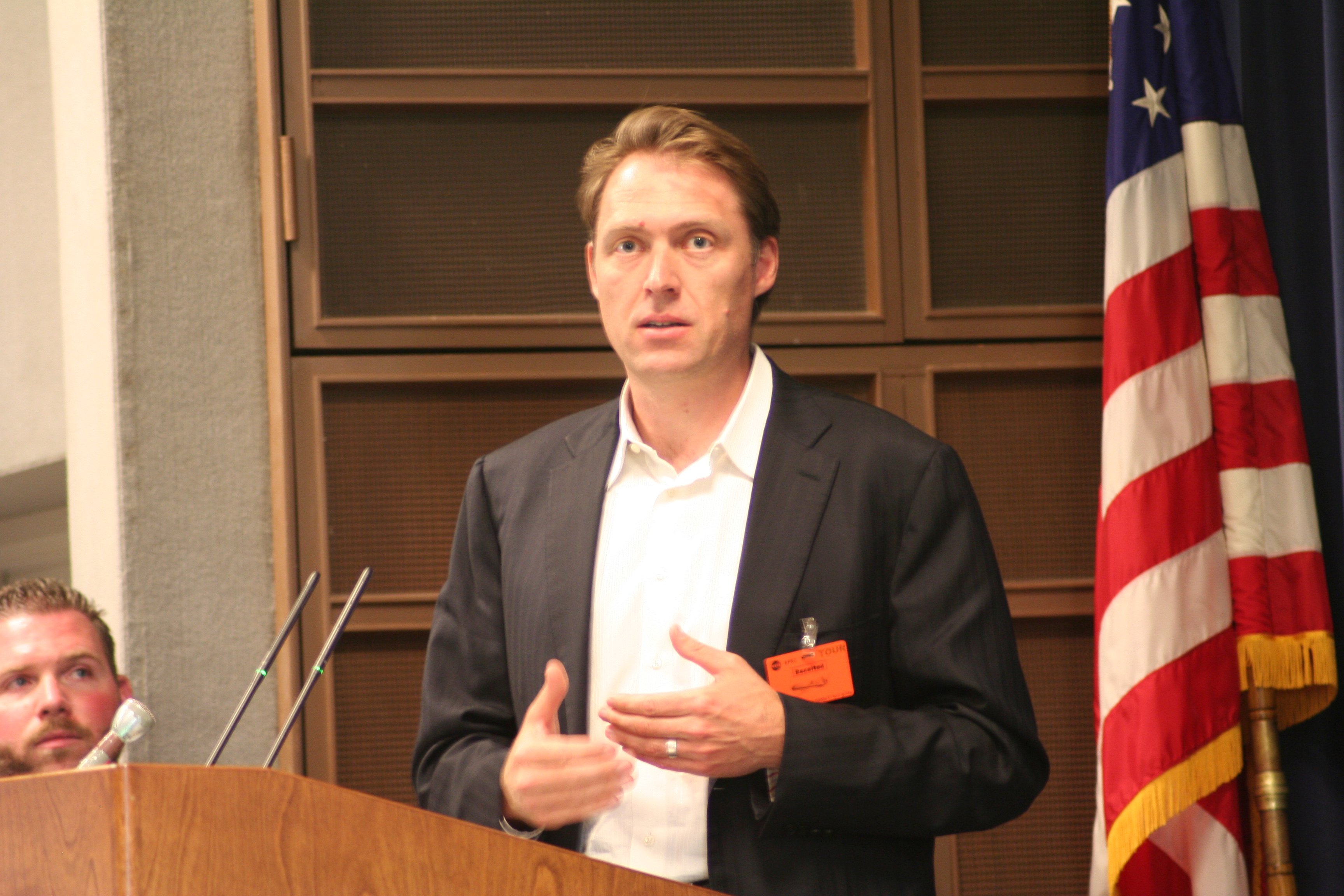
Finally, I want to thank all of the speakers who shared their passion and projects with us. This is JoeBen Bevirt, the founder of Joby Aviation. Joby is one of the key partners in private industry working closely with NASA Armstrong to develop the LEAPTech system.

48_IMG_7769 small

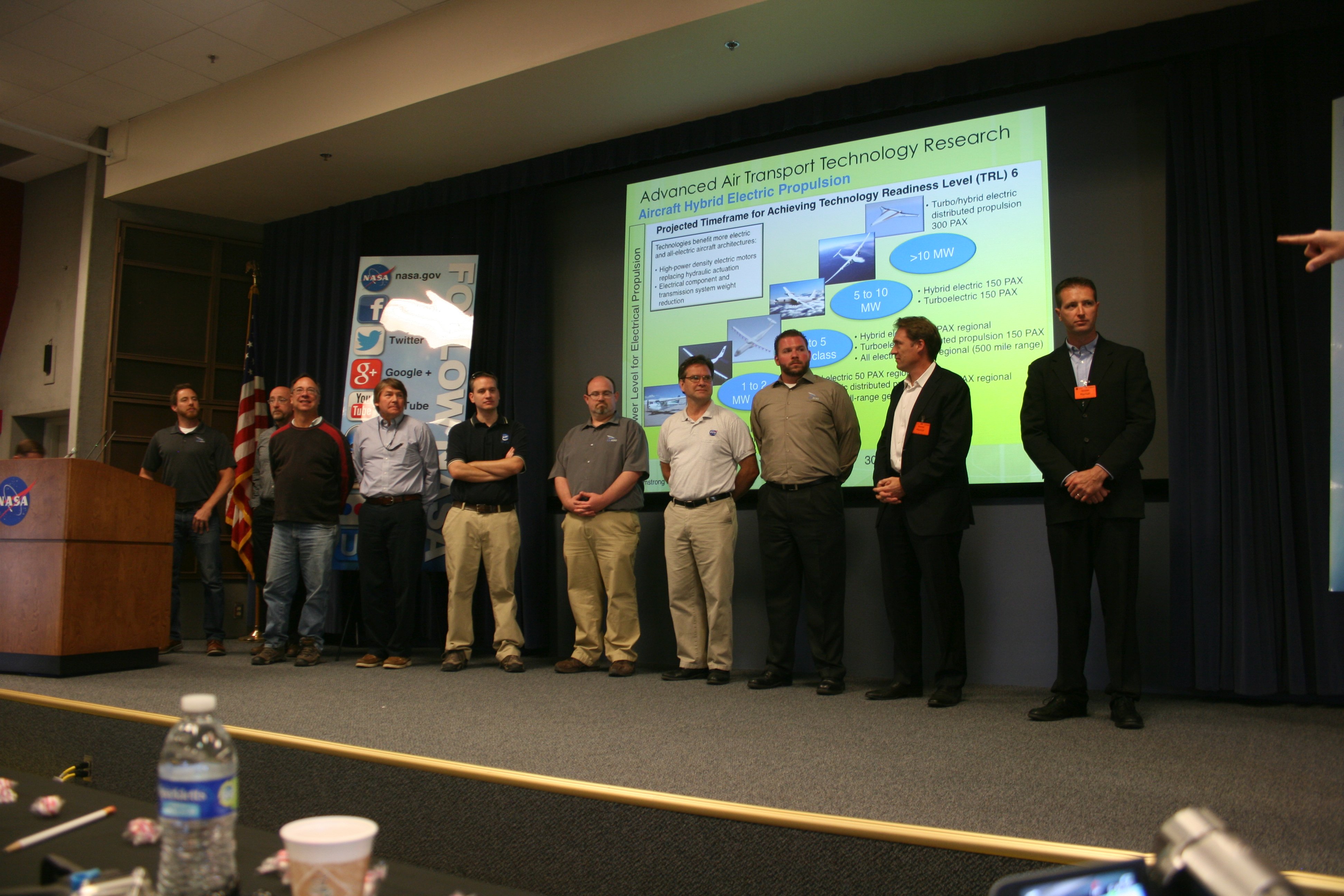
We also got to meet and ask questions from a whole lineup of Joby and NASA Armstrong engineers and scientists. Here, from left to right, are Benjamin Schiltgen, David Cox, Bruce Cogan, Jeffrey Viken, Sean Clarke (Principal Investigator, designed the LEAPTech power train), Trevor Foster, Mark Moore (Principal Investigator), Andrew Gibson, JoeBen Bevirt (Joby Aviation founder), and Scott Berry (Joby Aviation).

Some of the “big picture” ideas put forward by JoeBen Bevirt and Mark Moore are truly revolutionary. (I’ll probably share them a bit and rant and speculate at some later date.) These are not people who dream small dreams.

49_IMG_7823 small

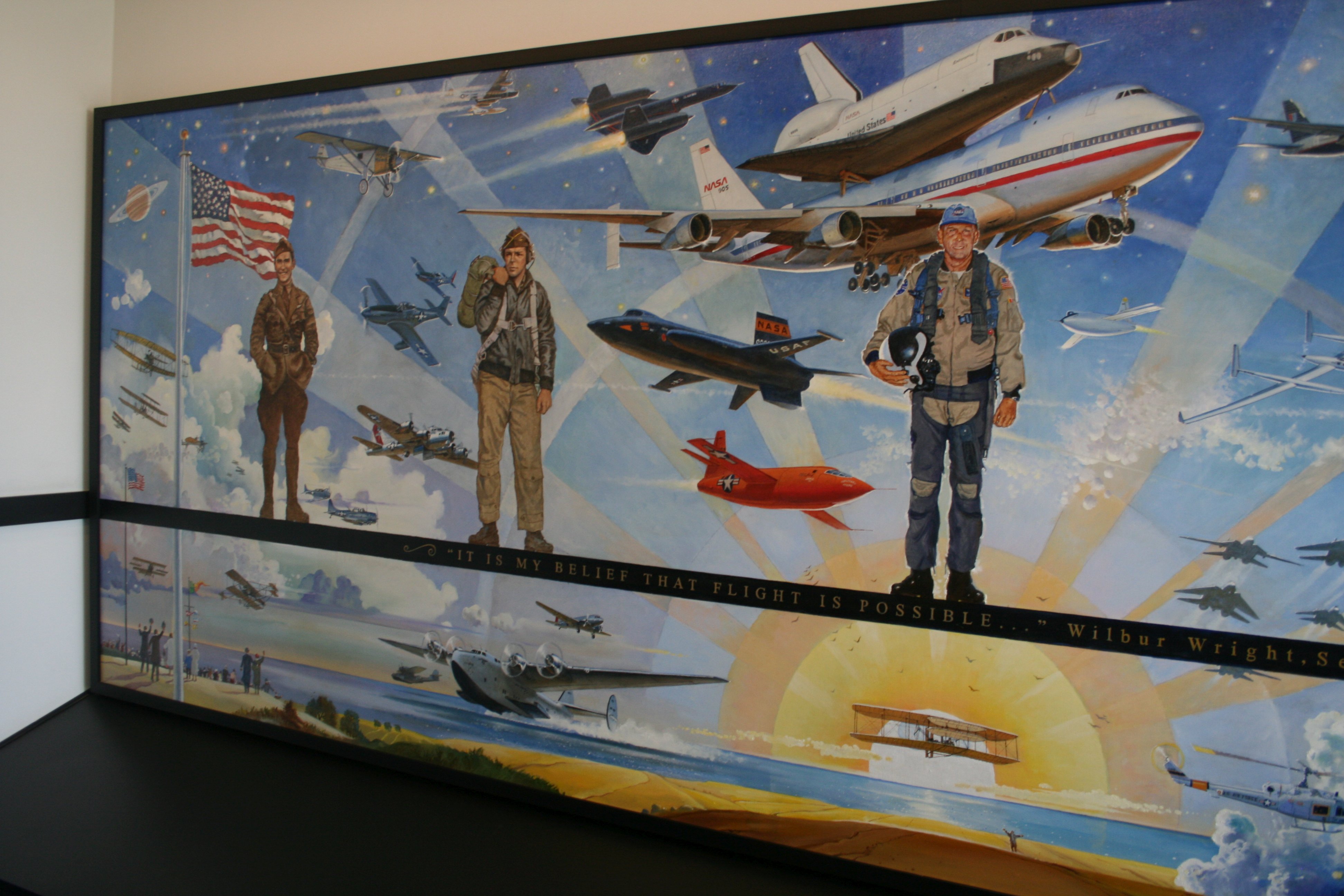
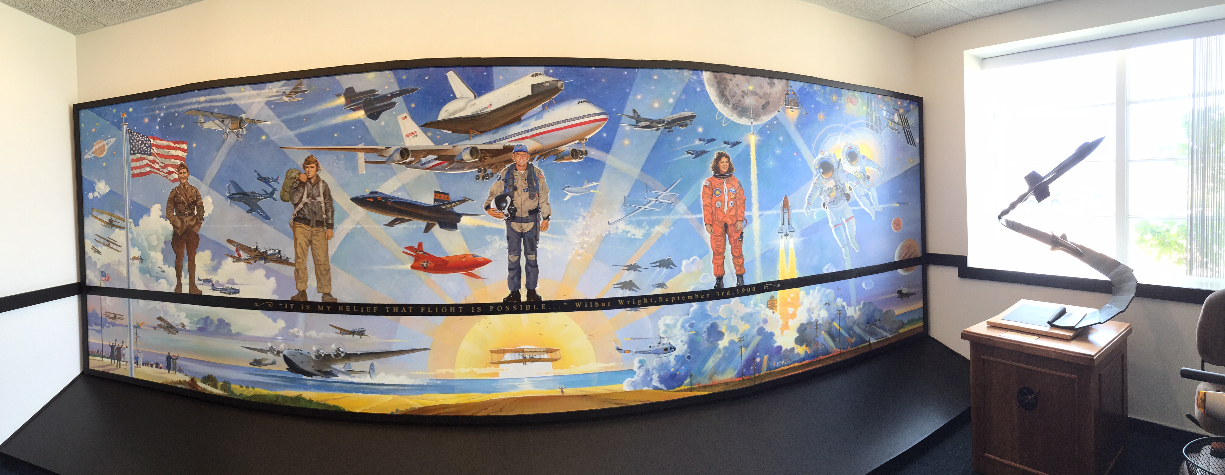
I’ve mentioned how much I love the work of Robert McCall. This is the second work of his that I’ve found in the NASA Armstrong buildings.

50_IMG_7821 small

This was in a lobby entrance area to one of the buildings. If I worked here, I imagine that I might often be found at lunchtime, just sitting and admiring all of the wonderful details here. Unless there was an airplane flying around, in which case I would be out watching it.

51_IMG_9123 small

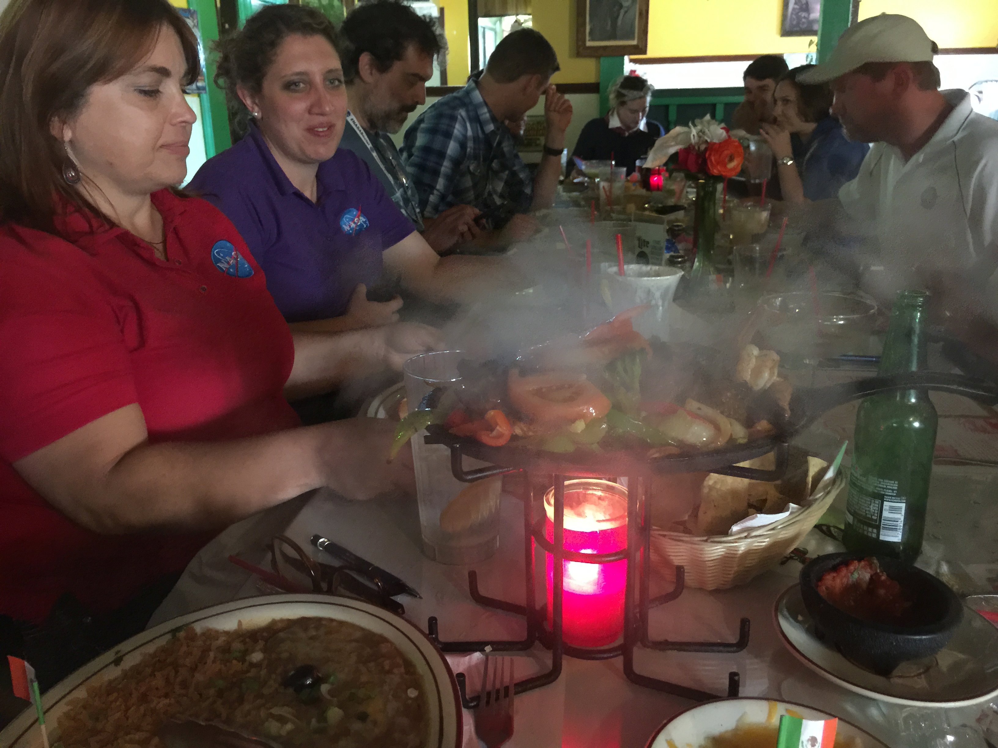
Following the end of the NASA Social, after we got brought back off base and to our cars, some of us got together for dinner with our NASA Social hosts and hostesses. This particular place (Domingo’s Seafood & Mexican Restaurant) has been a haunt to astronaut crews training at Edwards and returning to Earth during Shuttle landings at Edwards. The walls contain many signed pictures of astronauts, test pilots, and flight crews. The fajitas were HOT, the atmosphere was fantastic, and the company was even better!


As always, a million thanks to the NASA Armstrong staff, lead by Kevin Rohrer, Kate Squires, and Kate Squires. They’re the ones who make these spectacular events happen and make it look seamless. (They are powerful wizards!) I also want to thank all of my fellow NASA Social attendees, who allowed me to pick their brains and learn from their experience as well, while also making new friends.

I look forward to my sixth NASA Social – soon.

Leave a comment

Filed under Flying, Panorama, Photography, Space

Yet More Weird, Weird Weather

The LEAPTech NASA Social pictures and articles are coming. 295 pictures (plus more than an hour of video) are being whittled down to about three dozen images, to be combined with the story behind them all, probably in a four-part report. That’s not quite done yet.

This week’s Flash Fiction from Chuck Wendig, which I’ve missed for about a month now? Yeah, right. Maybe that’s not happening again this week either.


At risk of simply “talking about the weather” — Jeeze Louise, did you see the rain coming down today in SoCal?!

If you haven’t spent a few years in the region, you can’t really grasp just how unusual it is to get rain here at this time of year. It’s not quite “sign of the impending Apocalypse” unusual, but it’s definitely “holy crap what’s going on here” unusual. Especially while we’re in this four-year drought and getting about 1% of the rain we normally get in the “rainy season.”

Today I was out at the CAF hangar, playing catch up. The rain out in Camarillo was significant, and being that I was in a huge, mostly empty, metal echo chamber, the noise was impressive as well. I was involved with my accounting stuff and really hadn’t noticed that everyone else had left, so when the next wave of really heavy showers hit, I was surprised to find myself alone.

It’s a little hard to hear, but at about the 12-second point the noise went from really loud to really, REALLY loud. (And doesn’t that Spitfire look gorgeous? I love that plane, I really do.) After the dash through the ops office to get a view outside, you can also see a small plane on short final off in the distance. It looked like a Cessna 150 or 172, and in that weather he had to really have his hands full. I saw him taxi by a little later so he got down OK, but the pilot might need a change of pants.

An hour or so later, after it had tailed off a bit, I made my dash to the car. The Camarillo area was in a relatively calm spot, but there were awesome and ominous clouds all around. To the north, toward the coastal mountains…

IMG_9136

…and toward the south and the ocean about five miles away.

IMG_9137

Finally, I made it home (through scattered showers) just to have it start to absolutely pour again just as I was turning into the driveway. (Timing is everything!) In addition, soon after we got an hour or so of lightning and thunder, always a favorite of mine. (Really — not being snarky.)

For those of you where this kind of weather is known as “Thursday,” I hope you’ll forgive the “gee whiz” factor here. I grew up with “normal” weather and loved it when it got a little bit active. After more than forty years in SoCal, with its extremely muted climate, this is great stuff.

Leave a comment

Filed under CAF, Panorama, Photography, Video, Weather

Long, Wonderful Day At NASA Armstrong

…and I’m going to tell you all about it with lots of pictures.

Tomorrow. (Probably.)

Today I was up at 0345AM, drove to Lancaster, picked up a group of fellow NASA Social attendees at the hotel they were using for out-of-town members, spent all day seeing wonderful things and becoming much better informed and possibly wiser, going out to a great dinner with many of the NASA Social group, then driving home. It’s now 2157PM and I don’t think I can spell wurds any moore.

Here’s a taste, a McCall original that I hadn’t seen there before. I think I’ve mentioned how much I love McCall’s work.

IMG_9089

Leave a comment

Filed under Flying, Panorama, Space

‘Fifi’ Panoramas

Out on our (“our” = Commemorative Air Force Southern California Wing at Camarillo Airport) ramp this evening:

IMG_7434

This picture is the “serious” version. From left to right:

  • The tip of the tail of our SNJ4
  • The tip of the tail of our PBJ (Marine Corp version of the B-25)
  • Our SNJ5, the yellow plane)
  • “Fifi,” the honkin’ big, silver, four-engine B-29 Stratofortress
  • “Bucket Of Bolts,” a C-45 Expeditor, the military version of the Beech 18 (brown with yellow wings)
  • “China Doll,” our C-46 Commando
  • The B-29 Squadron’s setup for selling rides, hats, T-shirts, patches, toys, and so on

[[LATE EDIT — Remember, click on any picture to see the full-sized version]]

Now for the “not-so-serious” version:

IMG_7436

When you take a panorama photo on the iPhone, you pan left to right with a little arrow following a yellow line to make sure that you keep the camera level and the panorama looking all professional. I was wondering what happens when you ignore the little arrow and the yellow line…

This looks like something fun to play with in the near future.


1 Comment

Filed under CAF, Flying, Panorama

Panorama: Hannibal, Missouri

My last stitched panorama post was also from Missouri and also featured the Mississippi River. It’s a sheer coincidence, other than the fact that it’s a part of the world I grew up in and seem to visit more often than not. Not a theme. (Sometimes a cigar is just a cigar.)

Where last time I showed Chain Of Rocks Bridge near St. Louis, this time (a different trip) we were up by Hannibal. If you’re familiar at all with classic American literature, you know what Hannibal represents and why it’s a huge tourist draw.

When I was a kid growing up in Kansas City we visited Hannibal a couple of times. I remember those trips very fondly, especially since I was a voracious reader from an early age and was well familiar with “Tom Sawyer” and “Huckleberry Finn.” Even in the mid-1960s Hannibal was a tourist town playing up its history as the birthplace of Samuel Clemens (aka “Mark Twain”) and I was thrilled to get a chance to see the actual sites which many of the scenes in the books were based on. (The infamous cave where Tom and Becky Thatcher got lost is fantastic!)

This panoramic picture was taken in August, 2007. (Click to enlarge.) This time the whole family was visiting my son, who was stationed nearby at Scott Air Force Base. This view is from the “Lover’s Leap” outlook, from which you get a fantastic view of the town of Hannibal and the river that is its lifeblood. You can see the paddlewheel boat that gives tours up and down the river – we took the evening dinner cruise. The food was okay, the cruise was wonderful.

2007-08-06 Panorama (Hannibal Missouri) small

This panorama comes from fifteen images of 3456 x 2304 pixels (8 megapixels each) taken with a Canon Rebel XT DSLR, combined into a trimmed image of 24,357 x 2203 pixels (53.6 megapixels).

The other vivid memory of this day came after dark when we were headed back to the St. Louis area. We were on a state highway (taking the scenic route back) rolling through farmland. We ran into a couple miles of HUGE clouds of bugs, tens of thousands of them smacking into the windshield so that the wipers could barely keep up. It was unusual, fascinating, and utterly grotesque.


Leave a comment

Filed under Family, Panorama, Photography, Travel

Panorama: SOFIA

What a great day at my third NASA Social!

What a long day that leaves me wanting to flop face-down into my keyboard!

Tomorrow you will no doubt be inundated with me sharing what I learned at NASA Armstrong today. If you want a preview, there’s a list of my tweets & pictures from the day in the sidebar on the right-hand side of the screen. (If you’re reading this on the website using a desktop computer and not in an email or on a mobile device. It’s complicated.)

In the meantime, I have I mentioned how much I like the “panorama” function on the iPhone 6 and how it’s fast and easy and the pictures can be shared and emailed immediately, a fair trad off for the fact that they’re slightly less robust than panoramas stitched together from a series of megapixel DSLR photos? (Why, yes! Yes, I have!)

This is the interior of SOFIA, the Stratospheric Observatory For Infrared Astronomy. So, so, so, so über cool!

IMG_7133

Tomorrow, much, much more!

1 Comment

Filed under Astronomy, Flying, Panorama, Photography, Space

Panoramas: Spring Is Coming

Lest all of my friends in Boston and Massachusetts (Hi, Peter! Hi, Debbie!) despair of ever finding the bottom of the snow drifts that have them marooned in their own homes, so that they don’t all think that Eddard Stark was the one true prophet, here’s a picture from today at Camarillo Airport following yesterday’s “relentless drizzle”:

IMG_7023

SPRING IS COMING!

By the way, have I mentioned how much I like the “pano” feature on the new iPhones? It’s fast, easy, intuitive, and you save all the time of having to stitch together individual photo frames. You can then immediately email it, post it, or upload it.

The only negative I’ve found so far is that you can’t do a full 360° panorama. Plus, stitching together a ton of high-resolution individual photo frames will give you a MUCH more detailed panorama.

However, the trade-off for speed and ease is worth it. Plus, of course, I also had my “good” camera with me and took the frames I need for that full-sized panorama.

2015_01_27_Camarillo_Airport

iPhone panorama (top) is 6816 x 1479 (10.1 megapixels). This version is slightly “smoother”, for example, if you look at the far edge of the taxiway in front of me.

Panorama from nine frames of 3888 x 2592 (10.0 megapixels) each combine to an image of 13,386 x 2,290 (30.6 megapixels).  This version has much better dynamic range (items in shadow show up much better) and viewed full-sized (click on either image) it’s a much more detailed picture.

Both are great for what they do and what their strong points are. Neither is perfect.

But the bottom picture does have that fantastic Socata TBM 700 taxiing by at the far left. (And the resolution to be able to read the N-number!)  NICE plane!

Chin up, Southern New England!

3 Comments

Filed under CAF, Panorama, Photography, Weather

Panorama: St. Louis, Missouri

The Mississippi River is one of the great rivers of the planet, draining all of North America from the Appalacian Mountains in the east to the Rocky Mountains in the west. Periodic flooding in the areas near the Mississippi River are a way of life.

Route 66 was the great cross-country highway of the mid 1900’s, the primary route from Chicago to Los Angeles before the interstate highway system was built after World War II. Route 66 has been idealized in stories, songs, and movies, an icon of American lore from that era.

Where Route 66 crosses the Mississippi River, you’ll find Chain Of Rocks Bridge. It’s unusual in that it has a 30° bend in the middle. While it was later abandoned and neglected following the building of the interstates, it’s now been restored as a key link in a network of walking and bicycle paths along the Illinois and Missouri shores north of St. Louis, Missouri.

This panoramic picture was taken in September, 2008. (Click to enlarge.) I was visiting my son, who was stationed nearby at Scott Air Force Base. This particular viewpoint is from about the middle of the bridge, where the bend is. In the river you can see two water intake towers for the local pumping station. In the distance you can see St. Louis. Off to both sides there was some minor flooding going on as the river level was up, but not up anywhere near the catastrophic levels that it is capable of reaching.

2008-09-19 Panorama (Chain Of Rocks Bridge) cropped small

This panorama comes from seventeen images of 3456 x 2304 pixels (8 megapixels each) taken with a Canon Rebel XT DSLR, combined into a trimmed image of 26,450 x 2165 pixels (57.2 megapixels).

It was warm and muggy, as this part of the country often can be in summer, but nowhere near as bad as it could have been that day. In addition to the bridge, the river, and the scenes of flooding along the river banks, what I enjoyed seeing the most were the thousands of wild birds, dozens of different species, whole flocks of hundreds of cranes circling overhead.


Leave a comment

Filed under Family, Panorama, Photography, Travel